
DATA
Synspective provides SAR data and remote monitoring services to government agencies and companies worldwide. We also provide SAR data from our satellites to data analysis companies developing their own data products and solutions. Together, a SAR data ecosystem is taking shape that will transform how we as humans manage our environment, natural resources, and exposure to risk.
SOLUTION


SATELLITE
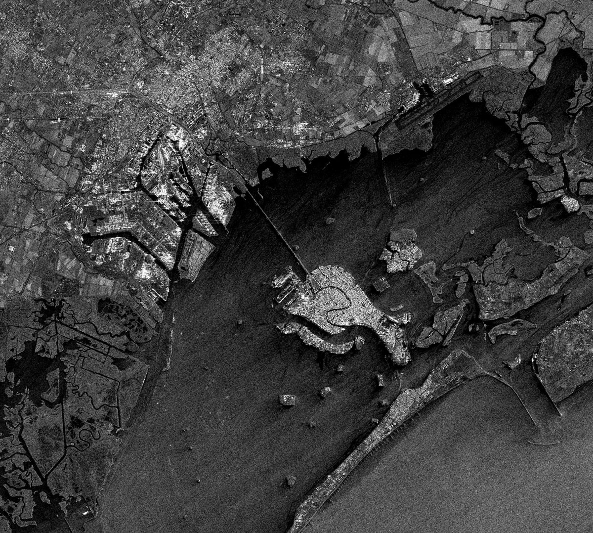
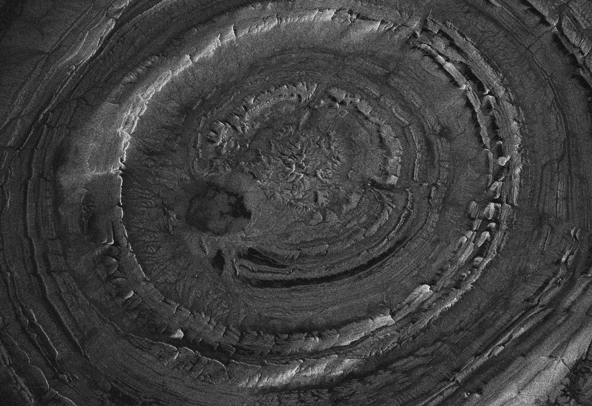
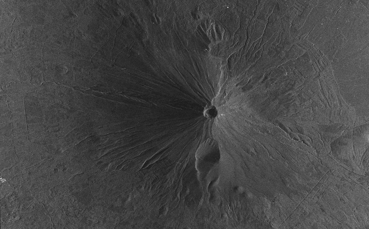
Our small 100kg class SAR satellites can monitor the world with high precision, regardless of the time of day or weather conditions. With 3 satellites successfully launched, we aim to build a constellation of 30 satellites that will enable near real-time observation of any part of the world.

LATEST NEWS

OUR PARTNERS

Please contact us if you have any questions or requests.
Contact us