


After years of working with disaster management agencies, I have come to believe that the hardest problems in this space are not technical ones. Every conversation eventually moves past sensors and resolution to two more fundamental questions: whether the data will be available when needed and whether it will work within the systems teams already use.
The primary bottleneck in disaster response today is the business model. Most agencies assume they will activate a data subscription when a disaster is imminent. That approach puts procurement decisions in the middle of an emergency, at precisely the moment when no one has the capacity to onboard a new provider or negotiate licensing terms. The agencies best positioned to use satellite intelligence effectively are those that establish relationships before an event, with licensing structures and workflow integration already resolved.
Licensing is more complex than most customers initially realize, and the consequences of getting it wrong surface at the worst possible time. Commercial satellite data can be licensed to a single user, a single organization, or multiple agencies. The choice carries real operational weight because derived analytics are often subject to the same restrictions as the underlying imagery. An agency that purchases flood damage assessment data and cannot share those results with a neighboring jurisdiction has created a serious bottleneck for itself. Working through licensing models in advance, including understanding the cost implications of broader sharing agreements, is part of what preparedness looks like.
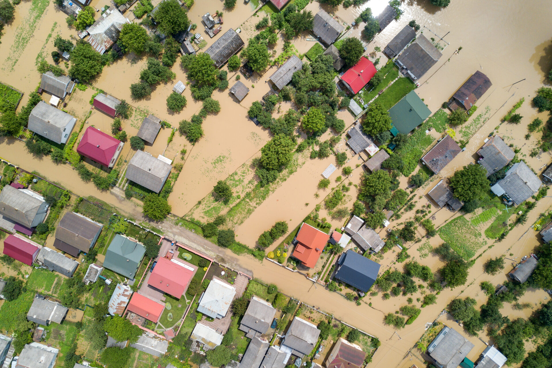
Regarding latency, customers often assume they need data faster than their workflows can absorb. With a growing constellation capable of revisiting a location in under an hour, it would be reasonable to expect speed to be the central value proposition. In practice, for most flood and wildfire scenarios, updates every one to two hours can be sufficient. Disaster response is fundamentally about having the current insights about an unfolding disaster and mobilizing resources on the ground, and that mobilization takes time, regardless of how quickly satellite data arrives. For most disaster scenarios, the value lies in reliable, consistent coverage throughout the event.
Spatial Resolution follows similar logic. A 3-meter resolution covering a 20-by-50-kilometer area, rather than very high resolution covering a much smaller area, could be the right starting point for disaster assessment. That footprint covering most impacted zones can provide enough detail to identify which roads are passable, which structures have sustained damage, and where resources should be directed.
How data reaches end users matters as much as the data itself. During an active disaster, agencies cannot stop to interpret raw imagery. What first responders need are GIS-ready outputs that load directly into their existing operational systems, showing which structures are inundated, which routes remain accessible, and where populations may be isolated. The interface has to be seamless because anything that requires new training or unfamiliar tools during an emergency is impractical.

Different customers also need different outputs from the same underlying data. Insurance companies are interested in potential impacts on insured properties in a given region and, post-disaster, require actionable information to deploy field teams. First responders have entirely different requirements, needing current situational awareness in formats compatible with the common operating picture systems their teams already rely on. The most important integration work is designing analytics around distinct workflows rather than delivering a single output and expecting customers to adapt.
Governments do not yet have a consistent model for budgeting and accessing satellite-derived disaster intelligence across the full cycle: prepare, respond, and recover. That gap is increasingly visible as commercial constellation capacity has grown to the point where reliable, frequent revisits are now operationally realistic for the first time. The opportunity is to build procurement and integration frameworks that match that capability, with the right data delivered in the right format, under licensing terms that support the way emergency management works.
=====
Kumar Navulur leads Synspective USA and brings more than 30 years of experience in the geospatial industry. He holds a PhD from Purdue University and serves on the UN Group of Experts on Global Geospatial Information Management.