Solution Overview
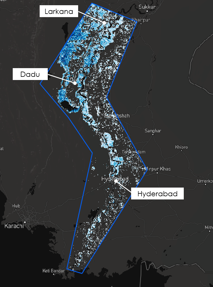
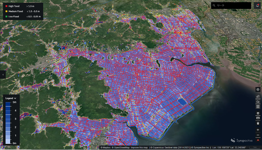
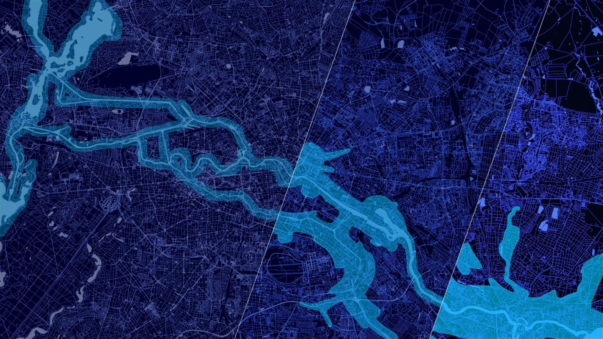
Flood damage evaluation service for disaster response that assesses inundation area, inundation depth, and damage to roads and buildings. In a disaster, it is necessary to promptly respond to the damage across a wide area based on accurate and precise primary information. Unlike conventional observation methods using optical satellites and airplanes/drones, SAR satellites enable all-weather ground observation and can quickly determine the presence or absence of inundation damage in a wider area. Furthermore, utilizing the most advanced analysis methods such as AI technology, FDA can identify the range of impact on facilities such as roads and buildings.

Benefits and Outputs
- Primary information for flood damage evaluation
- Reduced time required to grasp the situation of the flood damage
- Facilitates rapid decision-making
This Solution Would Support
- Flood risk assessment of non-life insurance companies
- Estimation of flood damage to owned/managed assets at financial institutions
- Acquisition of primary information by ministries and local governments