Solution Overview
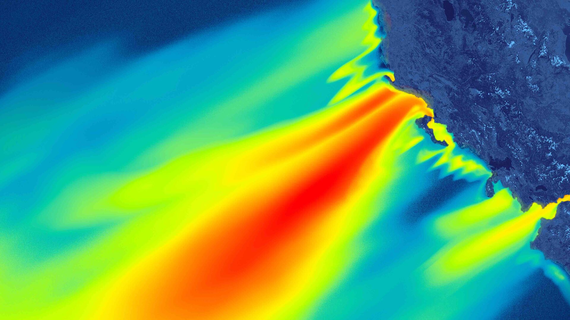
Selecting optimal turbine installation locations in oceans is a crucial factor that influences offshore wind power generation. However, onsite measurements are costly and challenging. By utilizing cutting-edge Synthetic Aperture Radar (SAR) satellite data, it’s possible to observe and analyze wave heights and wind speeds with measurements across vast ocean areas.
Thanks to their unique capabilities, SAR satellites can capture high-resolution wind speeds approximately 10m above the sea surface. These satellites also regularly capture details of the site’s surrounding terrain and the effects from other offshore wind farms. With the latest remote sensing technology, we can optimize the placement of offshore wind turbines and enhance the efficiency of maintenance and operations.
Advantages and Benefits
- Measures of wind speed information over a wide area
- Observes disaster effects on areas of interest and surrounding areas
- Optimizes turbine placement based on wind speed variations
- Utilizes archive data for mapping and understanding patterns over time
- Provides high-quality, cost-effective measurement methods
Sectors
- Offshore wind power companies
- Offshore wind management companies
- Environmental assessment companies