

SAR Data Gallery
SAR DATA DOWNLOAD
Synspective's small SAR satellite, StriX, is equipped with a sensor called a synthetic aperture radar (SAR), which can observe the Earth's surface in any weather condition day or night. Not affected by clouds or rain, SAR is suitable for persistent monitoring of disasters and detailed changes to secure critical infrastructure and other facilities. This page lists sample images taken by StriX in various regions, at various times, and in various weather conditions. Please select "Date," "Country," or “Tag" from the pull-down menu below to filter the images. Please note that you will need to enter your email address and other information.
-
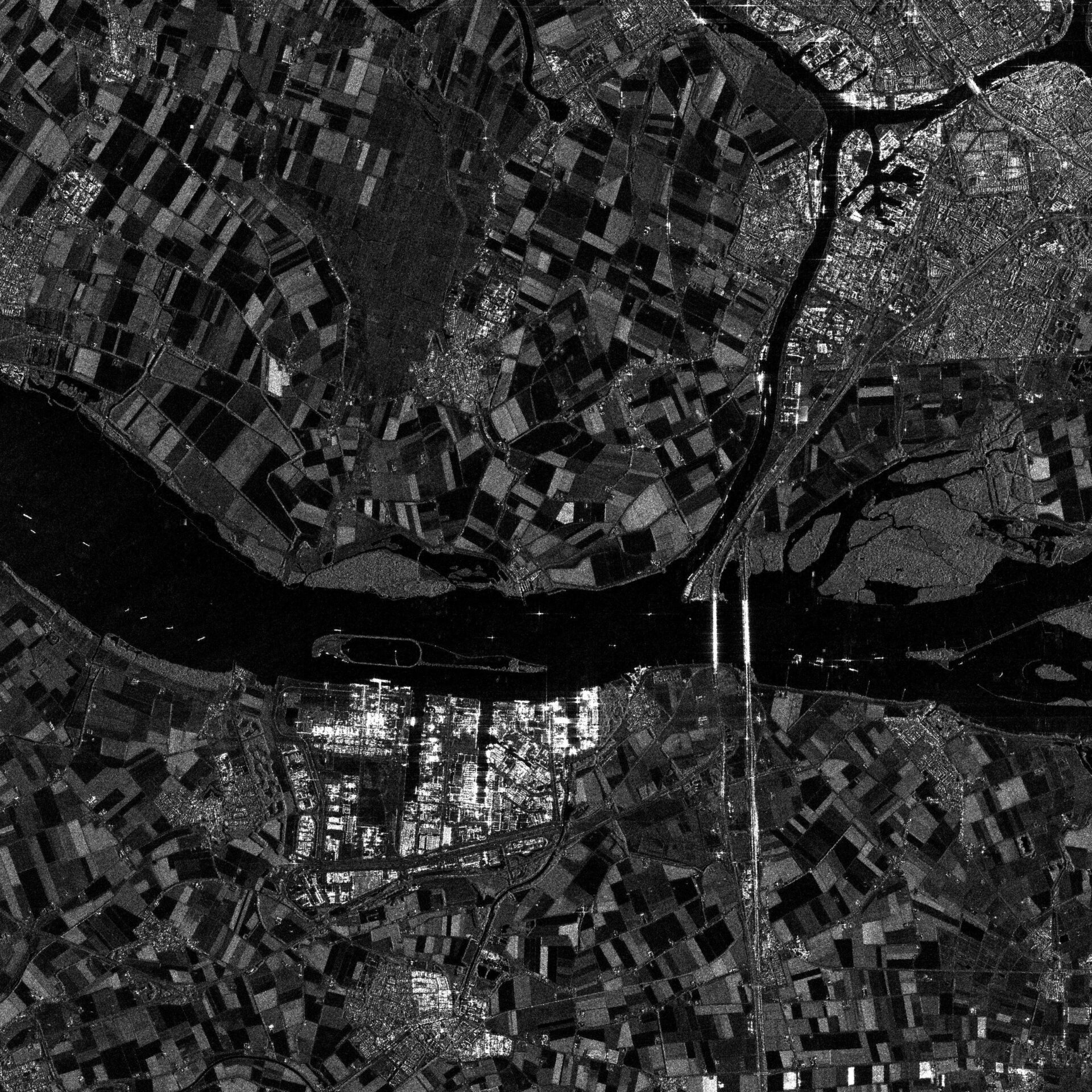
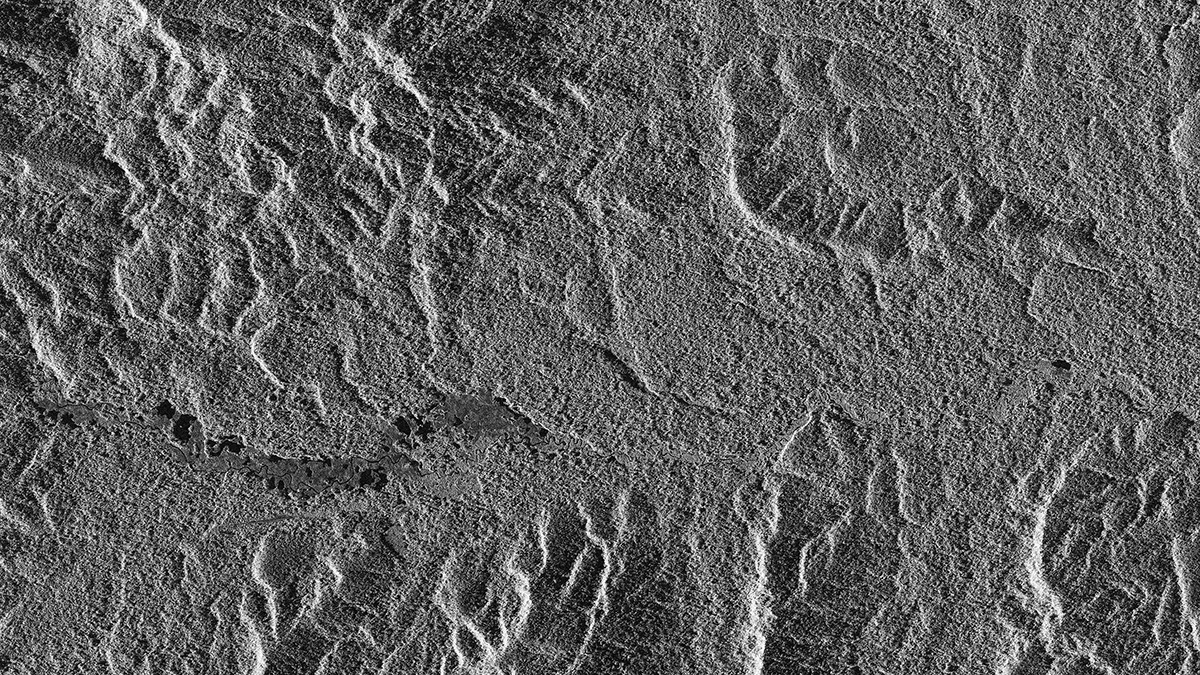
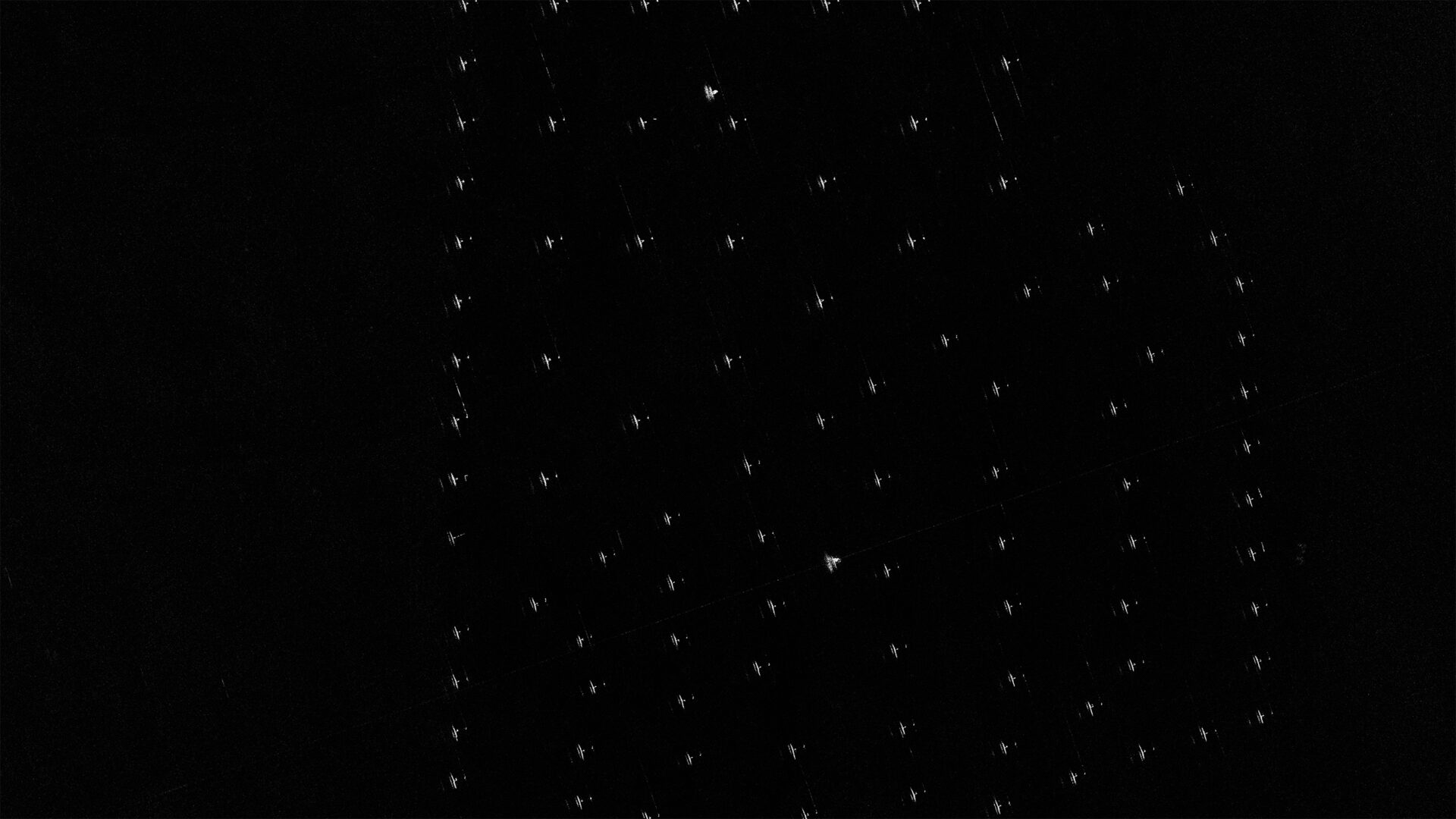
 Susono/Japan2026/03/02(UTC)Modes: Sliding Spotlight 2Length [km]: Swath 10 x Length 10Resolution [m]: 0.46 × 0.5
 -
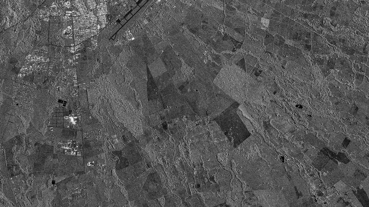
 Denver/USA2026/01/30(UTC)Modes: Sliding Spotlight 2Length [km]: Swath 10 x Length 10Resolution [m]: 0.46 × 0.5
 -
 Norfolk/USA2026/01/22(UTC)Modes: Sliding Spotlight 2Length [km]: Swath 10 x Length 10Resolution [m]: 0.46 × 0.5
 -
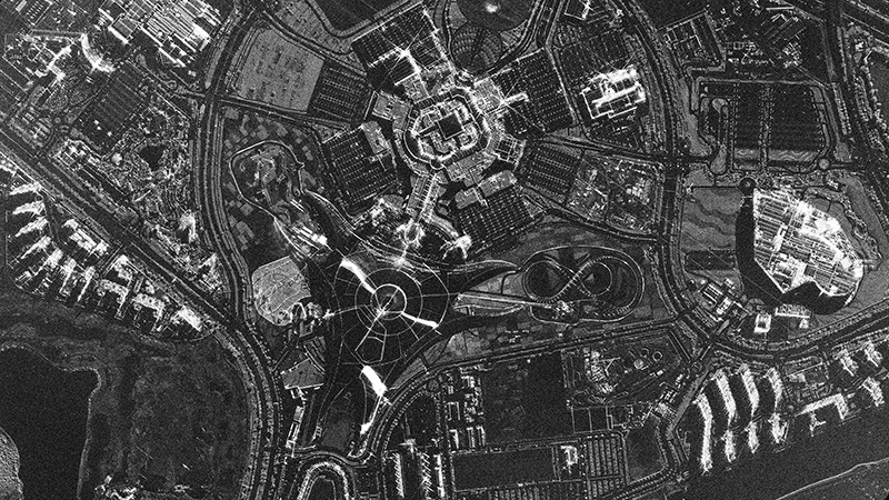
 The Line/Saudi Arabia2025/12/18(UTC)Modes: Sliding Spotlight 2Length [km]: Swath 10 x Length 10Resolution [m]: 0.46 × 0.5
 -
 Ferrari World/United Arab Emirates2025/10/04(UTC)Modes: Staring Spotlight 4Length [km]: Swath 10 x Length 3Resolution [m]: 0.46 × 0.25
 -
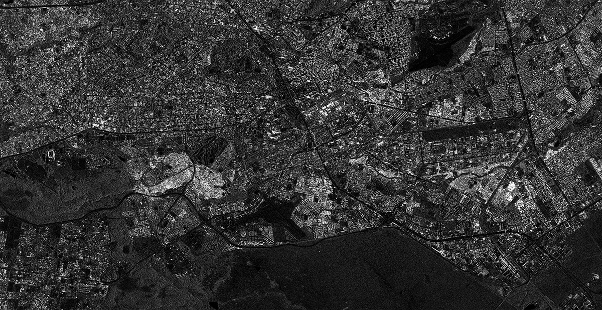
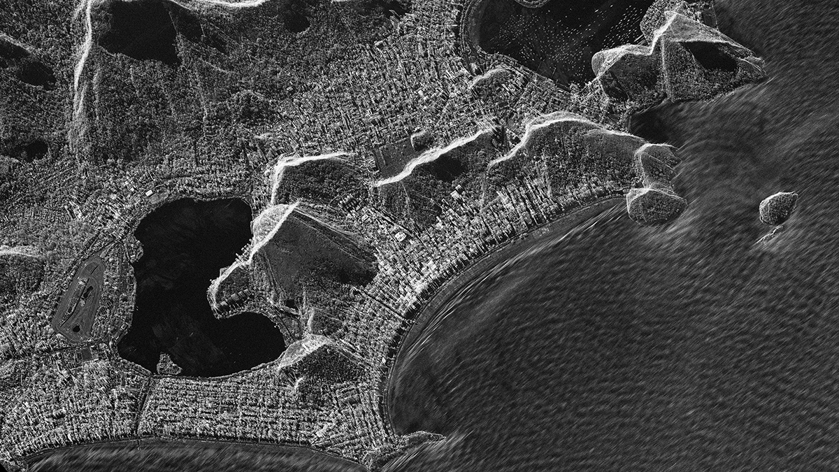 Rio de Janeiro/Brazil2025/09/24(UTC)Modes: Sliding Spotlight 2Length [km]: Swath 10 x Length 10Resolution [m]: 0.46 × 0.5
 -
 Lima/Peru2025/09/22(UTC)Modes: Sliding Spotlight 1Length [km]: Swath 10 x Length 10Resolution [m]: 0.9 × 0.9
 -
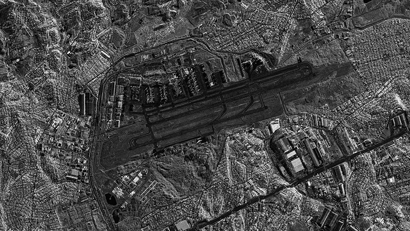
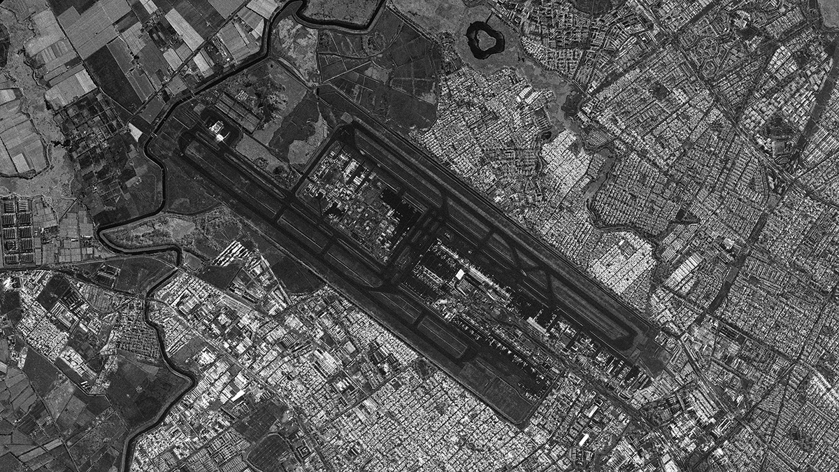 El Dorado International Airport, Bogota/Colombia2025/09/20(UTC)Modes: Sliding Spotlight 2Length [km]: Swath 10 x Length 10Resolution [m]: 0.46 × 0.5
 -
 Amazon Region/Brazil2025/09/18(UTC)Modes: Sliding Spotlight 1Length [km]: Swath 10 x Length 10Resolution [m]: 0.9 × 0.9
 -
 São Paulo/Guarulhos International Airport/Brazil2025/08/09(UTC)Modes: Sliding Spotlight 2Length [km]: Swath 10 x Length 10Resolution [m]: 0.46 × 0.5
 -
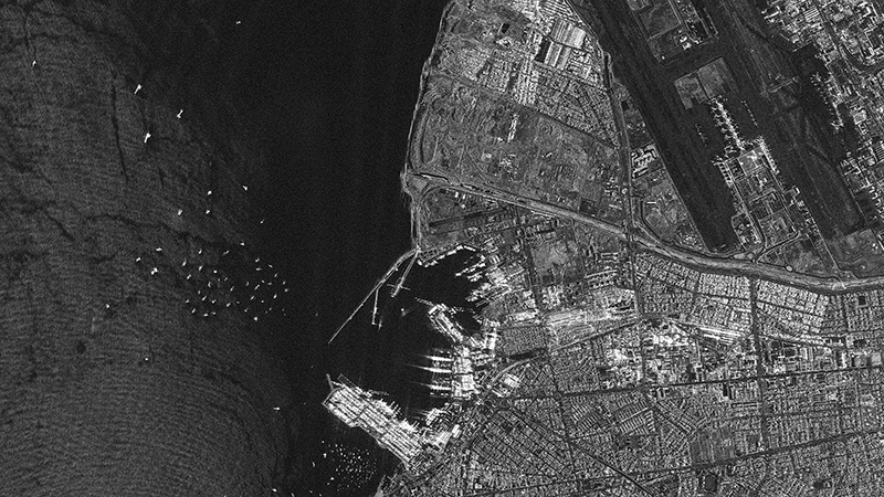
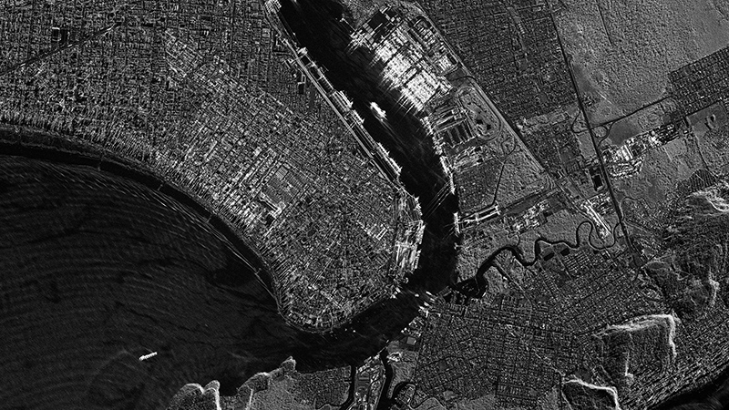 Port of Santos/Brazil2025/08/08(UTC)Modes: Sliding Spotlight 2Length [km]: Swath 10 x Length 10Resolution [m]: 0.46 × 0.5
 -
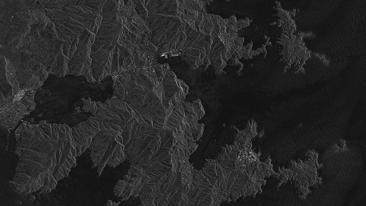
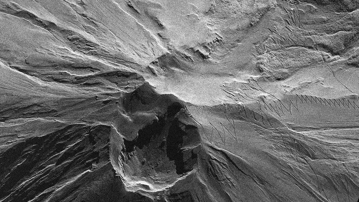 Mt. Fuji/Japan2025/07/21(UTC)Modes: Staring Spotlight 3Length [km]: Swath 10 x Length 3Resolution [m]: 0.46 × 0.5
 -
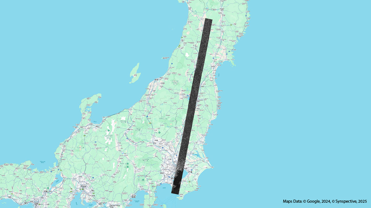 East Japan Area/Japan2025/07/20(UTC)Modes: Long StripmapLength [km]: Swath 10-30 x Length 50 (2 to 10 scenes)Resolution [m]: 3.6 × 2.6
 -
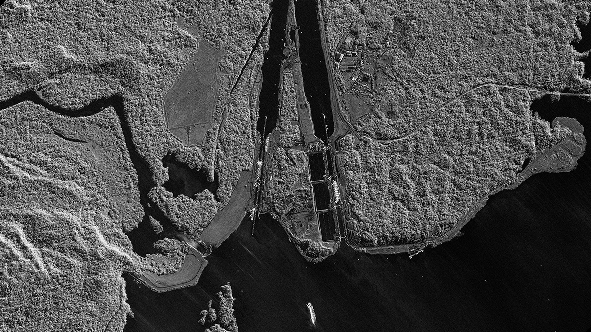 Panama Canal (Atlantic Side)/Panama2025/07/20(UTC)Modes: Sliding Spotlight 2Length [km]: Swath 10 x Length 10Resolution [m]: 0.46 × 0.5
 -
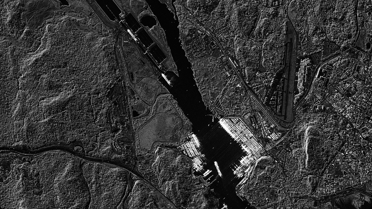 Panama Canal (Pacific Side)/Panama2025/07/20(UTC)Modes: Sliding Spotlight 2Length [km]: Swath 10 x Length 10Resolution [m]: 0.46 × 0.5
 -
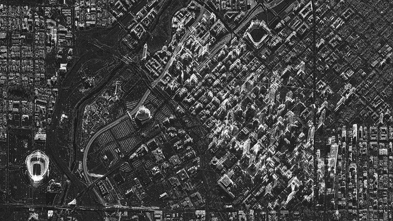
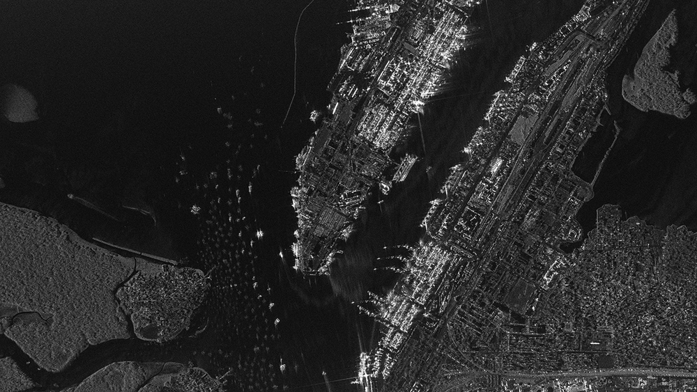
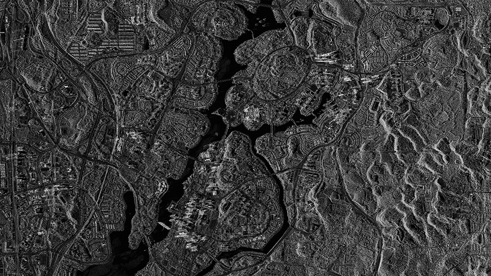
 Financial District, New York City/USA2025/07/12(UTC)Modes: Staring Spotlight 4Length [km]: Swath 10 x Length 3Resolution [m]: 0.46 × 0.25
 -
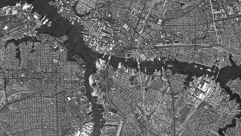
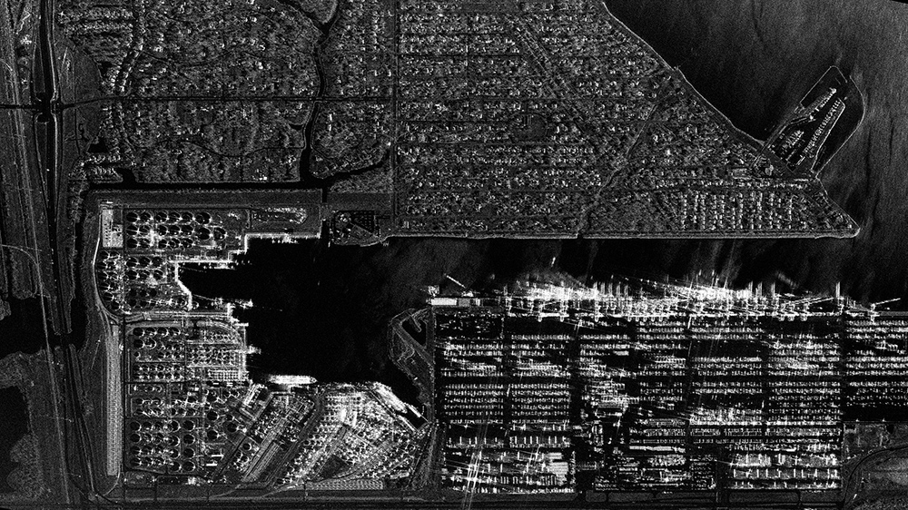 Houston Port/USA2025/06/05(UTC)Modes: Staring Spotlight 2Length [km]: Swath 10 x Length 3Resolution [m]: 0.9 × 0.25
 -
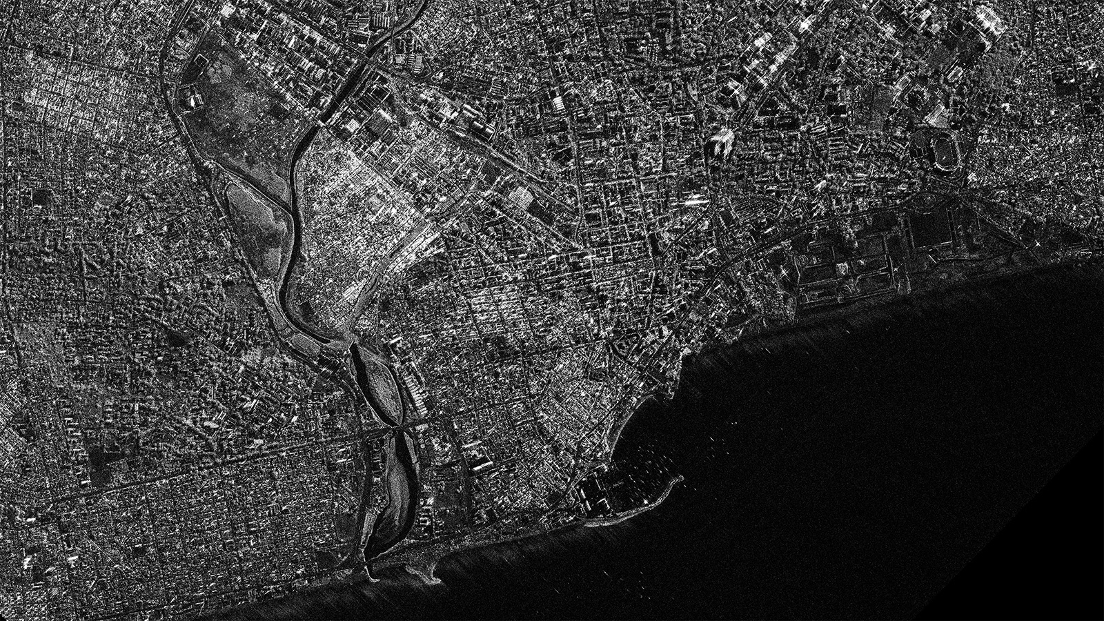
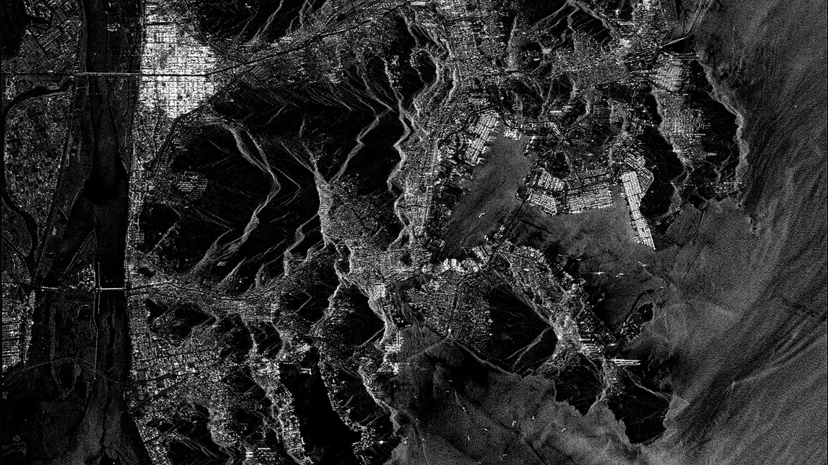
 Karachi/Pakistan2025/05/09(UTC)Modes: Staring Spotlight 1Length [km]: Swath 10 x Length 3Resolution [m]: 0.9 × 0.5
 -
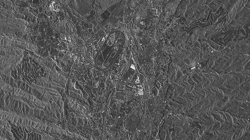
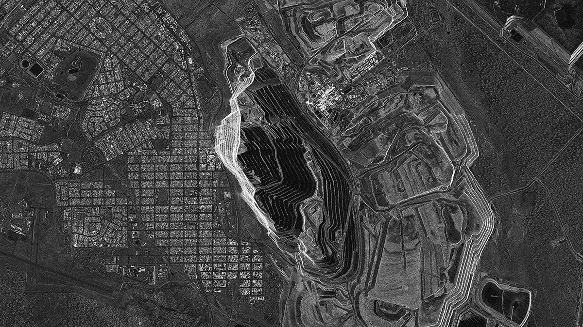 Super Pit/Australia2025/04/26(UTC)Modes: Sliding Spotlight 1Length [km]: Swath 10 x Length 10Resolution [m]: 0.9 × 0.9
 -
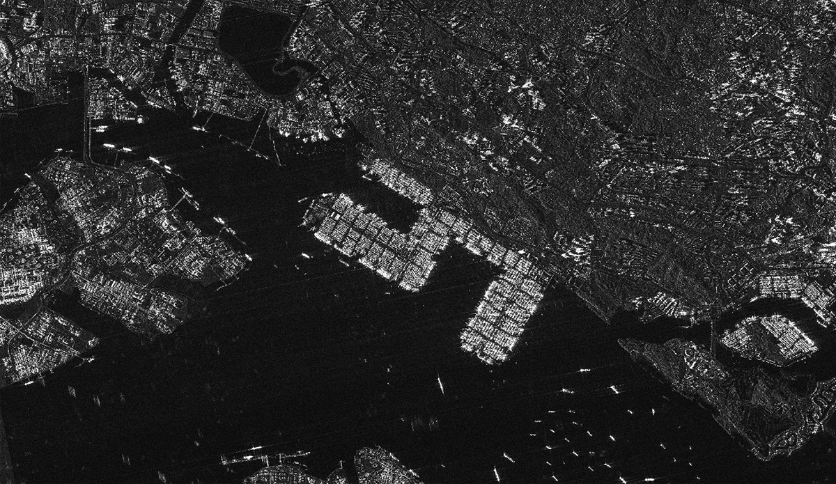
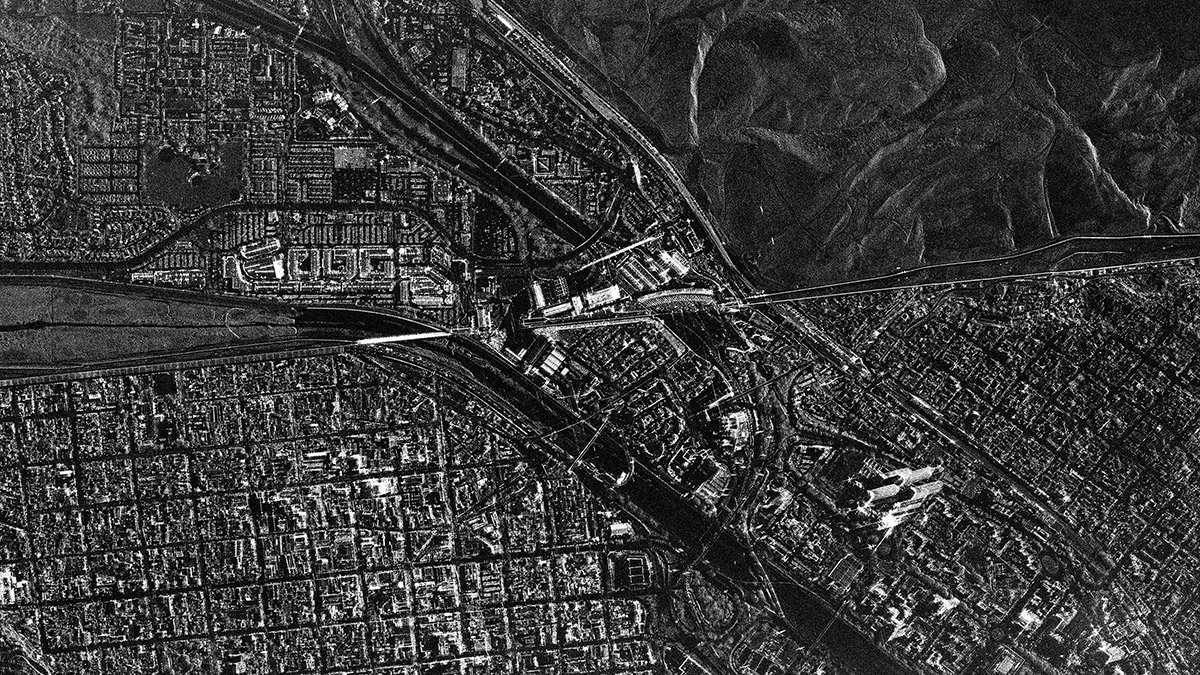 San Ysidro Border Crossing/US-Mexico2025/03/16(UTC)Modes: Staring Spotlight 2Length [km]: Swath 10 x Length 3Resolution [m]: 0.9 × 0.25
 -
 Accra/Ghana2025/02/27(UTC)Modes: Sliding Spotlight 1Length [km]: Swath 10 x Length 10Resolution [m]: 0.9 × 0.9
 -
 Nairobi/Kenya2025/02/22(UTC)Modes: StripmapLength [km]: Swath 10-30 x Length 50-70Resolution [m]: 3.6 × 2.6
 -
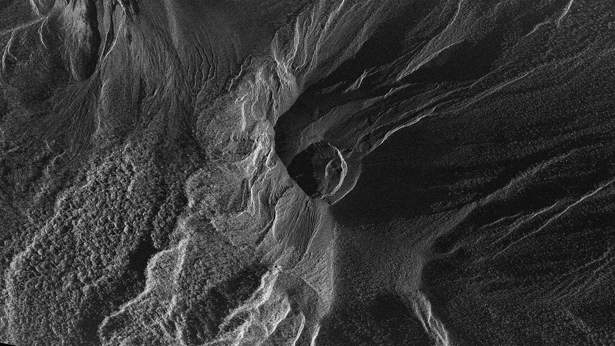 Mount Lewotobi Laki Laki/Indonesia2024/11/15(UTC)Modes: Staring Spotlight 1Length [km]: Swath 10 x Length 3Resolution [m]: 0.9 × 0.5
 -
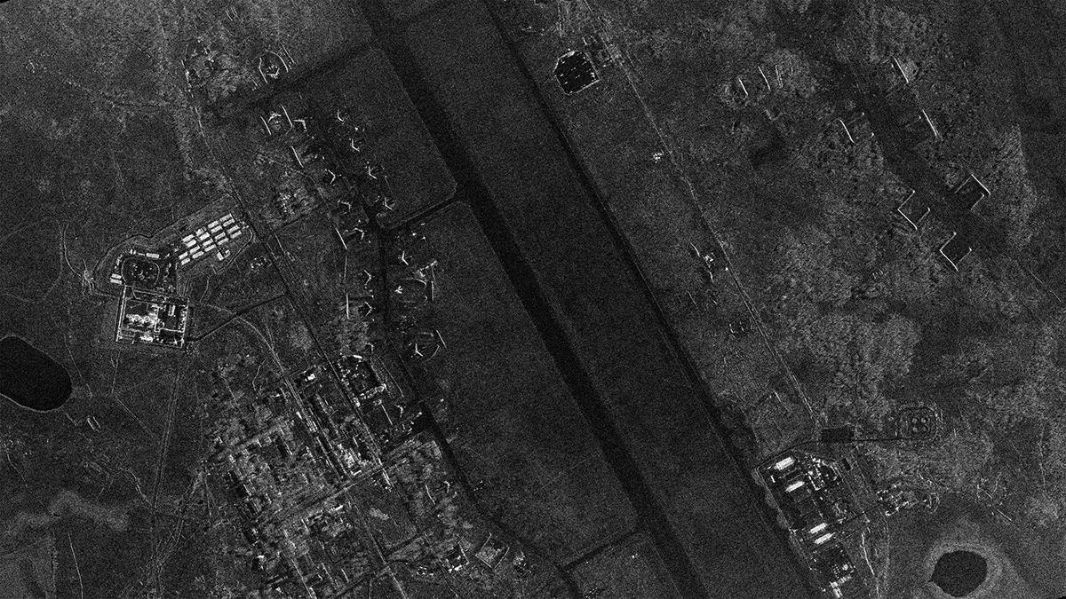 Ukrainka Air Base/Russia2024/10/07(UTC)Modes: Staring Spotlight 1Length [km]: Swath 10 x Length 3Resolution [m]: 0.9 × 0.5
 -
 Soma City/Japan2024/06/23, 2024/07/01, 2024/07/09(UTC)Modes: StripmapLength [km]: Swath 10-30 x Length 50-70Resolution [m]: 3.6 × 2.6
 -
 Offshore Wind Farm/Denmark2023/06/05(UTC)Modes: StripmapLength [km]: Swath 10-30 x Length 50-70Resolution [m]: 3.6 × 2.6
 -
 Onagawa/Japan2023/03/16(UTC)Modes: StripmapLength [km]: Swath 10-30 x Length 50-70Resolution [m]: 3.6 × 2.6
 -
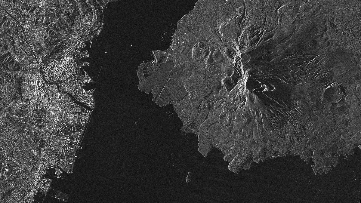 Sakurajima/Japan2023/01/29(UTC)Modes: StripmapLength [km]: Swath 10-30 x Length 50-70Resolution [m]: 3.6 × 2.6
 -
 Hachiro Lagoon/Japan2022/12/12(UTC)Modes: StripmapLength [km]: Swath 10-30 x Length 50-70Resolution [m]: 3.6 × 2.6
 -
 Venice and its Lagoon/Italy2022/12/12(UTC)Modes: StripmapLength [km]: Swath 10-30 x Length 50-70Resolution [m]: 3.6 × 2.6
 -
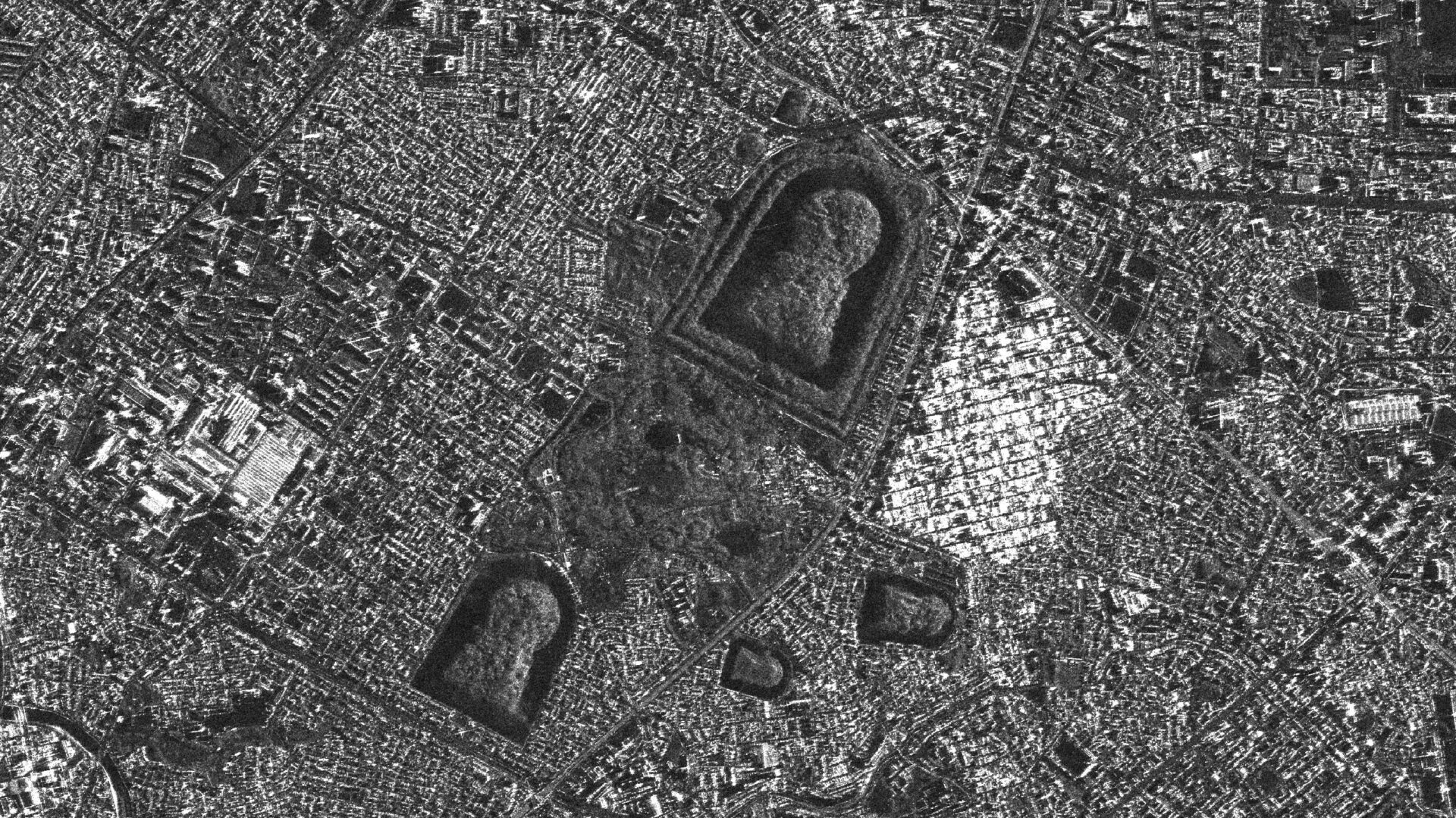 Mozu Tombs/Japan2022/12/06(UTC)Modes: Sliding Spotlight 1Length [km]: Swath 10 x Length 10Resolution [m]: 0.9 × 0.9
 -
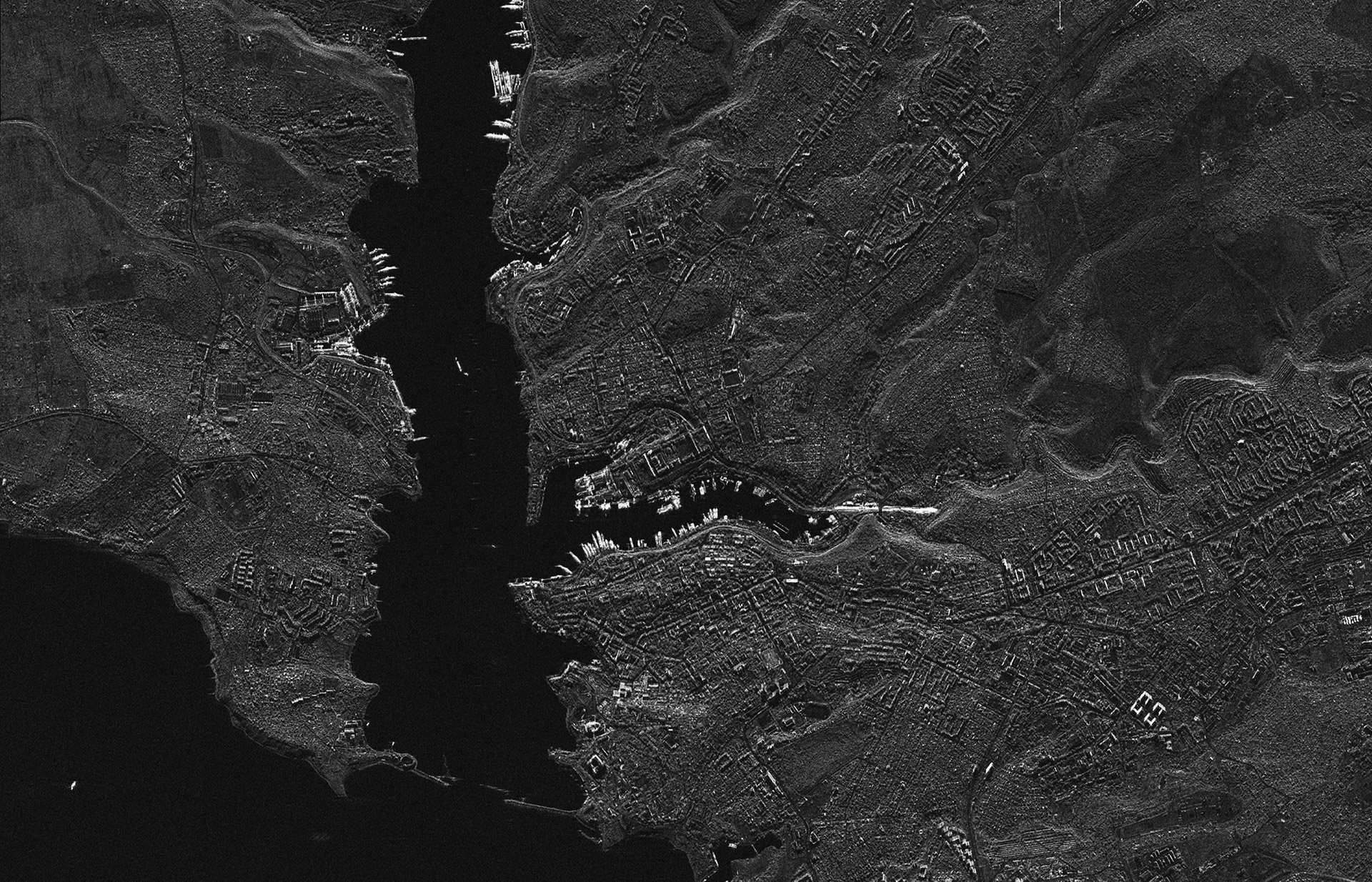 Sevastopol / Ukraine2022/09/21(UTC)Modes: Sliding Spotlight 1Length [km]: Swath 10 x Length 10Resolution [m]: 0.9 × 0.9
 -
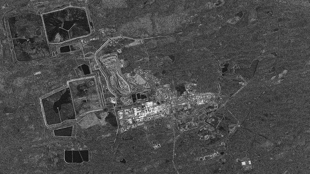 Olympic Dam/Australia2022/09/12(UTC)Modes: StripmapLength [km]: Swath 10-30 x Length 50-70Resolution [m]: 3.6 × 2.6
 -
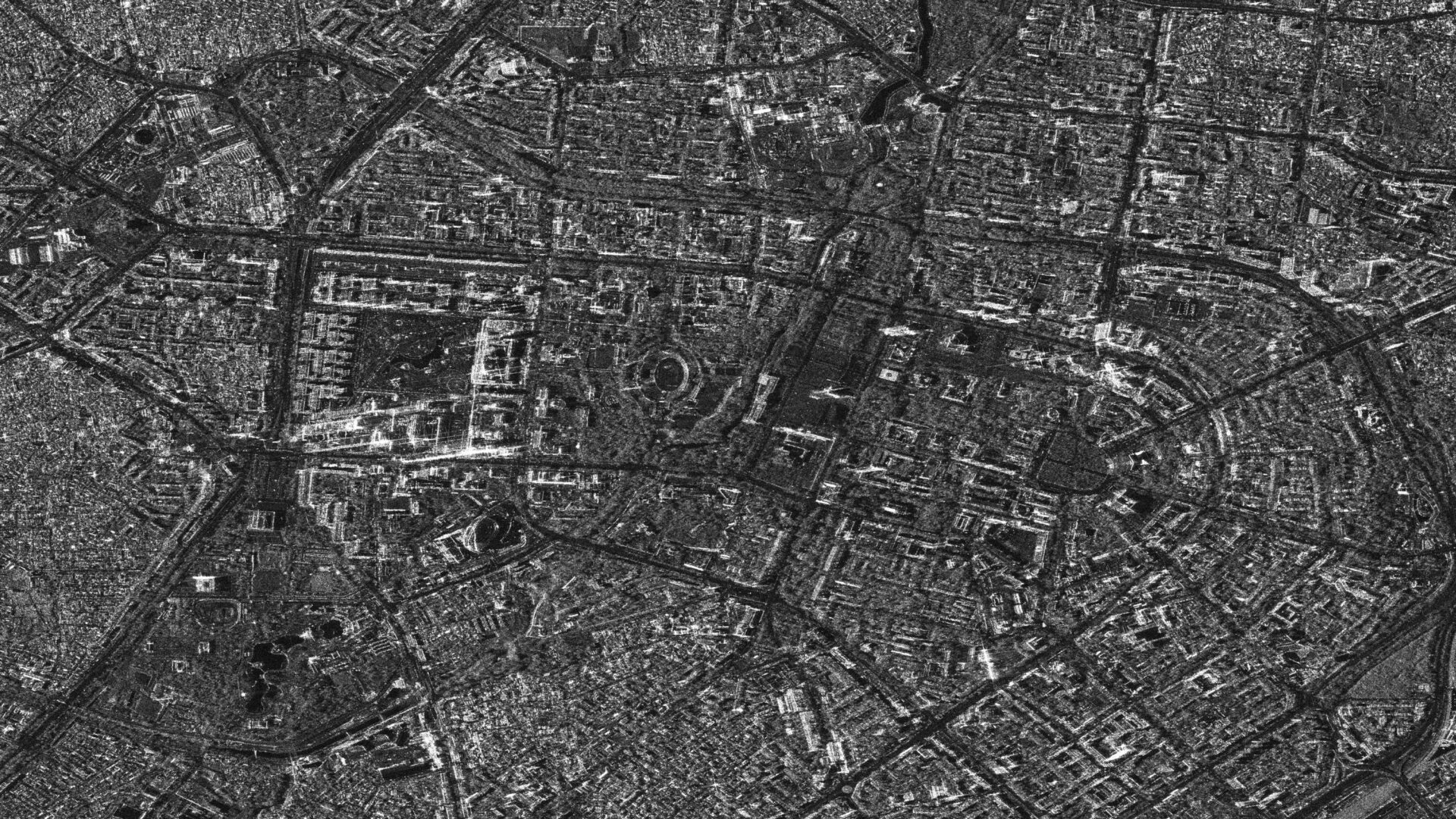 Tashkent/Uzbekistan2022/08/15(UTC)Modes: Sliding Spotlight 1Length [km]: Swath 10 x Length 10Resolution [m]: 0.9 × 0.9
 -
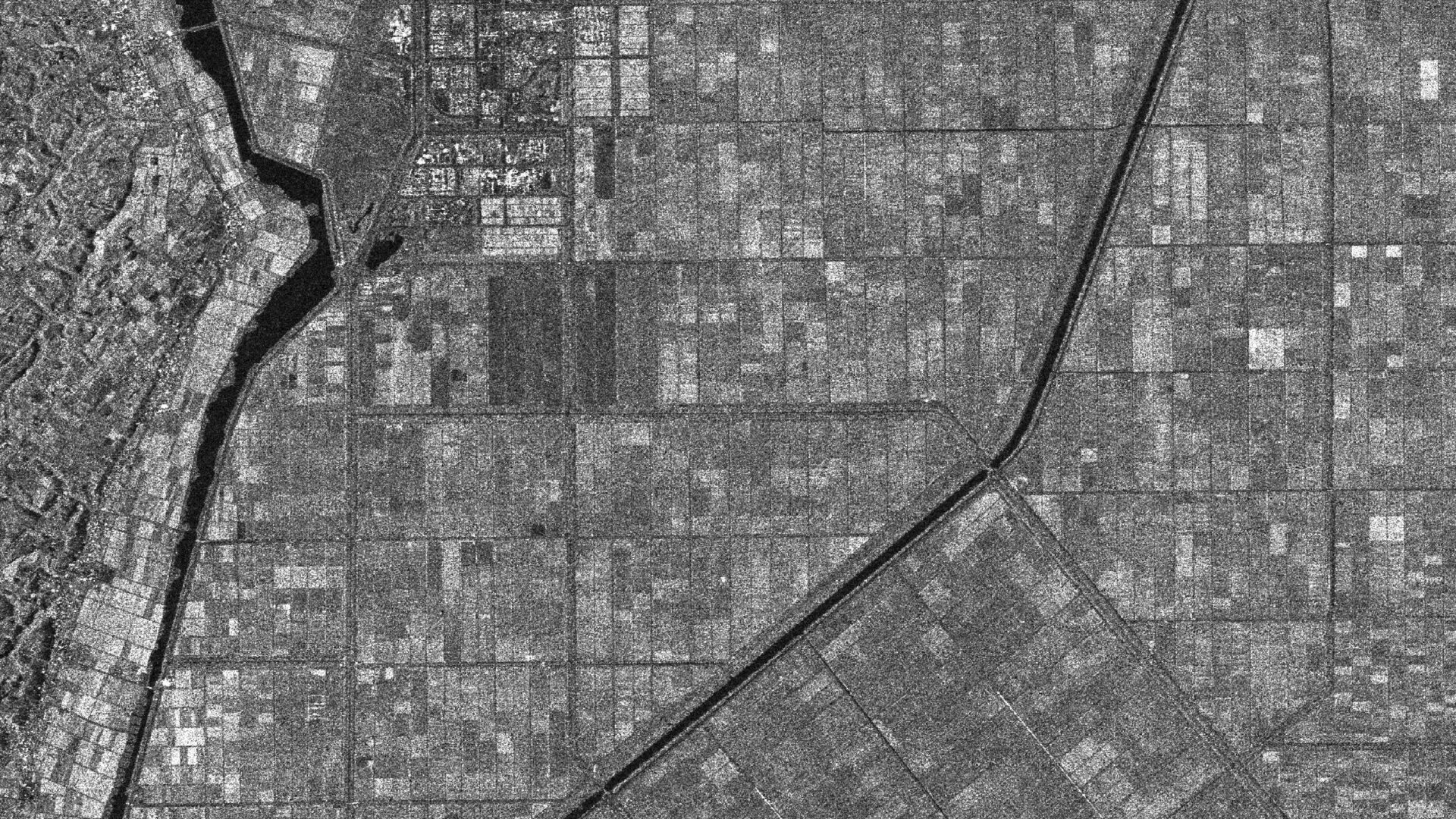
 Yopal/Colombia2022/08/12(UTC)Modes: StripmapLength [km]: Swath 10-30 x Length 50-70Resolution [m]: 3.6 × 2.6
 -
 Putrajaya/Malaysia2022/08/11(UTC)Modes: Sliding Spotlight 1Length [km]: Swath 10 x Length 10Resolution [m]: 0.9 × 0.9
 -
 Busan/South Korea2022/08/11(UTC)Modes: StripmapLength [km]: Swath 10-30 x Length 50-70Resolution [m]: 3.6 × 2.6
 -
 Port of Singapore/Singapore2022/07/29, 2022/07/30, 2022/07/31(UTC)Modes: StripmapLength [km]: Swath 10-30 x Length 50-70Resolution [m]: 3.6 × 2.6