


Illegal gold mining has become one of the largest criminal economies in Latin America. In Peru, the illegal gold trade has been estimated at several times the size of the cocaine business, and the same armed groups increasingly work both, using gold to launder the proceeds of drugs because it moves more easily and draws less scrutiny. In Colombia, the proceeds of illegal mining have proven more profitable than drug trafficking. The physical toll is visible from above. More than 140,000 hectares of Peruvian rainforest have been cleared for mining in recent decades, dredging has rerouted rivers, and the mercury used to separate gold builds up in fish and reaches the people who eat them, at levels around four times health guidelines.
The trade is spread across expansive, roadless terrain along rivers that cross national borders, often in areas with little or no enforcement presence. The region is under cloud cover for most of the year, which limits satellite observation, and much of the activity that matters occurs at night. A single operation often runs on both sides of a border at once, with no checkpoint between, so the picture any one country can assemble is partial by default. Synthetic aperture radar is suited to these conditions. It images through cloud and operates day or night on a consistent cadence, independent of weather or sunlight.
Monitoring runs in two stages. The first is a wide-area survey, weeks or months ahead, building a picture of a region and surfacing the hot spots. At 3-to-5-meter resolution, it covers on the order of 1,000 square kilometers in a single collection, enough to establish the pattern of activity without yet resolving individual targets. The second revisits those hot spots at 25-centimeter resolution and higher frequency, close enough to resolve the individual targets the survey detected but could not pinpoint.
We tasked StriX over a stretch of the Amazon where illegal mining is known to occur and analyzed the imagery ourselves, independent of any client. The activity it captures is real, and it matches what we encounter in government work across the region. Along a section of the Puré River on the Colombia-Brazil border, StriX captured the same coordinates in daylight on March 17 and again after dark on March 18. The daytime frame shows the river empty, with only the marked boxes where dredges would later appear. The night frame, hours later, shows two dredges working the riverbed.
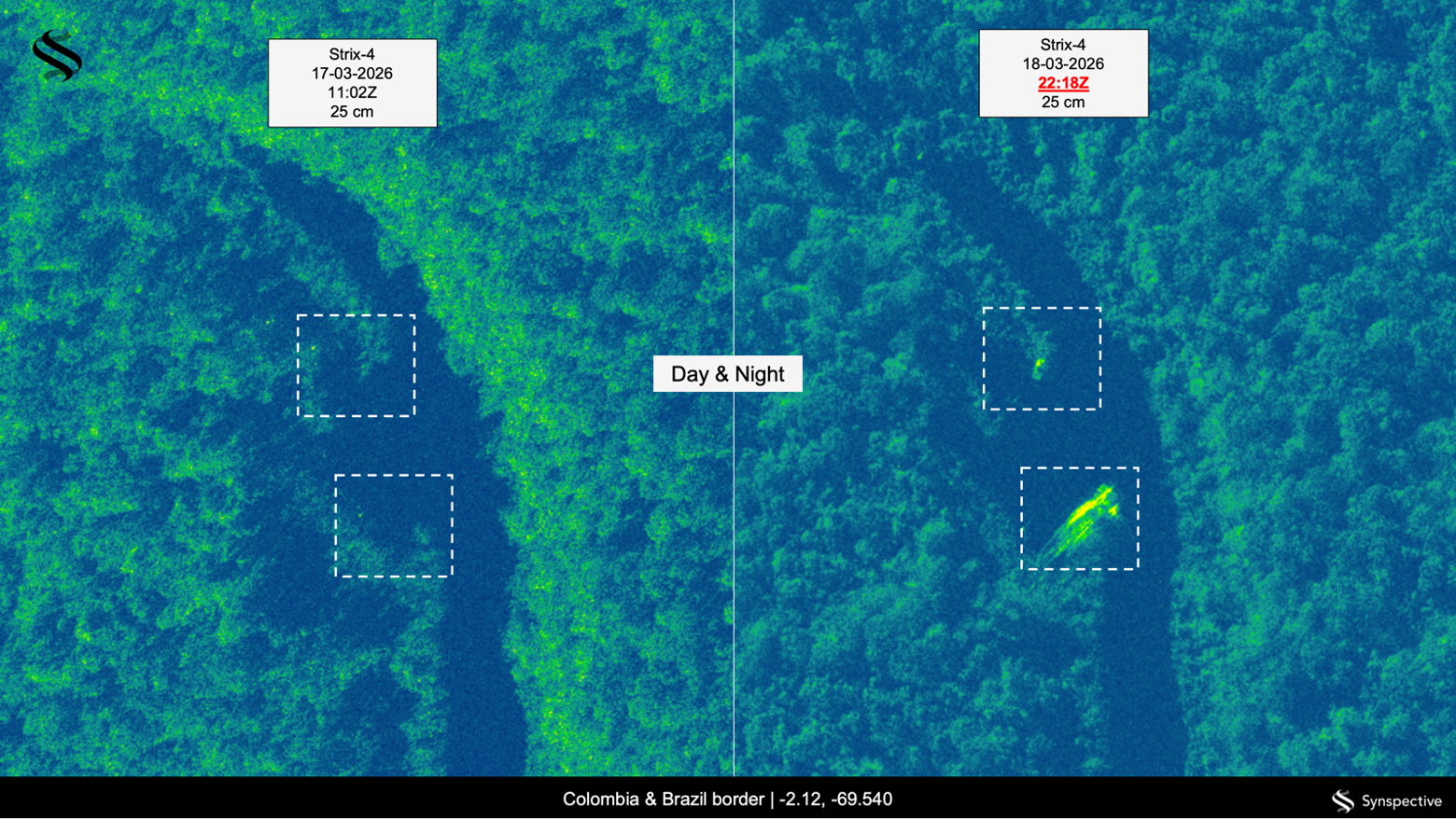
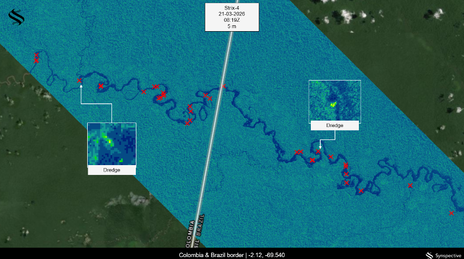
Several signatures stand out, each tied to a different part of the operation. The dredges are the clearest. The wide-area survey identified dozens along one stretch of river, and the higher-resolution revisit then fixed individual machines to specific coordinates. The alterations they leave in the riverbed serve as an early indicator, often visible before the dredges themselves. Their metal roofs return the radar signal strongly, standing out against the darker water. They appear on both the Colombian and Brazilian banks of the same stretch, with no checkpoint between them.
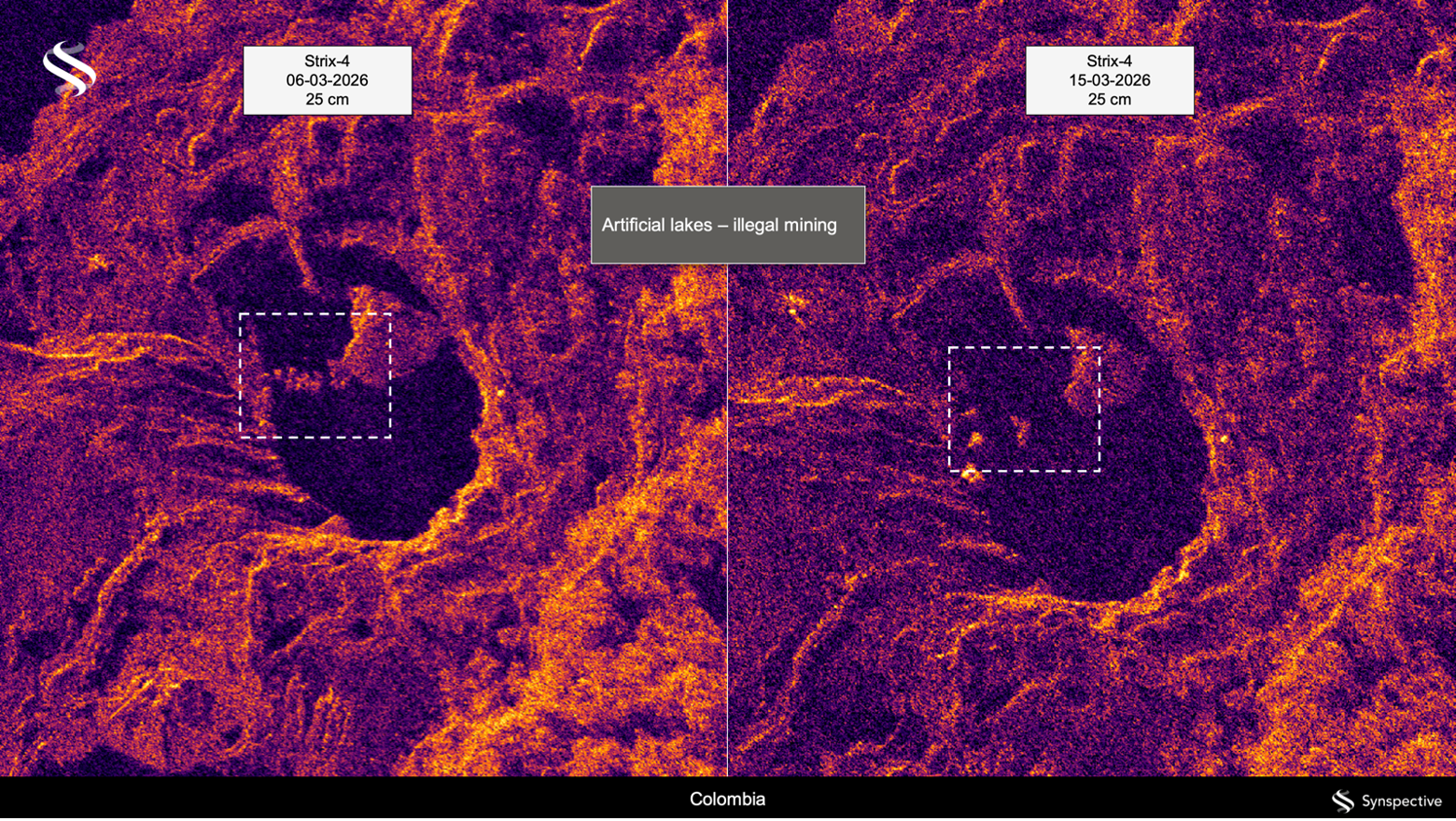
Artificial lakes are a second signature, dug beside rivers to process ore and appearing where the bank was clear before. A comparison of two passes nine days apart shows one such lake being reshaped, the sign of an operation still running.
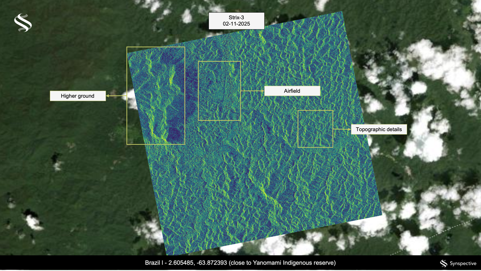
Bulldozers and excavators are a third, standing out against bare ground. In Brazil, where the law allows it, enforcement teams that reach these locations can destroy the equipment in place, a direct and costly blow to the operation. The mining never stands alone. Illegal airstrips cut into the forest within days, cleared corridors for high-value timber, and clusters of buildings that read as isolated bright spots in otherwise empty jungle all point to the wider logistics chain that sustains the activity.
The value of the imagery is in how quickly it can be acted on. A fresh capture can reach an agency in the hours before a planned operation, fixing locations to within a few meters, close enough to direct a team in by boat or helicopter while the activity is still underway. Once an analyst has characterized a signature as distinctive as a dredge, they can automate most of the detection and move to confirming the results. Our role is to provide that capability and train the agencies to use it.
Most monitoring today is organized country by country, while the criminal networks cross borders freely. Watching the whole system at once, day and night, and through the clouds, is now within reach.
Project Contributors
Tata Lacale Canal leads Synspective’s business in Latin America from Rio de Janeiro and brings more than two decades of experience in commercial Earth observation and SAR data services across the region.
Andre Gavlak drives Synspective’s business expansion in Latin America as a Sales Engineer for Synspective USA. He brings over 20 years of experience to the geospatial and remote sensing sectors, and holds a doctorate in physical geography and a master’s degree in Remote Sensing & GIS.
A Related Perspective from Sulsoft
Our partner Sulsoft has explored the same challenge from a Brazilian industry perspective, examining how SAR data can contribute to combating illegal mining in the Amazon. Their piece covers complementary ground on the technical and operational potential of radar-based monitoring in the region.
Read the full article on LinkedIn (Article in Portuguese)
References
Tim Lister and Claudia Rebaza, “Why illegal gold mining is overtaking cocaine as the drug of choice for traffickers in Latin America,” CNN, November 23, 2025.
Adriaan Alsema, “How Colombia’s gold finances illegal armed groups,” Colombia Reports, July 25, 2022.
Luke Taylor, “Illegal gold mining clears 140,000 hectares of Peruvian Amazon,” The Guardian, October 8, 2025.