

Summary
As natural disasters become more severe, quickly assessing the extent of damage across a wide area is essential for local governments to speed up their initial response.
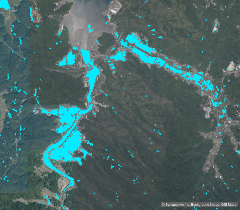
This article presents a demonstration of landslide and flood assessment using the small SAR satellite StriX, carried out in a joint venture with the construction consultancy Fujiyama Co., Ltd., as part of Saga Prefecture’s fiscal 2025 Demonstration Project on the Potential Applications of Satellite Data. StriX can image the surface even in poor weather or at night. By combining its emergency tasking with automated analysis and secure data linkage to the prefecture’s disaster-management system, Synspective built a workflow that delivers a first damage report within two hours of the simulated start of emergency tasking. Alongside the potential to cut time-to-assessment by about 22 hours compared with conventional methods, the demonstration showed that post-disaster flood-mark surveys could achieve expected cost reductions of more than 50 percent.
Background
One regional challenge for Saga Prefecture is accelerating the assessment of landslides and flooding after disasters.
Until now, once a disaster struck, staff went to the site and checked conditions by eye or with drones. Ensuring their safety in hard-to-access areas and the considerable time required to assess damage across the prefecture were persistent problems.
Challenge: Comprehensive, Weather-Independent Assessment and Fast Data Linkage
During a disaster, poor weather often sets in, and optical satellites and aircraft often cannot capture ground conditions. A further obstacle to practical use was the need to analyze the satellite data quickly and deliver it seamlessly into the local government’s disaster-management system. Building a secure data-linkage environment around LGWAN, the Local Government Wide Area Network, was one of the central problems to solve.
Solution: Emergency Tasking and Automated Analysis, Looking Ahead to Delivery Among the Fastest in Japan
In a joint venture with the construction consultancy Fujiyama Co., Ltd., Synspective ran a demonstration built around the small SAR satellite StriX, which images the surface even in poor weather or at night. The work looked ahead to the capability the constellation will unlock once fully established, emergency tasking and data delivery among the fastest in Japan. Envisioning the initial response to a disaster, we structured the full workflow, from tasking through to delivering information to the local government, around three elements.
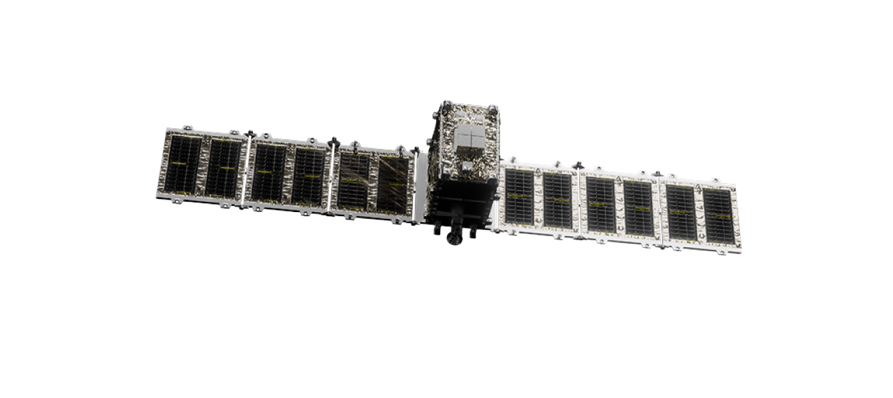
Synspective’s StriX satellite
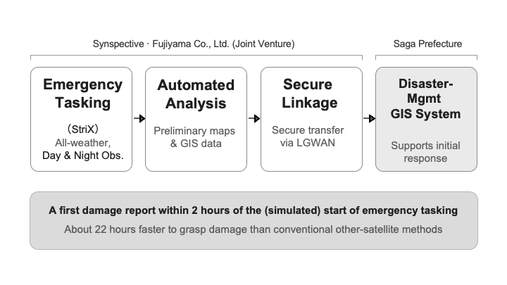
- 1.Emergency tasking (StriX): StriX observes the same area before and after a disaster, capturing on-the-ground conditions even in poor weather or at night. For this demonstration, we carried out the tasking as an emergency-response drill based on a simulated disaster.
- 2. Automated extraction of damaged areas: The system compares pre- and post-disaster imagery and automatically flags areas where they differ as potential landslide or flood zones. Algorithms that evaluate local spatial patterns, such as focal statistics, enable assessment of damage across the entire area rather than point by point.
- 3. Secure data linkage: We built and tested a workflow that delivers the analysis outputs—preliminary disaster maps and GIS data—to Saga Prefecture over a file-sharing service on LGWAN. (Supporting their publication to the prefecture’s disaster-management GIS system.)
Results: Cutting Time-to-Assessment by About 22 Hours, with Post-Disaster Survey Costs Reduced by More Than 50 Percent
The demonstration confirmed results that can greatly streamline a local government’s disaster response, as follows.
Table. Comparison of the conventional method and the StriX-based solution.
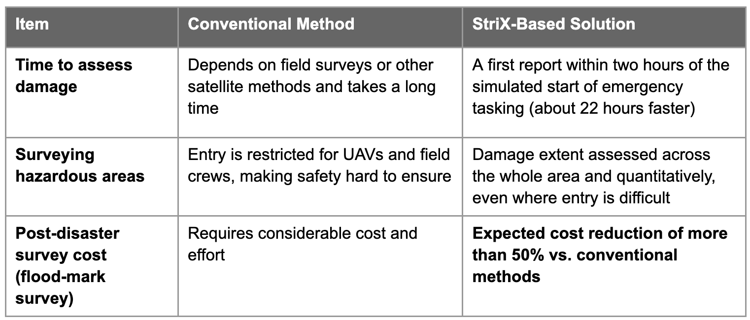
- 1. Outstanding immediacy: What makes that speed possible is StriX’s ability to observe in poor weather and at night, when optical satellites and aircraft are grounded. A first read of the damage reaches responders while the earliest decisions are still being made.
- 2. Safe, quantitative assessment: The picture comes without sending crews into unstable terrain, removing the safety trade-off that field surveys and drones run into when access is the constraint.
- 3. Lower post-disaster survey costs: The same outputs do double duty beyond the initial response, standing in for or supplementing the flood-mark surveys that feed disaster damage certification, where the bulk of the conventional cost and labor sits.
Future Outlook: Advancing Disaster-Prevention Digital Transformation and Expanding the Constellation for a Faster Initial Response
The demonstration confirmed that StriX’s emergency-tasking workflow and automated analysis contribute substantially to faster decision-making in a local government’s disaster response and hold up in practice.
As Synspective’s satellite constellation comes fully into place, imaging and data delivery among the fastest in Japan will become routine, whatever the time of day or weather. By strengthening links with secure systems such as LGWAN and delivering more timely, accurate disaster information, we will continue to advance disaster-prevention digital transformation for local governments.