

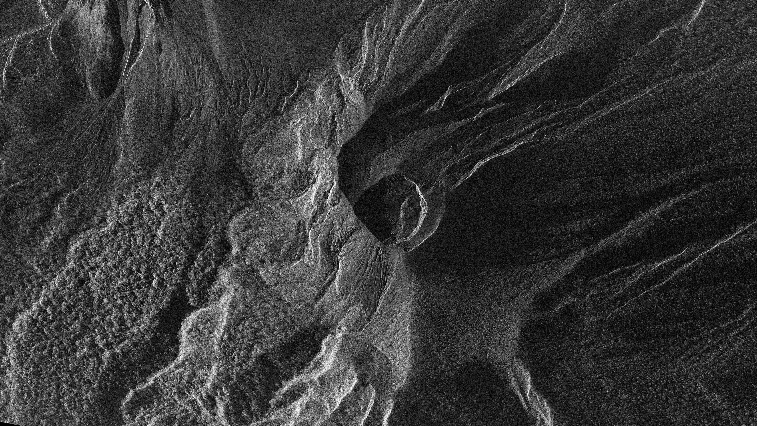
Mount Lewotobi Laki Laki/Indonesia
If you would like to download sample images from Synspective’s small SAR satellite, StriX, please fill out the following form:
Details
Note : For detailed product specifications, please refer to the latest SAR Data Product Guide.
Date and time:2024/11/15(UTC)
Country : Indonesia
Product/Data format : GRD/GeoTiff , SR-GRD/GeoTiff , SLC/CEOS
Lat : -8.551873011368318 Lng : 122.78043716528238
Satellite : StriX
Modes : Staring Spotlight 1
Length [km]: Swath 10 x Length 3
Resolution [m]: 0.9 × 0.5
Tags : #EnvironmentalMonitoring #DisasterManagement #LavaFlow #Flores #MountLewotobiLakiLaki #Indonesia #Volcano #Islands