

As previously announced, our small SAR satellite, StriX, has been actively observing the Noto Peninsula area.
On January 1st, the Noto Peninsula Earthquake occurred in Ishikawa, Japan, with a magnitude of 7.6. In response, we provide Synthetic Aperture Radar (SAR) satellite observation data of the affected area for disaster response, disaster reporting, and research purposes.
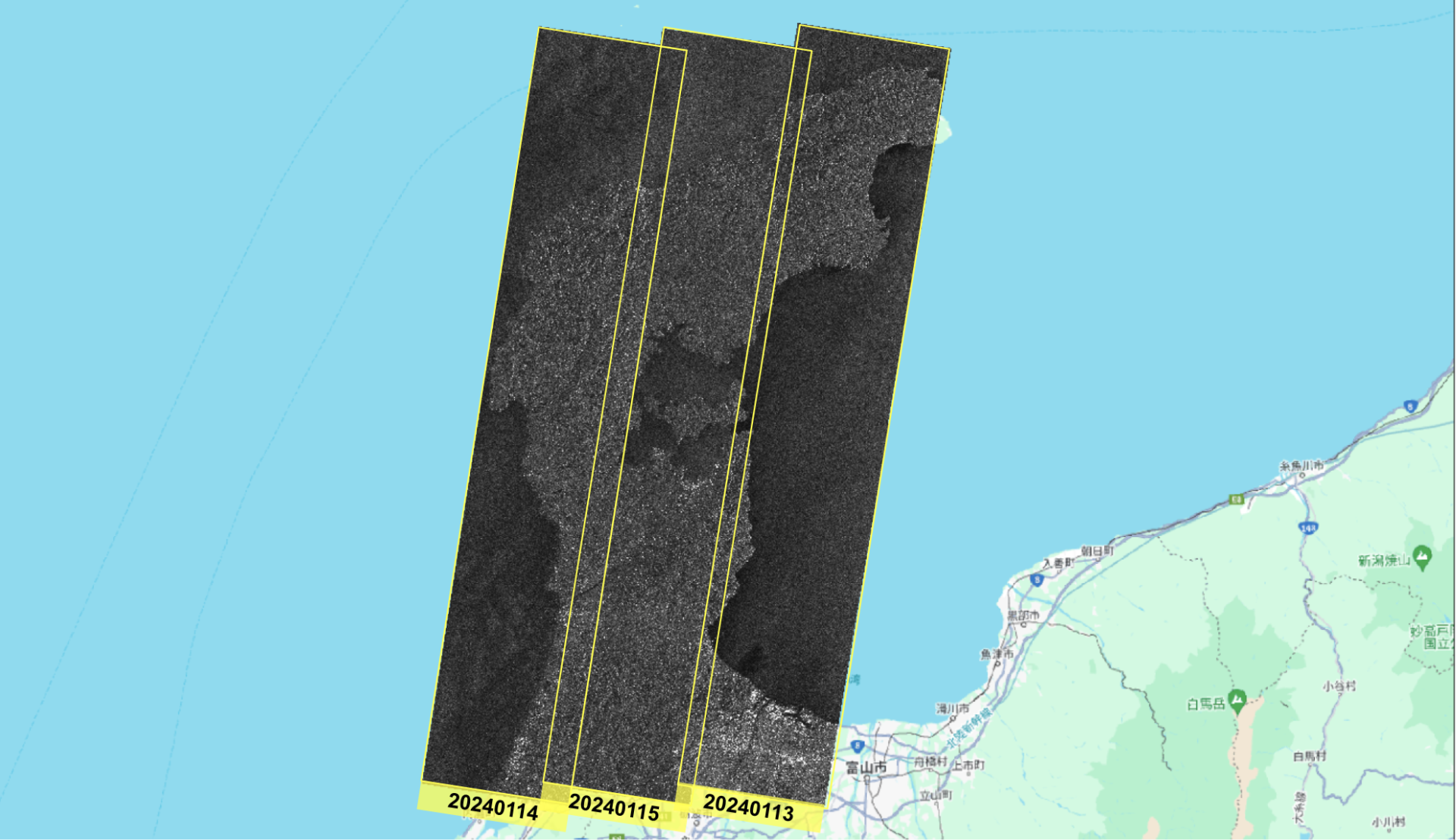
[Jan 13, 14, 15] SAR Coverage of Entire Noto Peninsula in Ishikawa, Japan
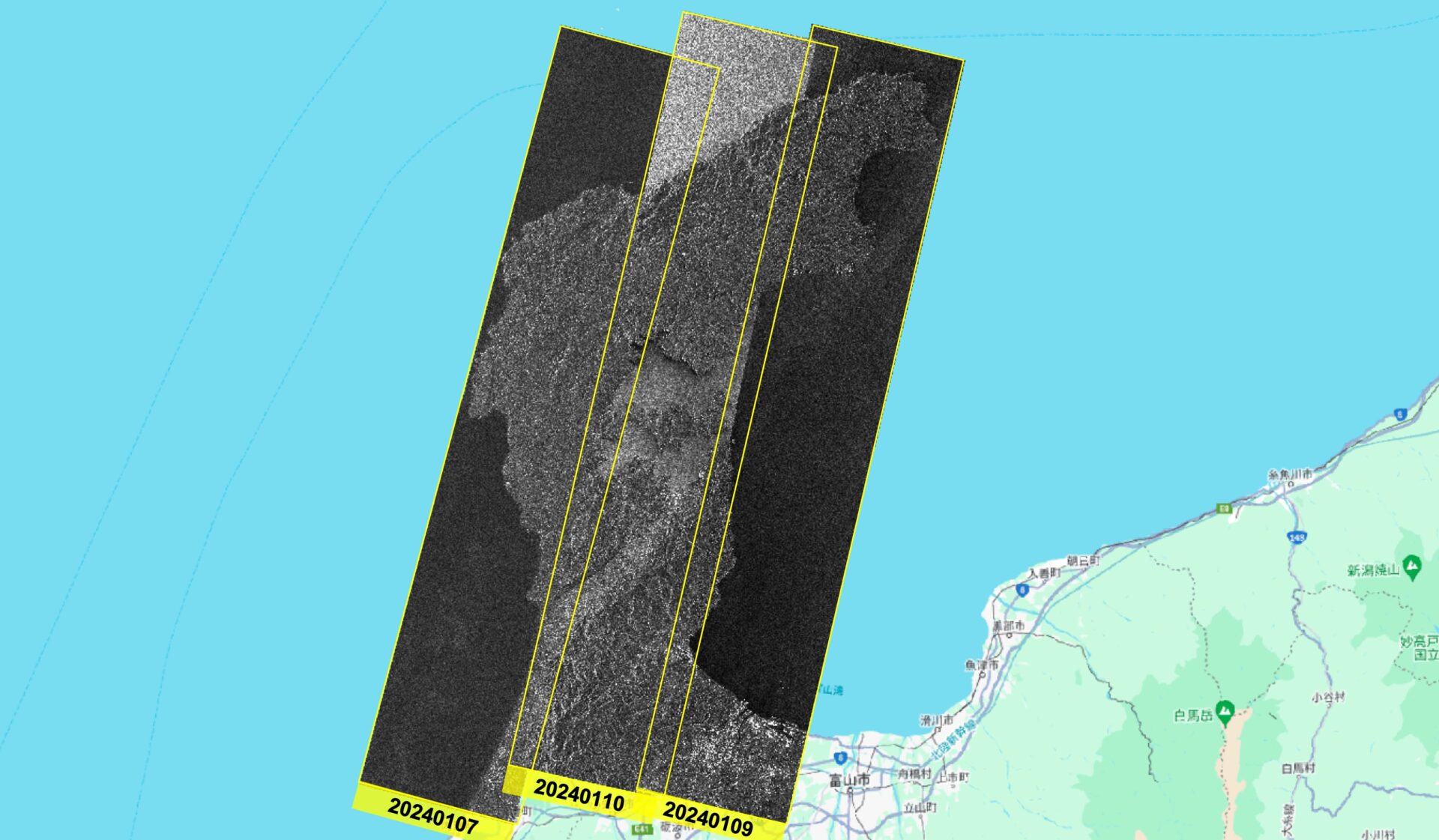
[Jan 7,9,10] SAR Coverage of Entire Noto Peninsula in Ishikawa, Japan
Maps Data: Google © 2024, © Synspective Inc.
Update
– Wednesday, January 15, 2024
Observation data for the Anamizu, Nanao, Monzen, Shika, Suzu and Himi regions of the Ishikawa Prefectures have been published.
– Wednesday, January 10, 2024
Observation data for the Anamizu and Nanao regions of the Ishikawa Prefectures have been published.
– Tuesday, January 9, 2024
Observation data for the Suzu and Himi /Takaoka regions of the Ishikawa and Toyama Prefectures have been published.
– Sunday, January 7, 2024
Observation data for the Wajima and Hakui regions of the Ishikawa Prefecture have been published.
Observation Data
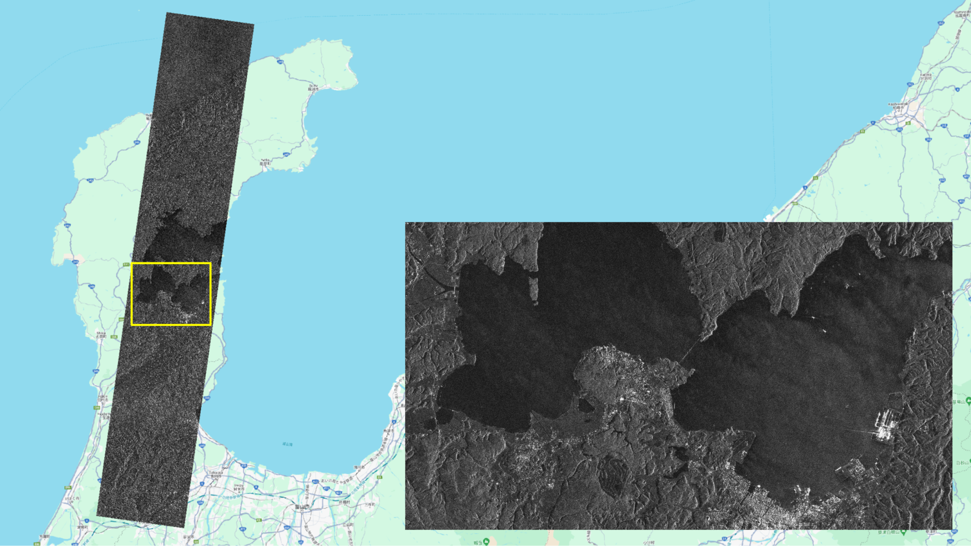
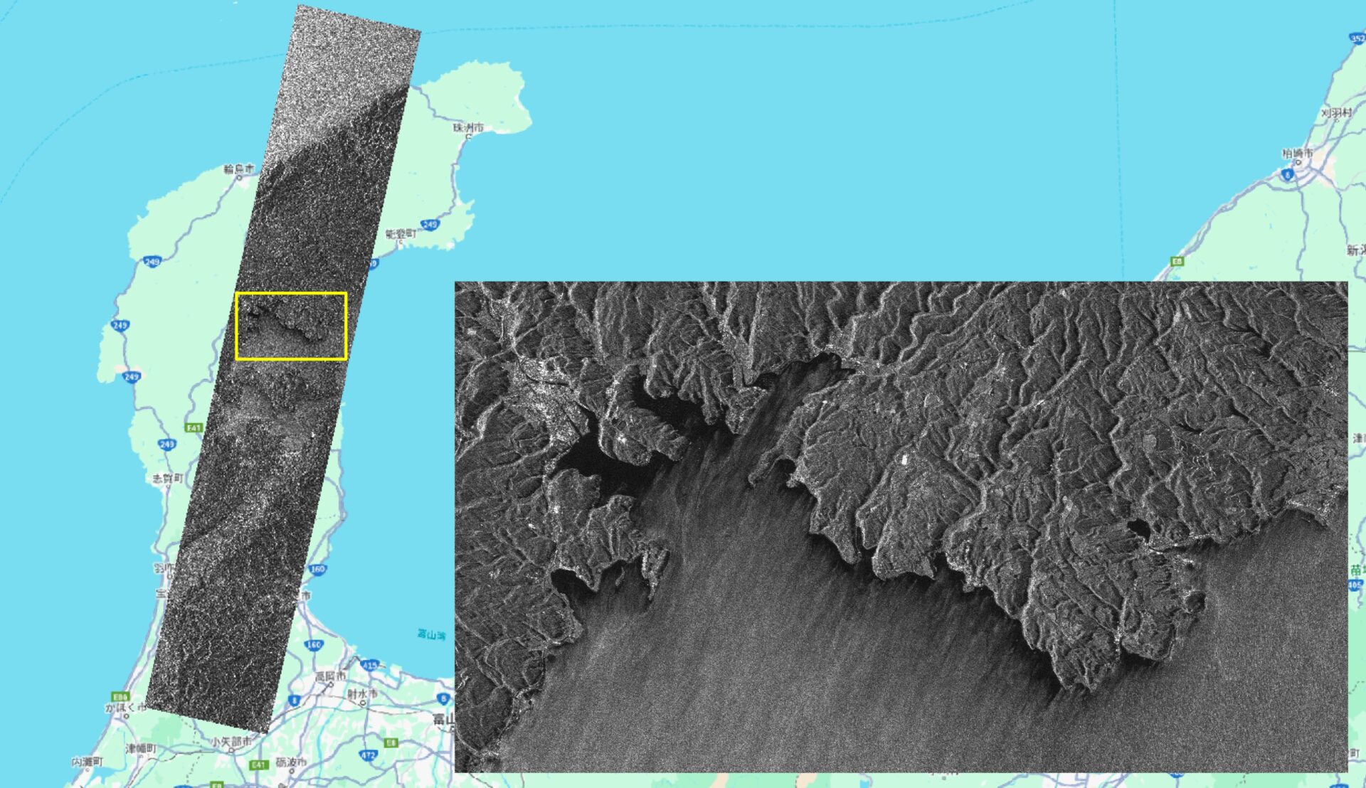
– Anamizu
Maps Data: Google © 2024, © Synspective Inc.
Observation Date and Time: 2024/01/15 23:47 (UTC)
Country: Japan
Product/Data format: GRD/GeoTiff , SR-GRD/GeoTiff , SLC/SICD
Lat : 37.3470°N, Long : 136.9882°°E,
Satellite: StriX-1
Observation Mode: StripMap
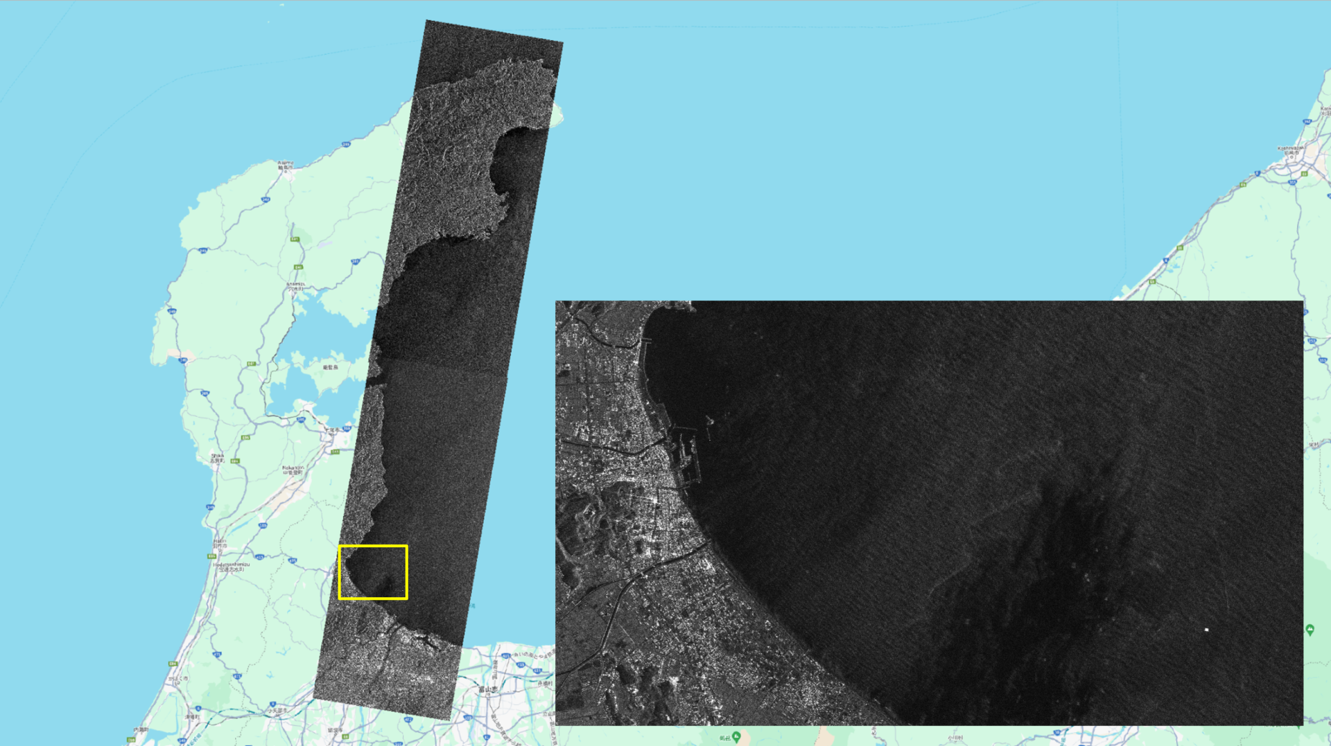
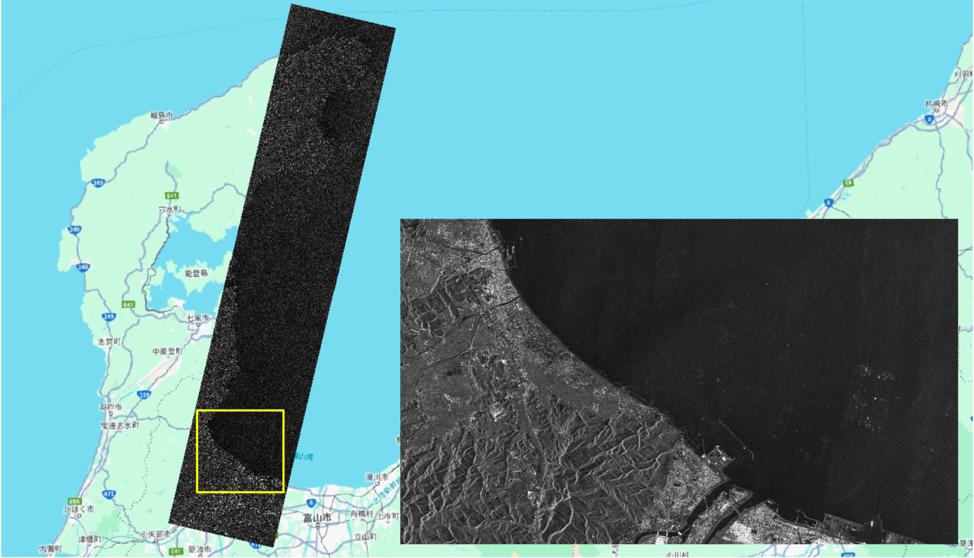
– Nanao
Maps Data: Google © 2024, © Synspective Inc.
Observation Date and Time: 2024/01/15 23:47 (UTC)
Country: Japan
Product/Data format: GRD/GeoTiff , SR-GRD/GeoTiff , SLC/SICD
Lat : 36.9061°N, Long : 136.9005°E
Satellite: StriX-1
Observation Mode: StripMap
– Monzen
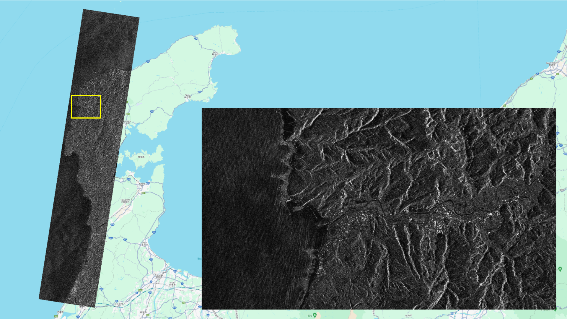
Maps Data: Google © 2024, © Synspective Inc.
Observation Date and Time: 2024/01/14 23:52 (UTC)
Country: Japan
Product/Data format: GRD/GeoTiff , SR-GRD/GeoTiff , SLC/SICD
Lat : 37.3501°N, Long : 136.8126°E
Satellite: StriX-1
Observation Mode: StripMap
– Shika
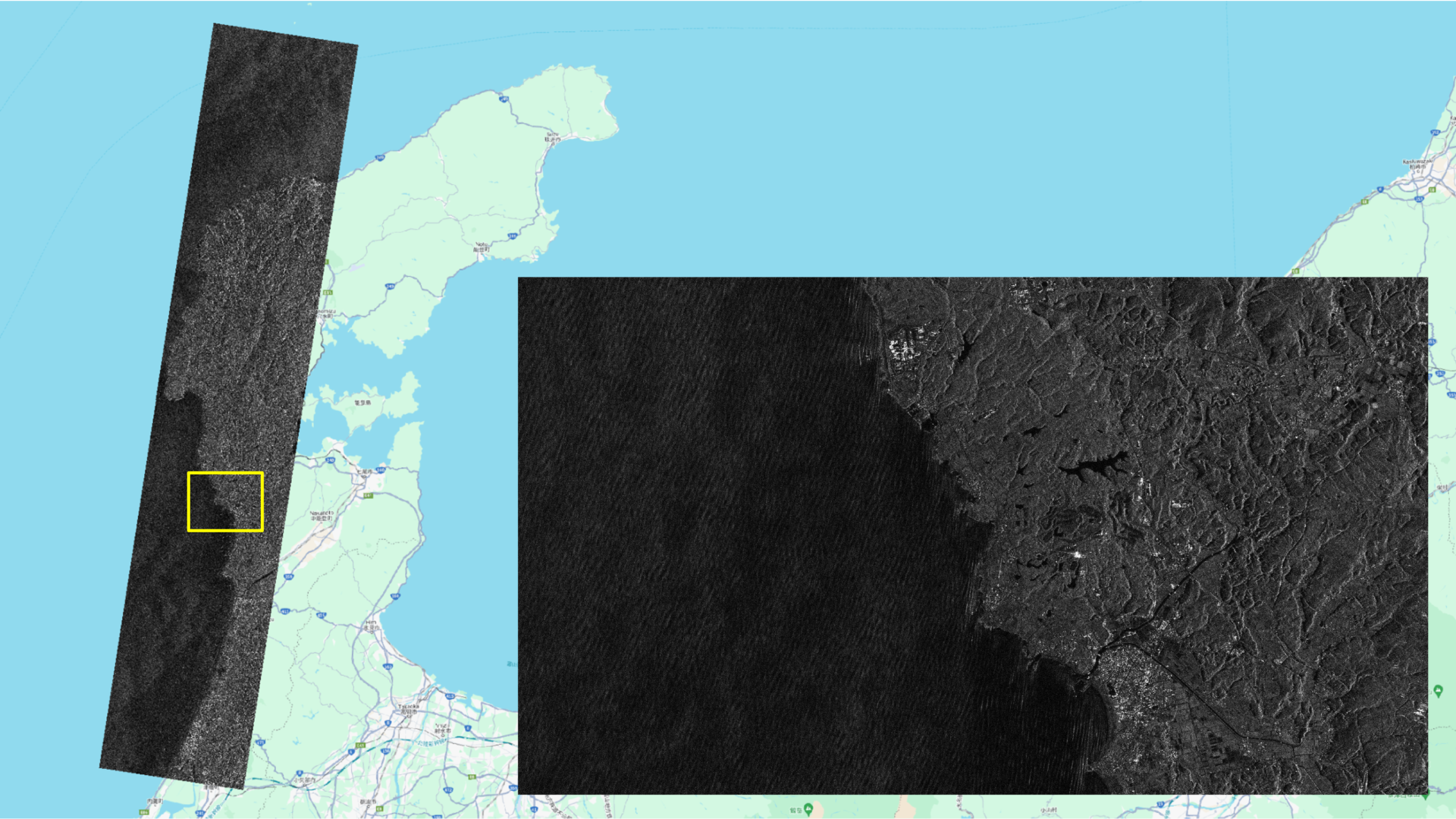
Maps Data: Google © 2024, © Synspective Inc.
Observation Date and Time: 2024/01/14 23:52 (UTC)
Country: Japan
Product/Data format: GRD/GeoTiff , SR-GRD/GeoTiff , SLC/SICD
Lat : 36.9092°N, Long : 136.7172°E
Satellite: StriX-1
Observation Mode: StripMap
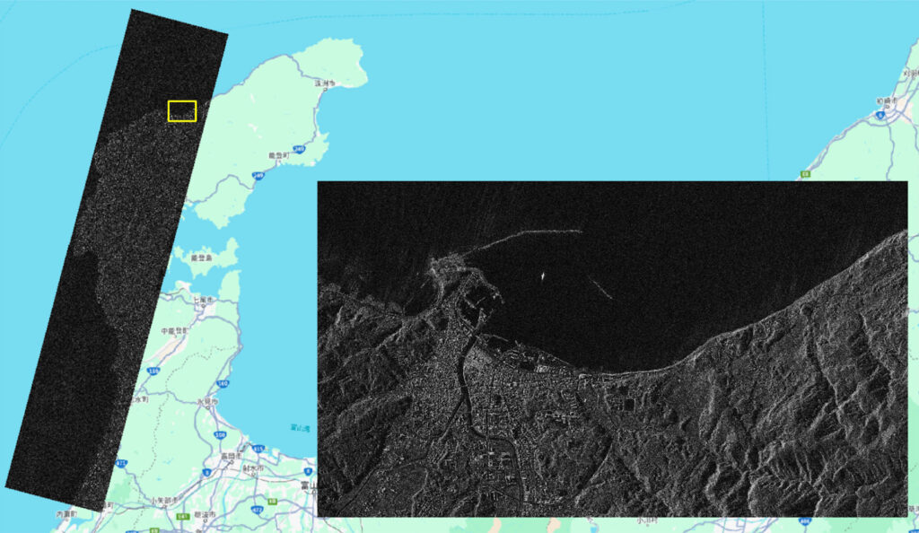
– Suzu
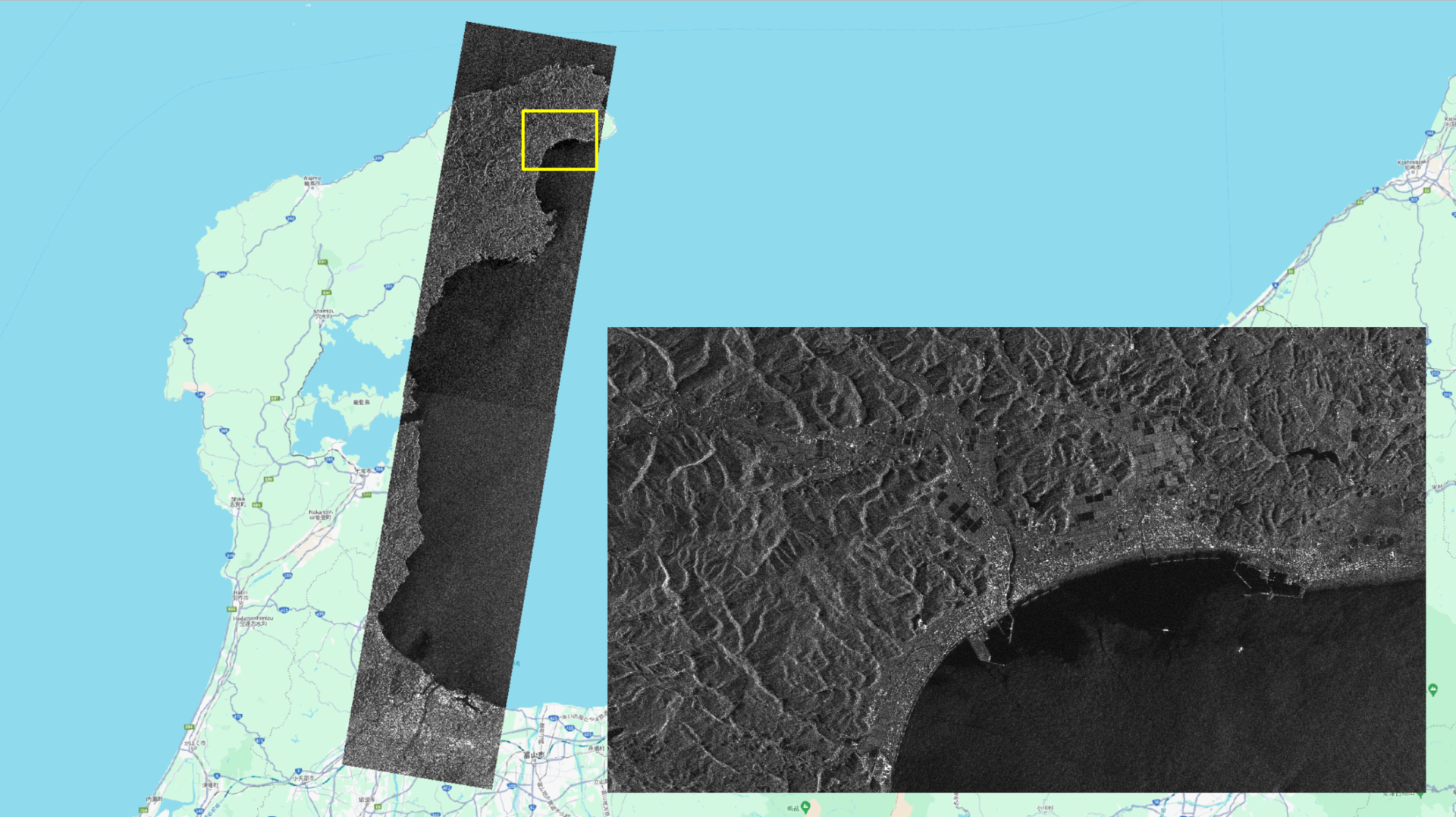
Maps Data: Google © 2024, © Synspective Inc.
Observation Date and Time: 2024/01/13 23:57 (UTC)
Country: Japan
Product/Data format: GRD/GeoTiff , SR-GRD/GeoTiff , SLC/SICD
Lat : 37.3453°N, Long : 137.1947°E
Satellite: StriX-1
Observation Mode: StripMap
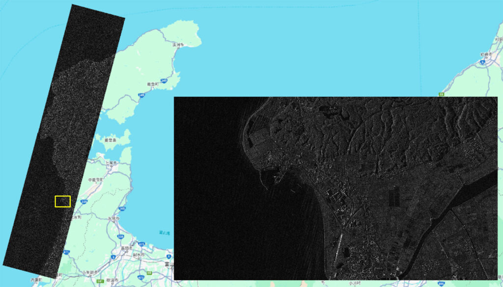
– Himi
Maps Data: Google © 2024, © Synspective Inc.
Observation Date and Time: 2024/01/10 00:18 (UTC)
Country: Japan
Product/Data format: GRD/GeoTiff , SR-GRD/GeoTiff , SLC/SICD
Lat : 36.9042°N, Long : 137.0912°E
Satellite: StriX-1
Observation Mode: StripMap
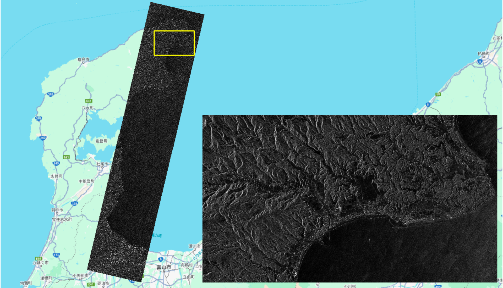
– Anamizu
Maps Data: Google © 2024, © Synspective Inc.
Observation Date and Time: 2024/01/10 00:18 (UTC)
Country: Japan
Product/Data format: GRD/GeoTiff , SR-GRD/GeoTiff , SLC/SICD
Lat : 37.3647°N, Long : 137.0245°E,
Satellite: StriX-1
Observation Mode: StripMap
– Nanao
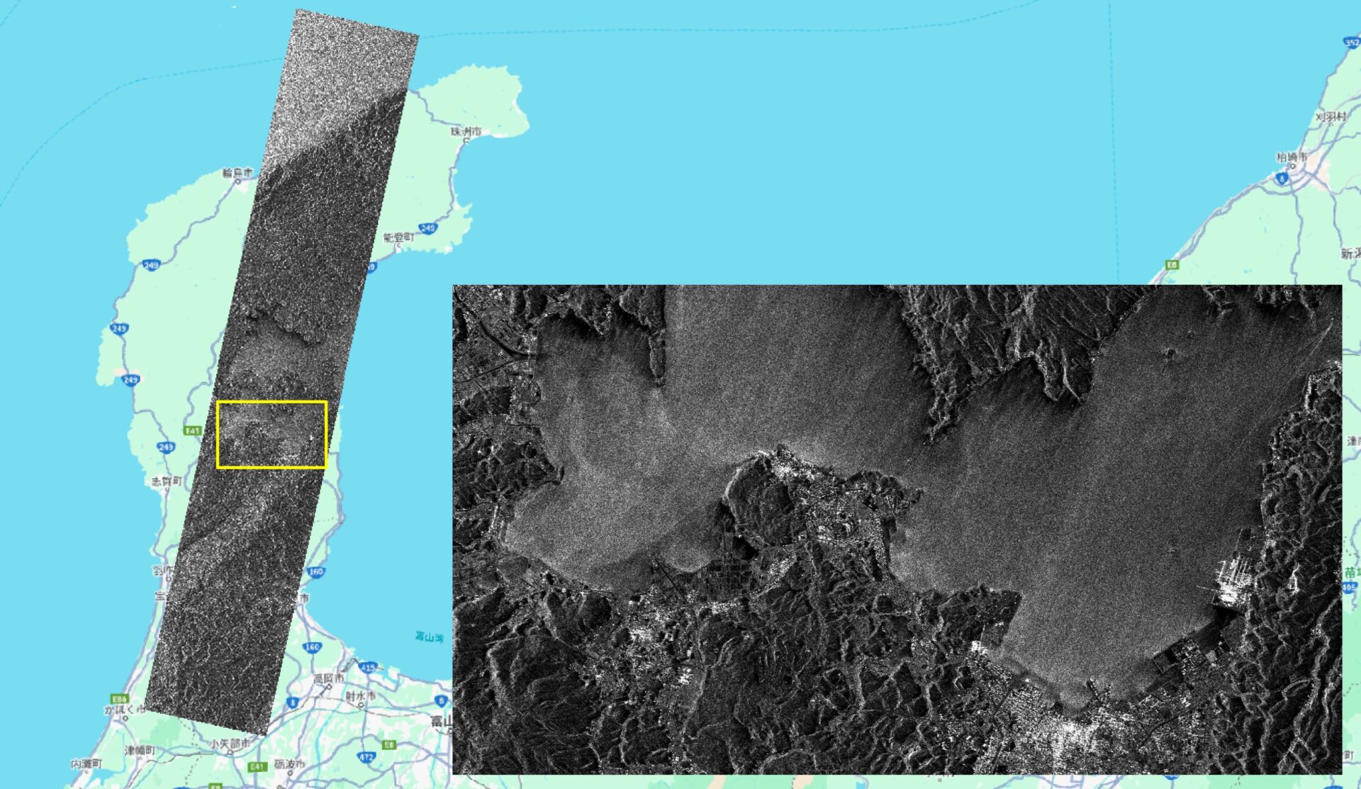
Maps Data: Google © 2024, © Synspective Inc.
Observation Date and Time: 2024/01/10 00:18 (UTC)
Country: Japan
Product/Data format: GRD/GeoTiff , SR-GRD/GeoTiff , SLC/SICD
Lat : 36.9362°N, Long : 136.8966°E,
Satellite: StriX-1
Observation Mode: StripMap
– Suzu
Maps Data: Google © 2024, © Synspective Inc.
Observation Date and Time: 2024/01/09 00:23 (UTC)
Country: Japan
Product/Data format: GRD/GeoTiff , SR-GRD/GeoTiff , SLC/SICD
Lat : 37.3421°N, Long : 137.2216°E
Satellite: StriX-1
Observation Mode: StripMap
– Himi and Takaoka
Maps Data: Google © 2024, © Synspective Inc.
Observation Date and Time: 2024/01/09 00:23 (UTC)
Country: Japan
Product/Data format: GRD/GeoTiff , SR-GRD/GeoTiff , SLC/SICD
Lat : 36.9049°N, Long : 137.0790°E,
Satellite: StriX-1
Observation Mode: StripMap
– Wajima
Maps Data: Google © 2024, © Synspective Inc.
Observation Date and Time: 2024/01/07 00:33 (UTC)
Country: Japan
Product/Data format: GRD/GeoTiff , SR-GRD/GeoTiff , SLC/SICD
Lat : 37.3462°N, Long : 136.8473°E
Satellite: StriX-1
Observation Mode: StripMap
– Hakui
Maps Data: Google © 2024, © Synspective Inc.
Observation Date and Time: 2024/01/07 00:33 (UTC)
Country: Japan
Product/Data format: GRD/GeoTiff , SR-GRD/GeoTiff , SLC/SICD
Lat : 36.9114°N, Long : 136.6919°E
Satellite: StriX-1
Observation Mode: StripMap
Disaster Response Free Data License
- For disaster response, reporting, and research purposes, Synspective provides the observation data captured by our SAR satellite StriX free of charge. There is no set deadline for this offer.
- Other terms and conditions are subject to the “Evaluation License for Synspective SAR Data ” as described below. (In case of any overlap, the above point 1 takes precedence.)
- By using the observation data, users legally bind themselves to the license terms and agree to them.
- When using the observation data, please credit “© Synspective Inc.”
Evaluation License for Synspective SAR Data