
Information 2026.08.14
Heavy Rainfall in Chiba Prefecture (2026): Emergency Observation with Small SAR Satellites and Data Provision to Related Organizations
We extend our deepest sympathies to all those affected by the heavy rainfall centered in Chiba Prefecture.
Synspective collaborates with public institutions during disaster management and maintains an emergency observation system using small SAR satellites.
In response to the recent heavy rainfall event (following the Heavy Rain Emergency Warning issued for Chiba Prefecture on August 13, 2026), we immediately initiated an emergency response. Emergency tasking was registered on the day of the event, and emergency observations of the affected areas began that night. In this response, we successfully delivered the preliminary report, including both data acquisition and analysis, in approximately 3.3 hours. The acquired data has been processed and is being provided sequentially to relevant institutions, with flood analysis results delivered in stages as well.
Overview of Observation and Analysis Results
SAR satellites can observe the Earth’s surface regardless of night or weather conditions (such as heavy rain or cloud cover), making them an effective tool for assessing situations immediately following a disaster. Below is an overview of the emergency observations and analyses conducted for this heavy rainfall event in Chiba Prefecture:
1. Broad-area Observation of Chiba Prefecture (Captured August 13, 2026, at 21:39 JST)
Emergency observation was conducted at night while the Heavy Rain Emergency Warning was in effect. Widespread flooding was confirmed in the paddy fields surrounding the upper reaches of the Shimotega Swamp river system, and a general increase in river water levels was clearly captured.
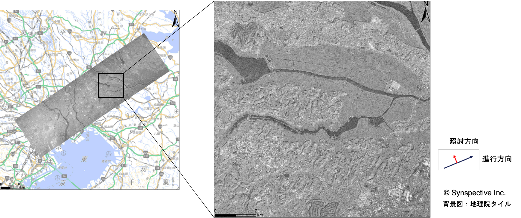
Figure 1: Chiba Prefecture / Captured on August 13, 2026, at 21:39 JST (© Synspective Inc. / Background map: Geospatial Information Authority of Japan Tiles)
2. Flood Analysis Around Oami and Honno Stations (Captured August 14, 2026, at 07:35 JST)
Flood analysis was conducted around Oami Station and Honno Station along the JR Sotobo Line. The estimated extent of flooding in paddy fields generally showed high alignment with actual aerial footage of the area.
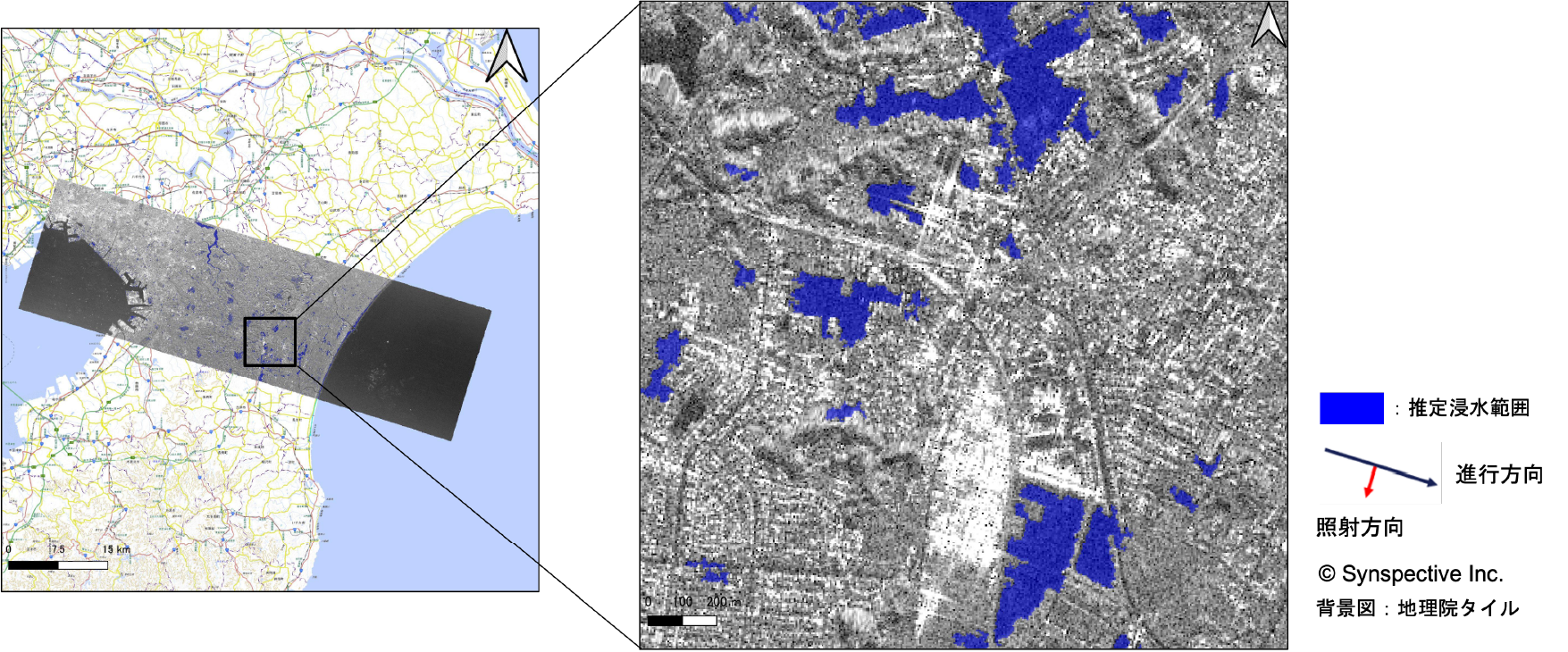
Figure 2: Flood Analysis Result around Oami Station, Chiba Prefecture / Captured on August 14, 2026, at 07:35 JST
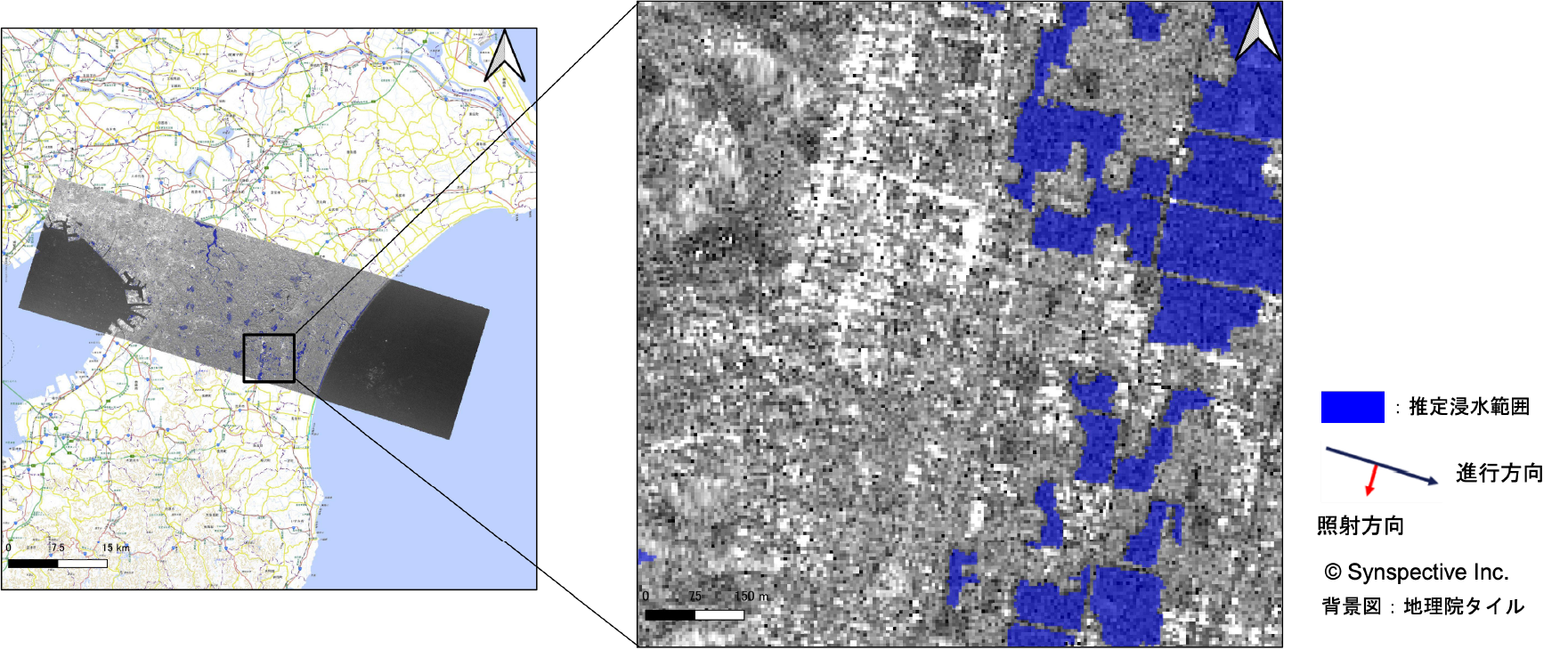
Figure 3: Flood Analysis Result around Honno Station, Chiba Prefecture / Captured on August 14, 2026, at 07:35 JST
Leveraging our small SAR satellite constellation capabilities, Synspective will continue to collaborate with public institutions and other relevant entities to provide rapid, continuous information during disasters. Please prioritize your safety, and we sincerely pray for everyone’s safety and a swift recovery.

