

TOKYO, 2024, June 6th – Synspective Inc., a Synthetic Aperture Radar (SAR) satellite data and analytics solutions provider, is pleased to announce the successful test observation of images for daily Interferometric Synthetic Aperture (InSAR) analysis with StriX-3, launched in March 2024, and StriX-1, launched in September 2022.
InSAR is a technique that detects changes in the Earth’s surface, including surface deformation, terrain height, and other minute movements with millimeter-scale accuracy. It achieves this by applying sophisticated processing to SAR images captured at different times to provide high-resolution data. This technique is capable of penetrating clouds and works in all weather conditions. Recently, we acquired several such images.
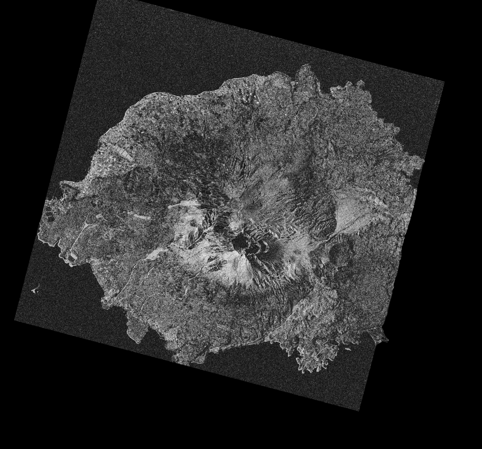
Our InSAR analysis used two-time pair images from consecutive days in the images below. The colored images show the difference in the phase of the SAR images through color changes, while the monochrome images indicate the coherence of the phase by brightness. High coherence is evident across the entire image. Further analysis can detect topographic data and millimeter-level displacement.
Large SAR satellites currently acquire images at intervals of up to six days. Acquiring images more frequently will significantly expand applications, such as safety management at construction sites and disaster prediction.
We have been selected by the Ministry of Economy, Trade and Industry (METI) for the Small and Medium Business Innovation Research Promotion Project (SBIR Phase 3). We will continue to develop technologies and establish a system for the stable provision of daily InSAR images. In addition, we will continue to develop InSAR analysis services, including our Land Displacement Monitoring (LDM) solution.
■ StriX-3 InSAR Image Details
Observation Date: May 7, 2024 and May 8, 2024
Location: Congonhas, Minas Gerais, Brazil
Observation Mode: Sliding Spotlight Mode
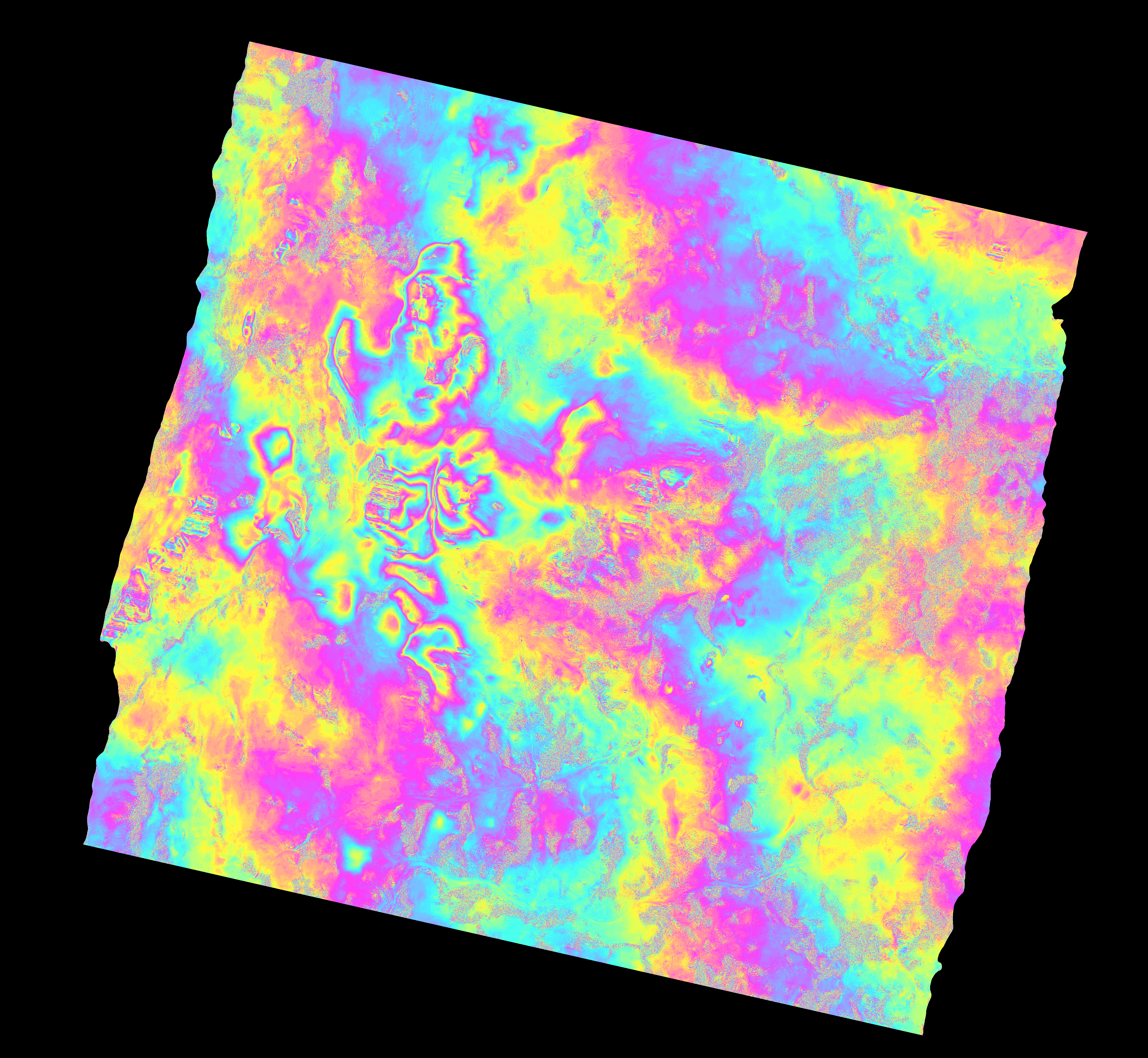 InSAR image |
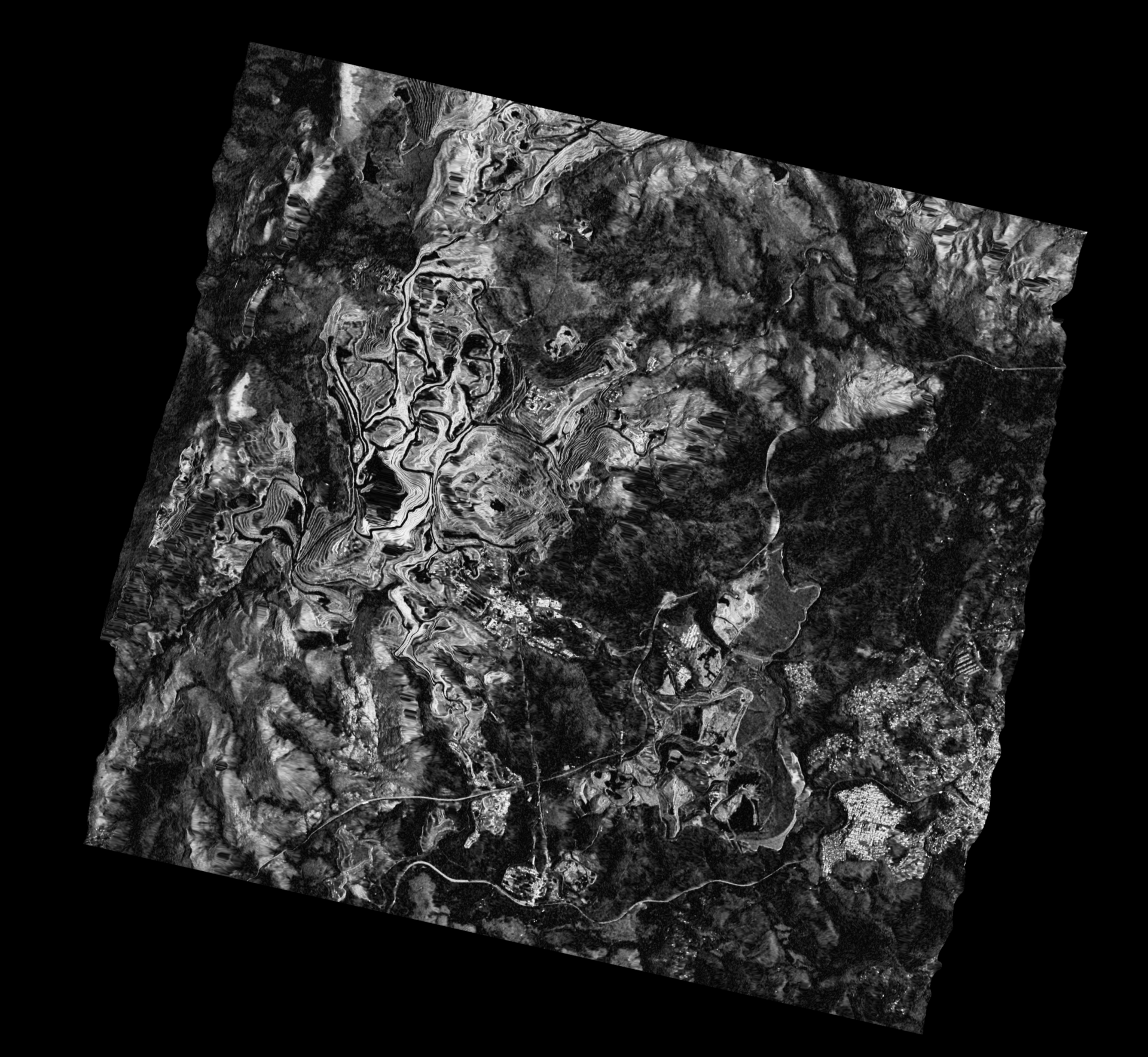 Coherence image |
| *Click for higher resolution radar satellite image | |
■ StriX-1 InSAR Image Details
Date: January 31, 2023 and February 1, 2023
Location: Sakurajima, Kagoshima, Japan
Observation Mode: Stripmap Mode
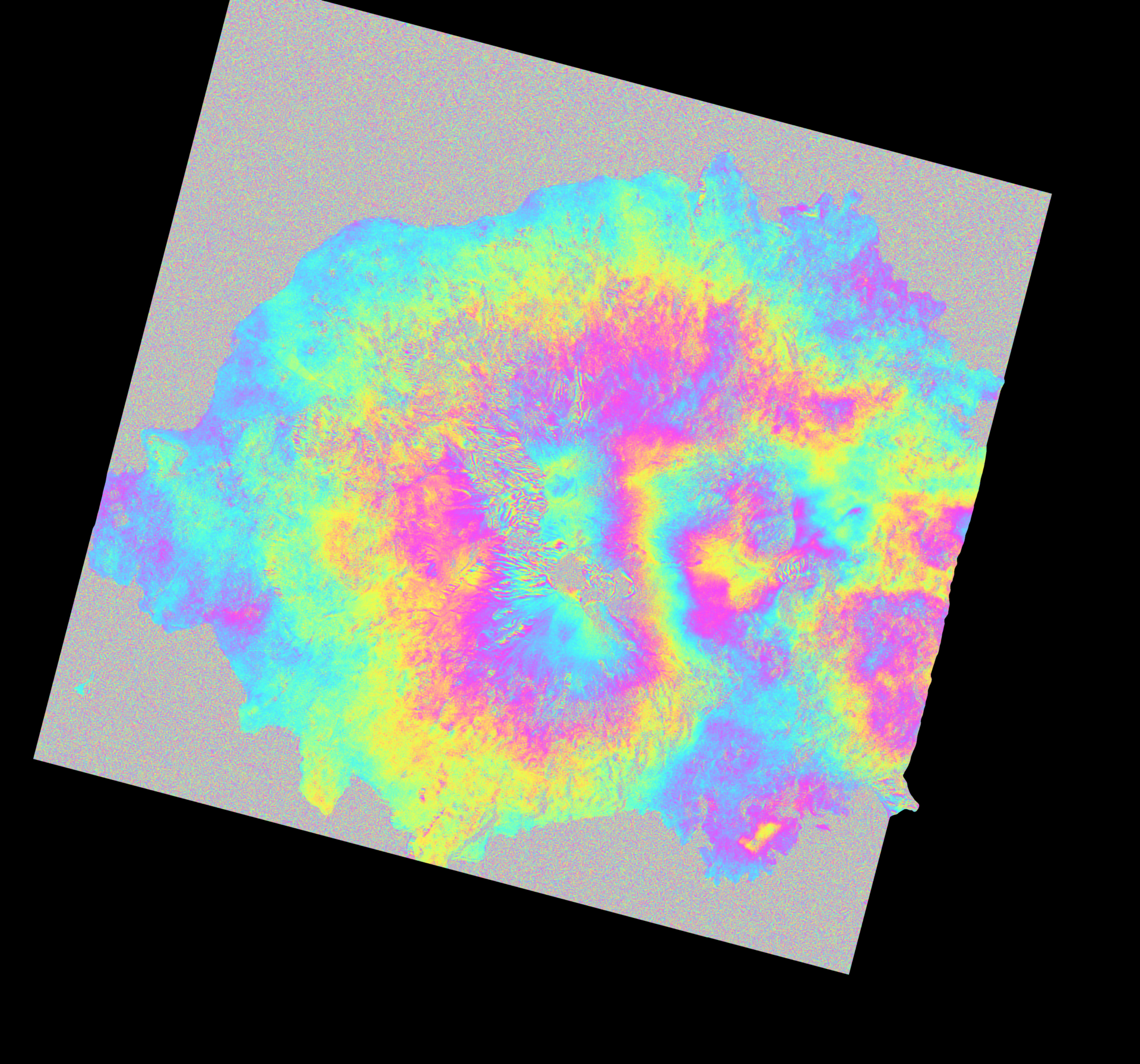 InSAR image |
 Coherence image |
| *Click for higher resolution radar satellite image | |
■ StriX InSAR-related technical information
Fringe 2023 presentation material: “Synspective’s Small X-Band SAR Satellite (StriX) Constellation and its First InSAR Results” https://fringe2023.esa.int/iframe-agenda/files/presentation-141.pdf
■ About Synspective
Synspective, established in 2018, is an end-to-end SAR satellite data and solution provider with the mission to realize a learning world for people to expand their capabilities and make tangible progress with new data and technologies. With a SAR satellite constellation that enables high-frequency and high-resolution Earth observation, Synspective delivers satellite data and various solutions that combine SAR and IoT data with machine learning and data science techniques.