

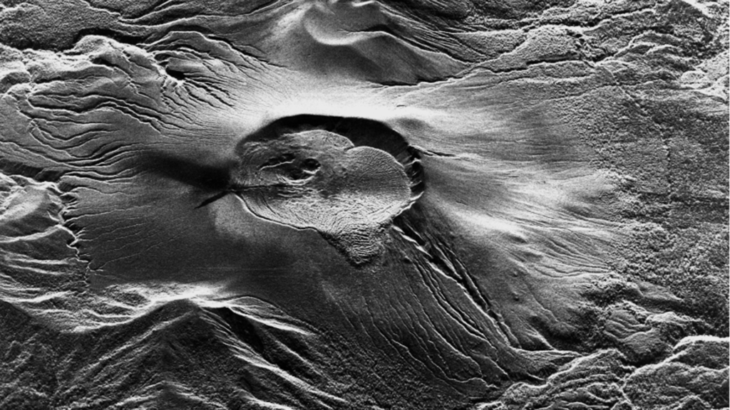
Summary
On June 22, 2025, Shinmoedake volcano in Japan’s Kirishima mountain range on the border of Kagoshima and Miyazaki prefectures erupted for the first time in seven years. Synspective’s StriX Synthetic Aperture Radar (SAR) satellite conducted high-frequency, high-resolution observations of the volcanic activity. The all-weather SAR capability enabled continuous monitoring on the Earth’s surface without interference from cloud cover or volcanic plumes, demonstrating the effectiveness of SAR satellites for volcanic monitoring applications.
Background
Shinmoedake is one of the most active volcanoes in Japan. The 2011 eruption deposited substantial volcanic ash across surrounding areas, resulting in significant damage to social and economic activities. The volcano exhibits cyclical activities, with the most recent eruption occurring in 2018. Effective volcanic monitoring requires accurate, timely detection of eruption precursors and activity progression to protect local populations and critical infrastructure.
Challenge: Volcano Observation Hindered by Weather and Observation Frequency
Monitoring volcanic activity requires detecting subtle surface changes, but conventional satellite observation frequency presents challenges.
> Weather Impact: Optical satellite observations cannot penetrate cloud cover or volcanic plumes, making surface conditions undetectable and limiting observation opportunities, especially during the rainy season and typhoon periods.
> Observation Frequency Limitations: Conventional satellites typically observe the same location every few days, making it difficult to track day-to-day volcanic changes.
Solution: All-Weather, High-Frequency Observation
Synspective’s StriX SAR satellite transmits radio waves and capture their backscatter, allowing surface observation through clouds, volcanic plumes, and during nighttime operations. This active sensing capability allows detection of topographical changes associated with volcanic activity regardless of weather conditions or atmospheric interference.
A single StriX satellite offers frequent observation, while coordinated constellation operations increase revisit frequency for specific locations. This enables detailed monitoring of short-term surface changes that conventional systems cannot capture. During Shinmoedake’s eruption, StriX satellites observed the active crater on consecutive days, successfully documenting the evolving surface conditions.
Observation Results from StriX
High-frequency, high-resolution observations by StriX have revealed multiple ongoing changes around the crater.
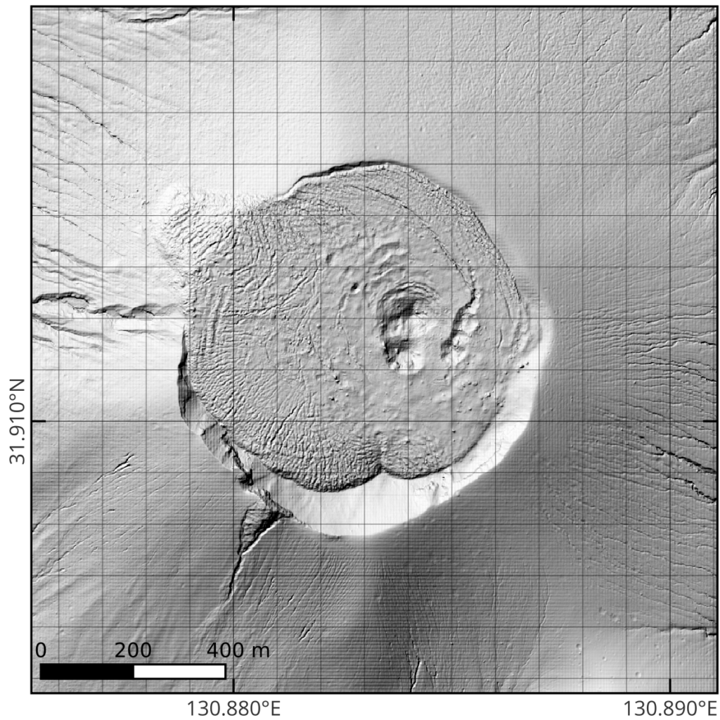
1) Clear Visualization of Topographical Changes Within the Crater
Comparing SAR images acquired before the eruption (February 26) and during eruption (June 28 and July 3) reveals new topographical changes within the crater. At a maximum resolution of 0.46 m x 0.25 m (Note), StriX detected detailed surface changes resulting from the volcanic activity.
(Note) For data product specifications, please see here: https://synspective.com/document/
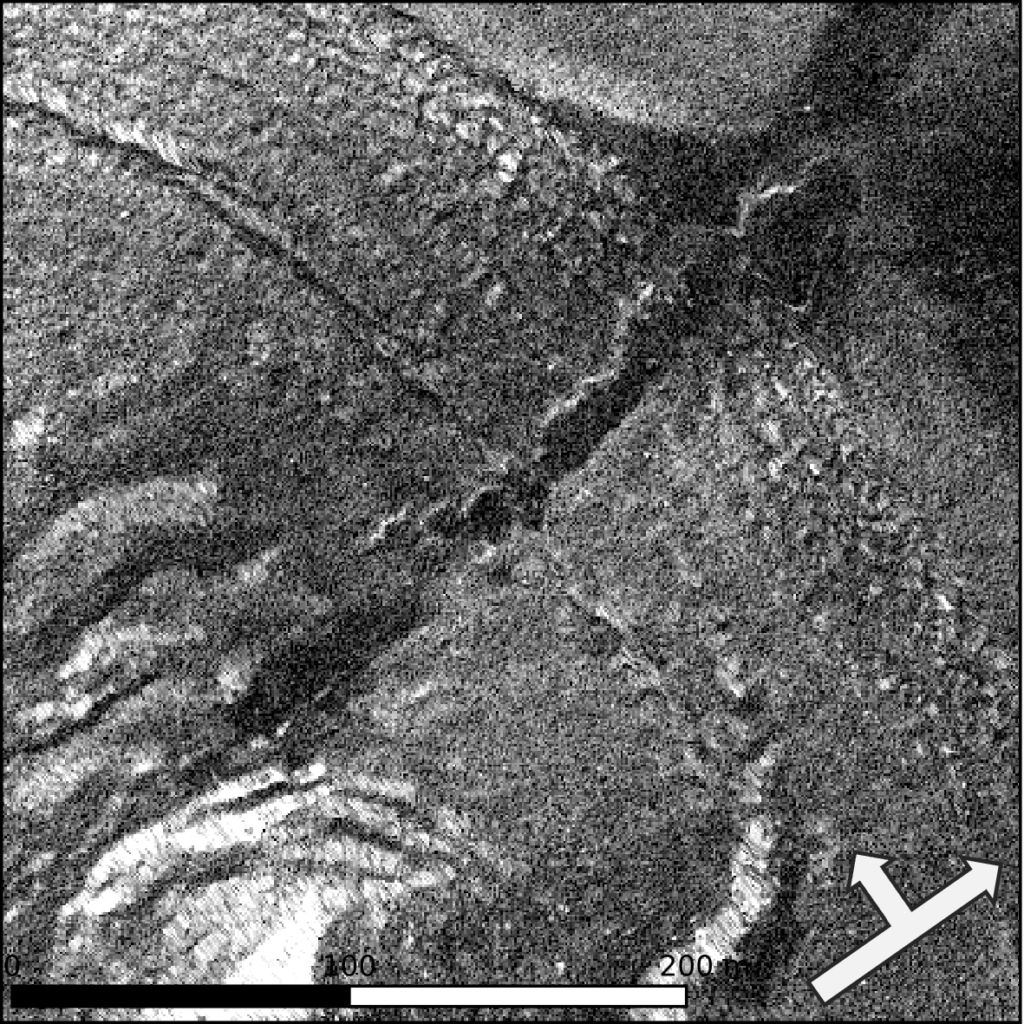
Pre-eruption SAR (Intensity) Image (2025-02-26)
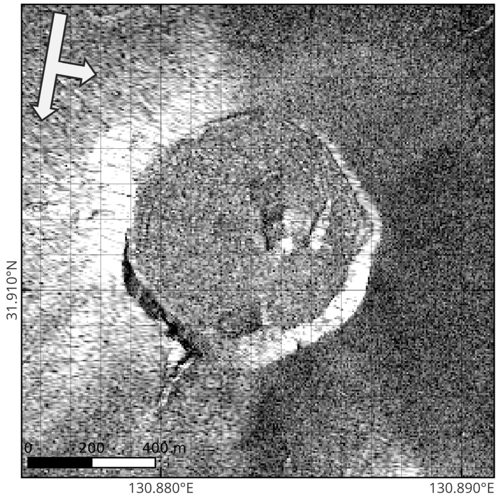
© Synspective Inc.
(Note) Arrows indicate the satellite’s flight path and look direction.
SAR (Intensity) Image During Eruption (2025-06-28)
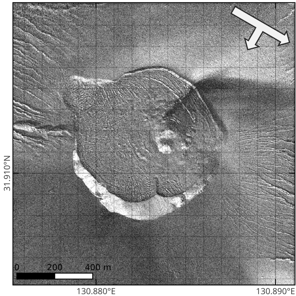
© Synspective Inc.
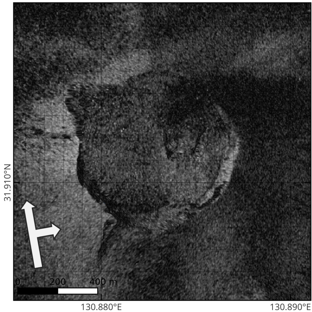
SAR (intensity) Image During Eruption (2025-07-03)
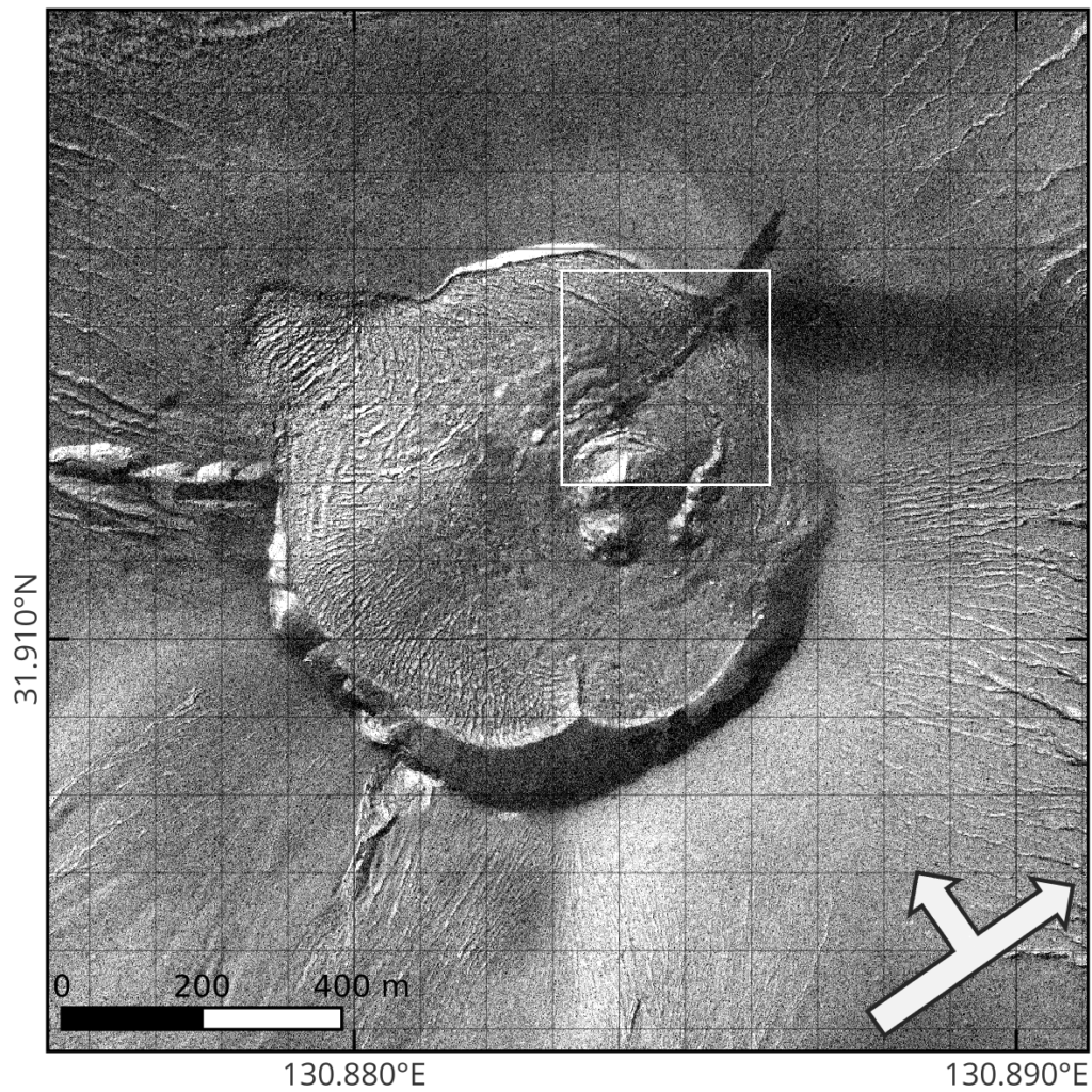
© Synspective Inc
Enlarged View
© Synspective Inc.
A comparison of Shinmoedake before and during the eruption as captured by StriX. The topographical changes within the crater are visible.
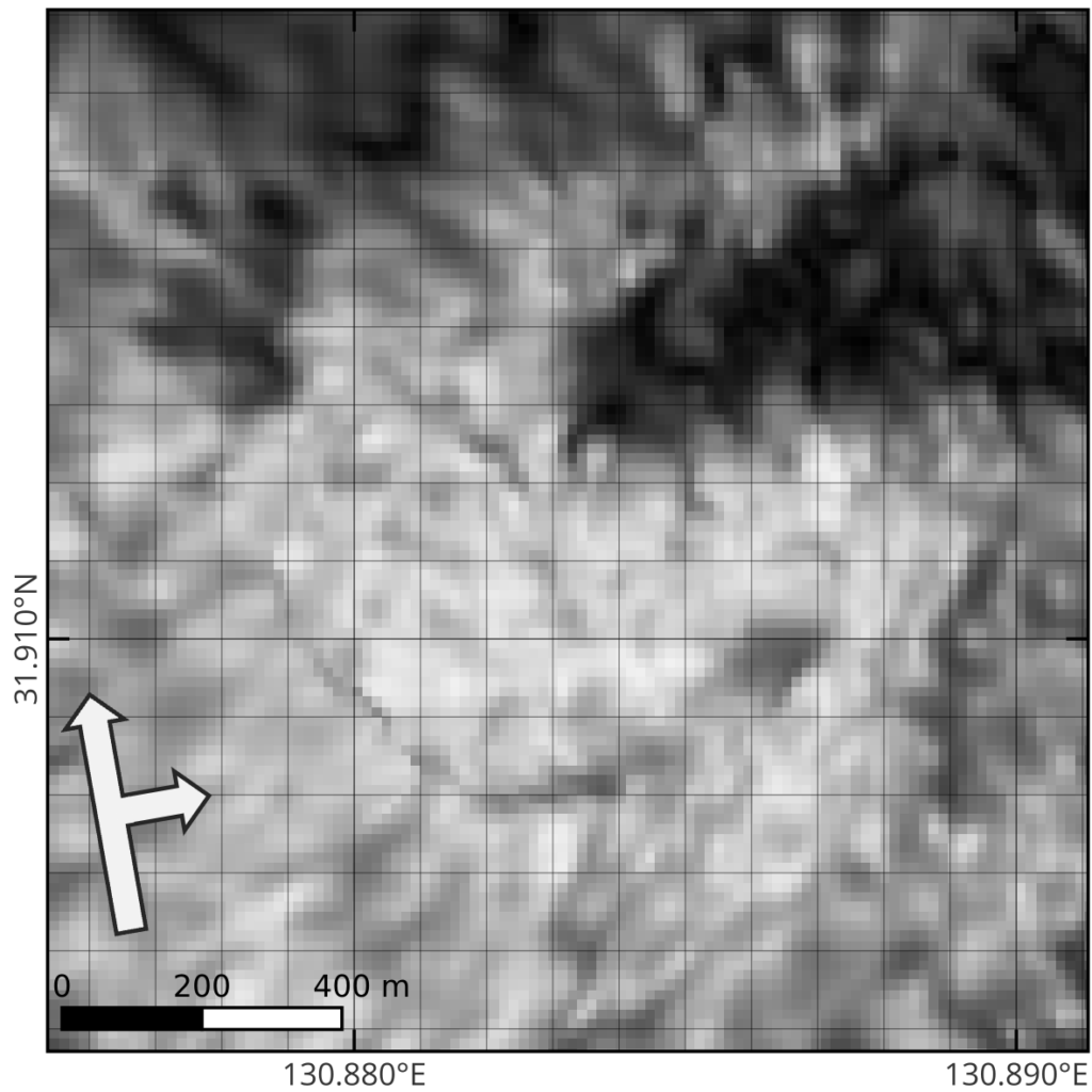
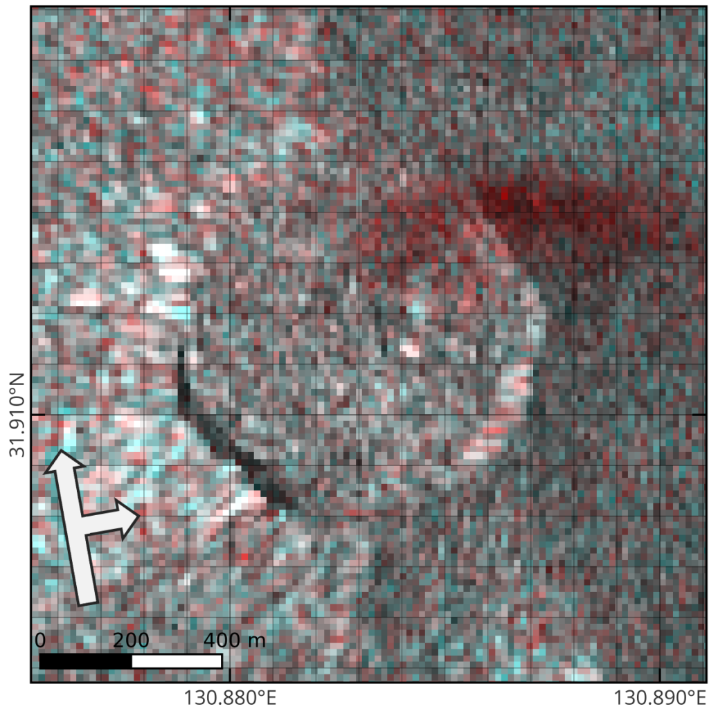
2) Detection of Minute Ground Surface Changes with Interferometric SAR (InSAR) Analysis
Interferometric SAR (InSAR) analysis compares data acquired at different times under similar observation conditions to detect subtle surface changes and ground displacement invisible in standard intensity imagery. This analysis utilized data from June 29 and July 1, acquired by different StriX satellites under nearly identical imaging conditions. The InSAR processing revealed surface changes consistent with ashfall deposition during these two days, which were not detectable in intensity images alone.
Data Pair from 2025-06-29 and 2025-07-01
a)Interferometric SAR (coherence) Image
© Synspective Inc.
b) Intensity Color Composite Image
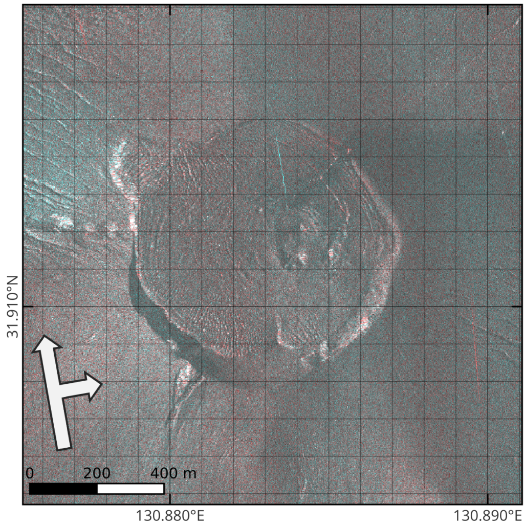
© Synspective Inc.
a) The InSAR (coherence) image shows areas where slight changes occurred due to the eruption (dark-colored parts).
b) The intensity color composite image does not clearly show similar changes on the ground surface.
These results are consistent with observations from other SAR satellites (Sentinel-1 and ALOS-4), supporting the high reliability of StriX data (Please refer to Reference 3 for Sentinel-1 analysis results and Reference 4 for ALOS-4 analysis results published by the Geospatial Information Authority of Japan).
Future Outlook
Synspective will continue to monitor volcanic activity using the StriX constellation to track ongoing developments. By maximizing the capabilities of all-weather, high-frequency observation by SAR satellites, we aim to contribute to a safe and more resilient society by delivering timely information to government agencies, municipalities, and research institutions engaged in disaster prevention and mitigation.
References
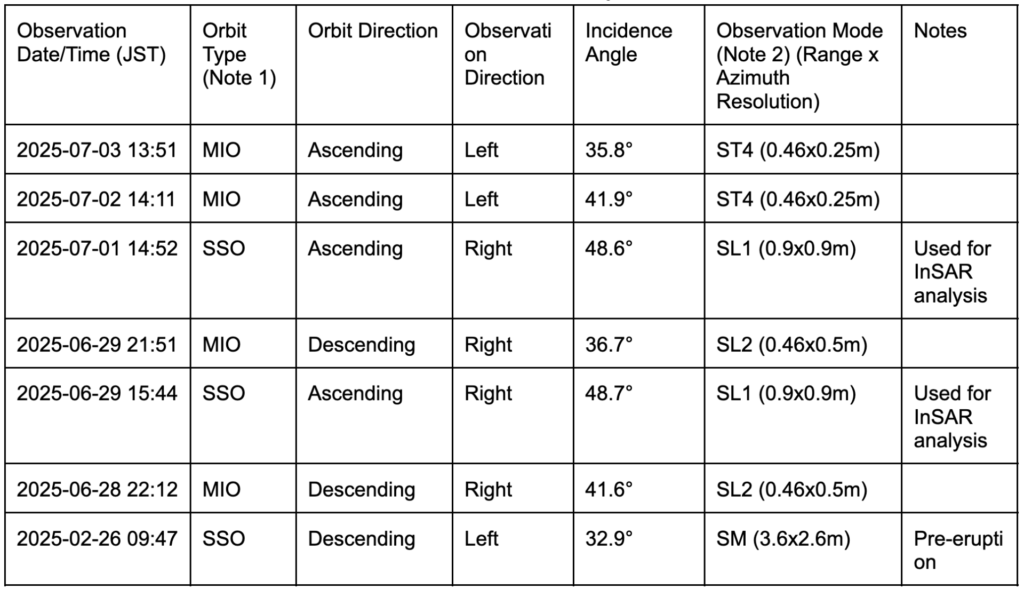
1) List of StriX Observation Data Used in the Analysis
Note 1:
MIO: Mid-Inclination Orbit
SSO: Sun-Synchronous Orbit
Note 2:
ST: Staring Spotlight
SL :Sliding Spotlight
SM :Stripmap
2) DEM Used: Geospatial Information Authority of Japan, Fundamental Geospatial Data (Digital Elevation Model) 1m Mesh (Elevation)
Shaded Relief Map
3) Sentinel-1 Observation Data
Pair from 2025-06-19 (Pre-eruption) and 2025-07-01 (During Eruption)
Interferometric SAR (Coherence) Image
© Copernicus Sentinel data [2025]
Intensity Color Composite Image
© Copernicus Sentinel data [2025]
4) ALOS-4 Observation Data
Crustal Deformation of Kirishimayama (Announced April 2, 2025) | Geospatial Information Authority of Japan (Japanese)