

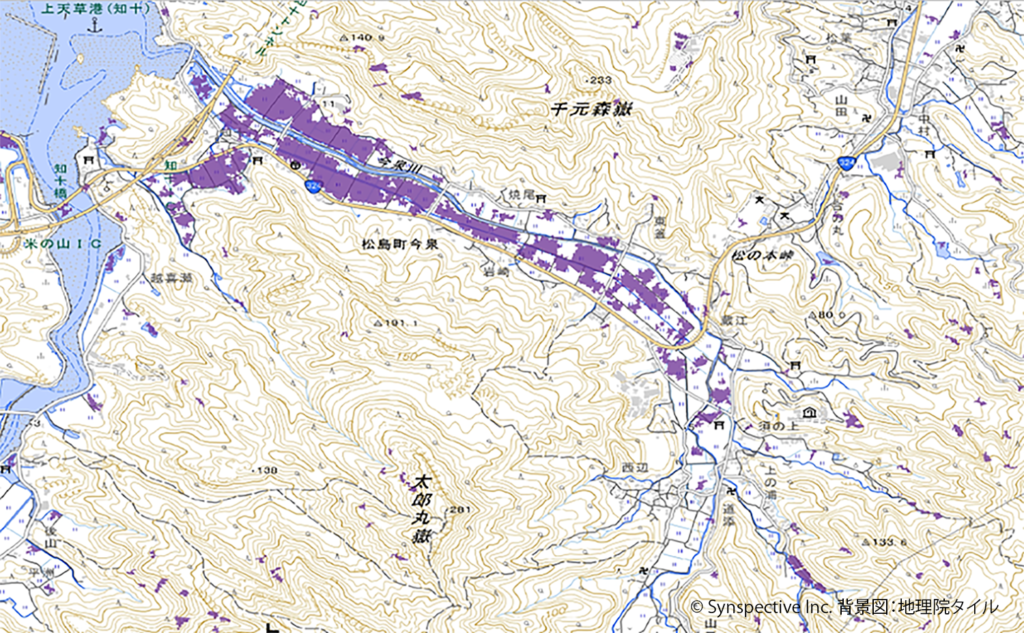
Synspective Inc., a Synthetic Aperture Radar (SAR) satellite data and analytics solutions provider, and Spectee Inc., a provider of AI-driven real-time disaster prevention and crisis management services, have developed a new method to estimate flood extents in greater detail than either data source alone. This method integrates wide-area flood extents extracted from SAR satellite data with location-specific flood depth information derived from social media posts. The effectiveness of this technique was confirmed through a joint retrospective analysis of past heavy rainfall data. This initiative is part of the partnership announced by both companies in July 2025 to accelerate and enhance disaster response.
In recent years, climate change has led to increasingly severe and frequent natural disasters worldwide, with flood damage posing a particularly critical threat. During a disaster, obtaining a rapid and accurate assessment of the full situation is essential for life-saving operations and prompt recovery efforts.
Synspective has contributed to flood risk management by offering solutions that leverage its SAR satellite StriX to observe and analyze wide-area land surface conditions day or night, regardless of weather conditions. However, relying solely on satellite observations presented challenges in accurately capturing localized flooding in densely populated urban areas with high-rise buildings and housing. Conversely, Spectee’s AI automatically analyzes social media posts to identify flood locations and depths, estimating flood extents in real time. While effective at pinpointing localized ground-level impacts, Spectee’s approach faced limitations in regions with few or no social media posts.
To address these complementary challenges, the two companies have been collaborating since July 2025 to develop a novel flood analysis solution. By fusing Synspective’s “Eye in the Sky” (SAR satellites), which captures wide-area coverage, with Spectee’s “Eye on the Ground” (social media data), which captures ground-truth details, the combined approach effectively eliminates each system’s blind spots.
Overview of the Flood Extent Estimation Method
[Methodology]
This method integrates two distinct data types, SAR satellite data and social media information, by combining them with geospatial data such as elevation and land-use maps.
– Wide-Area Flood Extent Extraction via SAR Satellite Data
SAR satellite data obtained from high-frequency satellite observations is automatically interpreted to extract wide-area flood extents.
– Location-Specific Flood Depth Identification from Social Media
Spectee’s AI automatically analyzes images, videos, and text posted on social media to identify flooded locations and estimate flood depths.
– Refinement and Optimization via Data Integration
The analysis results from steps 1 and 2 are cross-referenced and integrated with elevation and land-use data to refine the estimated flood extent. Using the flood extent boundaries from satellite data as a baseline, the system incorporates topographical characteristics, such as river basins and terrain slopes, to deliver detailed estimations of flood extent and depth consistent with real-world topography.
[Validation Results]
A joint analysis was conducted using data from a heavy rainfall event in Amakusa City, Kumamoto Prefecture, in August 2025. The results confirmed the following:
– In areas covered by both approaches, the analysis results from SAR satellite data and social media information were consistent with each other.
– In urban areas where satellite imagery alone struggled to detect flooding, incorporating social media data successfully complemented the coverage.
– By factoring in satellite-derived flood boundaries and topographical traits, the combined method successfully captured wide-area river overflow that was difficult to detect via social media posts alone.
– The flood extent estimated by this method qualitatively aligned with actual flood boundary surveys conducted by the Civil Engineering Department of the Amakusa Regional Bureau, Kumamoto Prefecture.
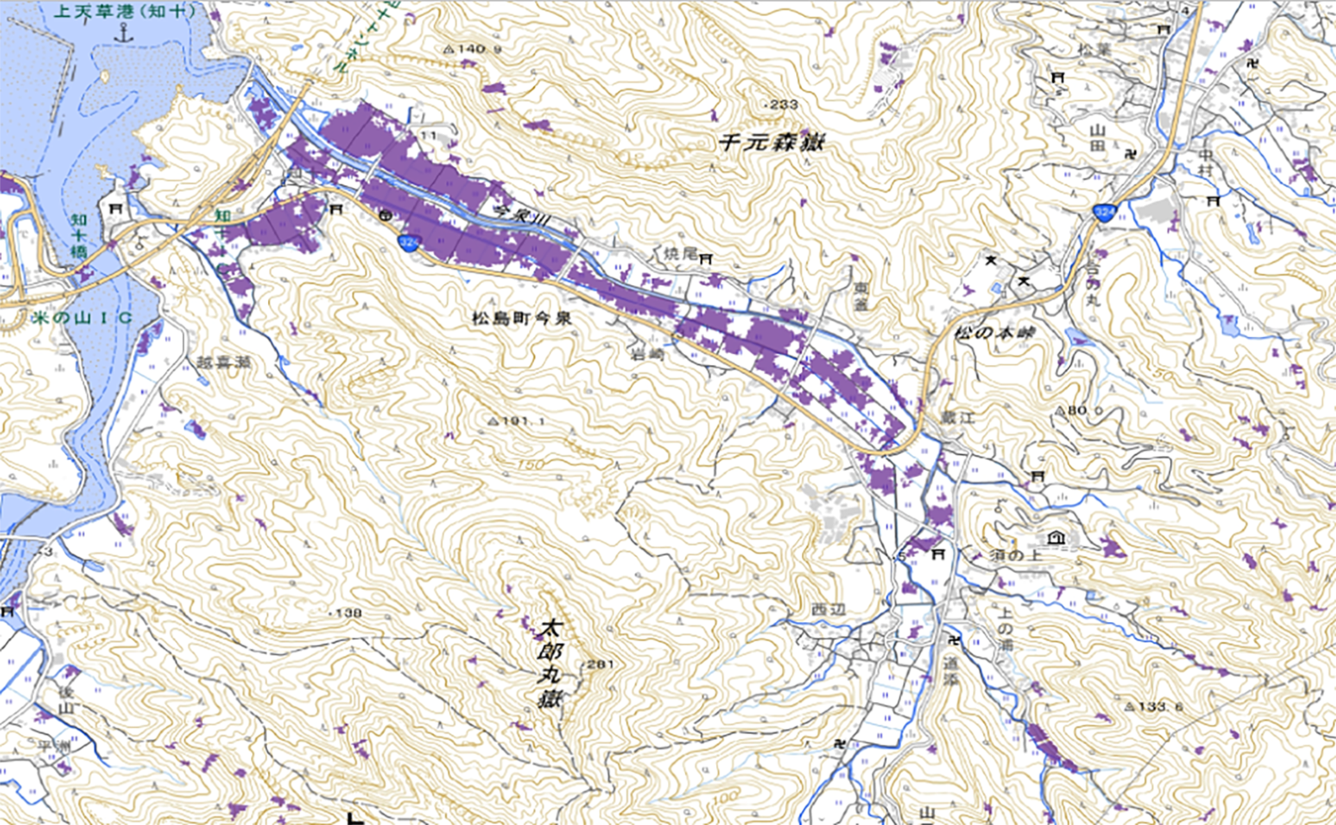
Figure 1: Flood extent in the Imaizumi River basin interpreted from Synspective’s SAR satellite data (© Synspective Inc. Background map: GSI Tiles, Geospatial Information Authority of Japan)
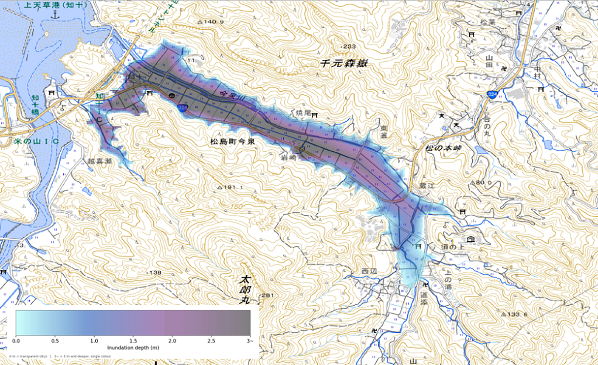
Figure 2: Flood extent in the Imaizumi River basin estimated using this joint method (© Spectee Inc. Background map: GSI Tiles, Geospatial Information Authority of Japan)
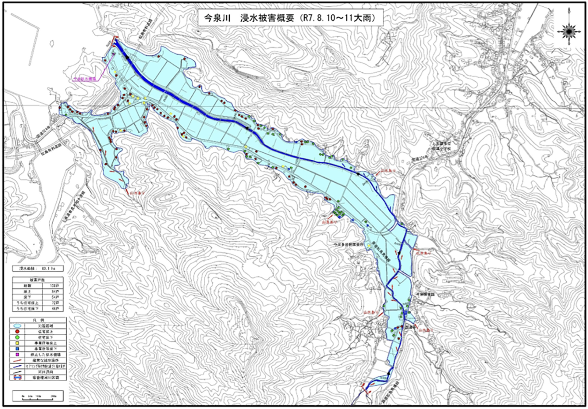
Figure 3: Actual flood extent in the Imaizumi River basin (Based on surveys by the Civil Engineering Department of the Amakusa Regional Bureau, Kumamoto Prefecture)
Future Outlook
Practical application of this method will enable early assessments of flooding conditions that better reflect the situation on the ground immediately following a disaster. Beyond accelerating initial emergency response, evacuation decisions, and the issuance of disaster victim certificates (risai shōmeisho)by local governments, this solution offers broad utility for private enterprises, including corporate facility damage assessment, business continuity planning (BCP), and supply chain risk evaluation.
Both companies will continue to conduct validations across diverse terrain conditions and disaster scales, aiming to establish technology that delivers stable, high-quality information and to realize early commercialization of the service.