

We express our deepest sympathies to all those affected by the earthquake centered in Kumamoto Prefecture.
Synspective collaborates with public institutions during disaster management and maintains an emergency observation system using small SAR satellites. SAR satellites can observe the Earth’s surface regardless of night or weather conditions, making them an effective tool for assessing situations immediately following a disaster.
In response to the recent earthquake (July 28, 2026, at approximately 4:27 PM JST, with a maximum seismic intensity of 7), we immediately initiated an emergency response. On the day of the earthquake, emergency tasking and imaging plans were finalized, and imaging of the affected areas was completed by early the following morning. The acquired data has been processed and is being provided sequentially to relevant institutions, with photo-interpretation analysis results delivered in stages as well.
Sample Observation and Analysis Data
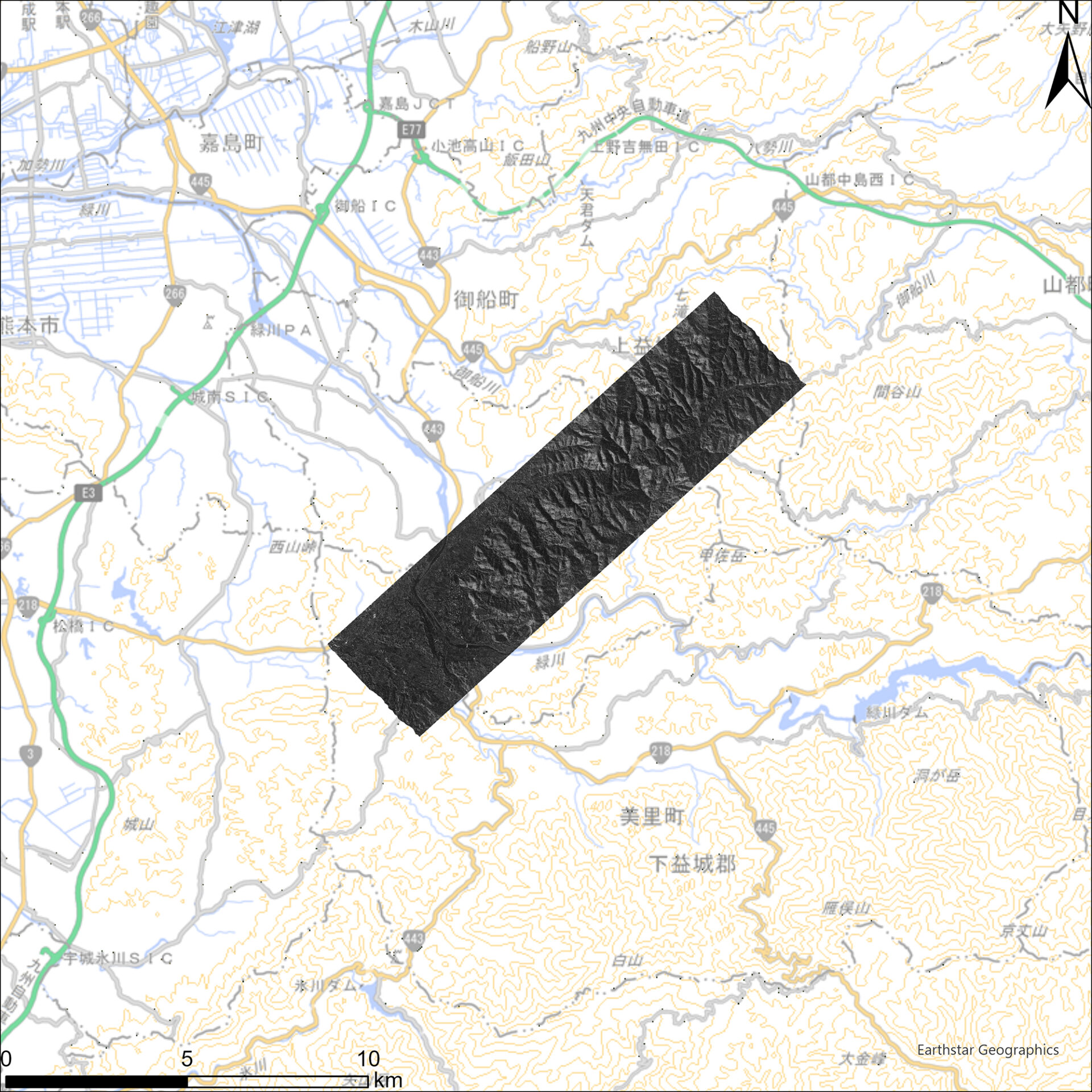
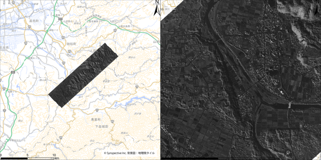
Figure 1: Observation Range (Central Kumamoto Prefecture) / Captured on July 29, 2026, at 00:34 JST (© Synspective Inc. / Background map: Geospatial Information Authority of Japan Tiles)
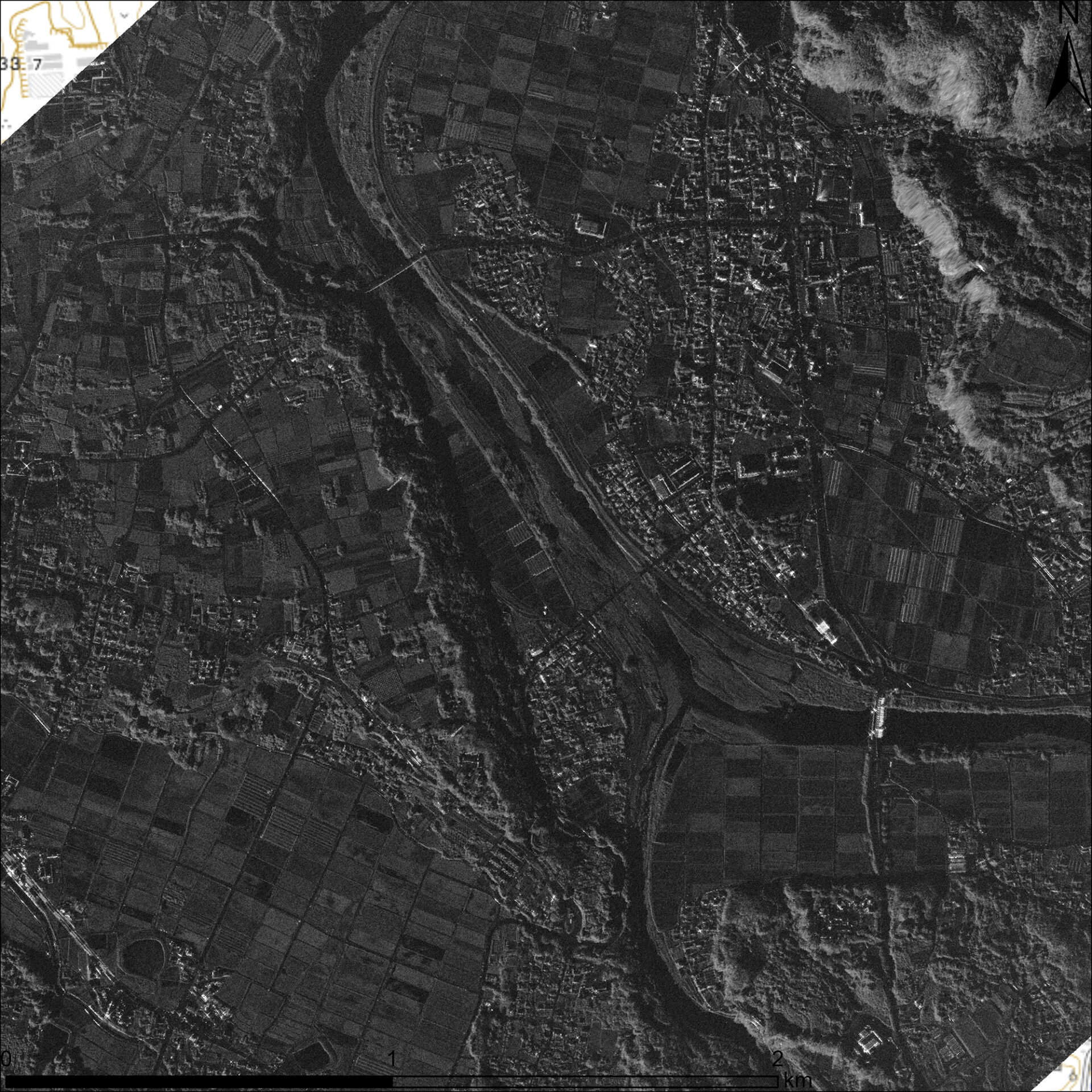
Figure 2: Enlarged View of Kosa Town Area / Staring Spotlight Mode (Resolution: 0.46 × 0.25 m)
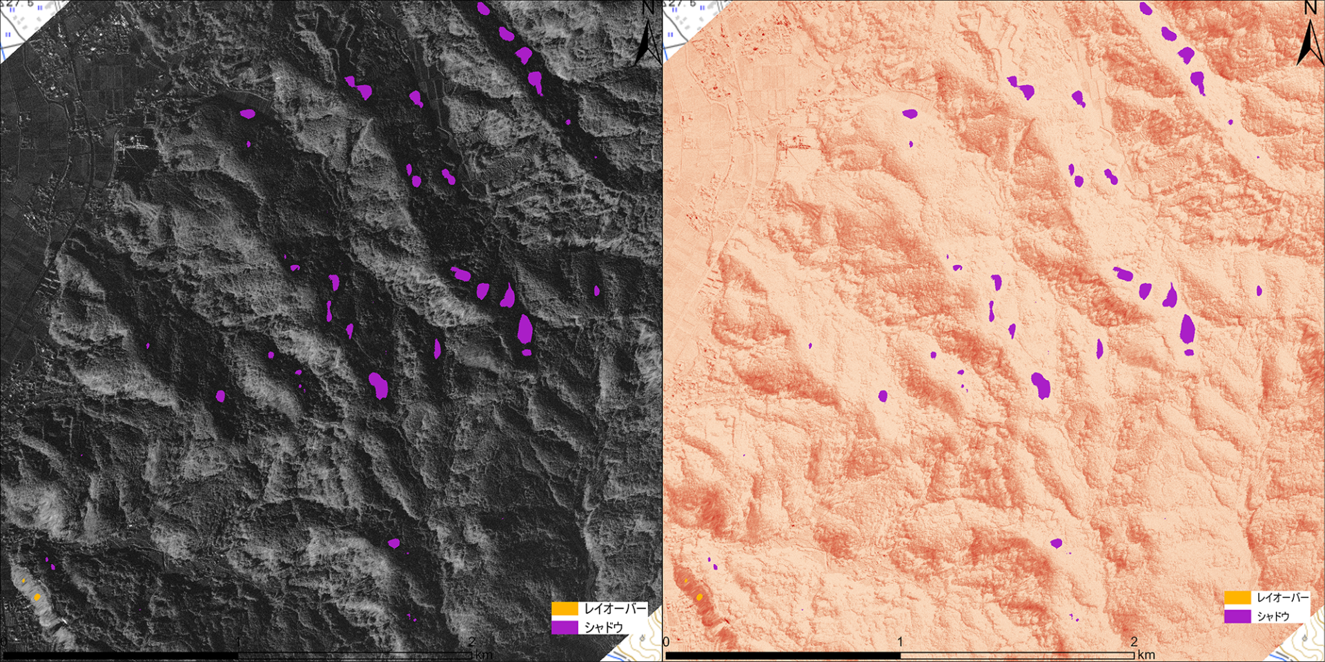 Figure 3: Interpretation map highlighting the entire imaged area. Slope Hazard Interpretation Result — No major landslides confirmed on observable slopes.
Aftershocks continue in the affected areas. Please prioritize your safety, and we sincerely pray for everyone’s safety and a swift recovery.
Leveraging our small SAR satellite constellation capabilities, Synspective will continue to collaborate with public institutions and other relevant entities to provide rapid, continuous information during disasters.