

Summary
Synspective used Synthetic Aperture Radar (SAR) data combined with machine learning techniques to analyze ship movements in Japan’s Tokyo Bay*. The use of SAR data enabled continuous monitoring of ground surfaces over a wide area.
*The Tokyo Bay spans the coasts of Tokyo, Kanagawa Prefecture, and Chiba Prefecture.
Issue
Ship detection has been carried out using Automatic Identification System (AIS) information, AI technology with fixed-point cameras and sensors, and image recognition technology. The addition of Synspective’s SAR satellite object detection technology makes it possible to effectively monitor a wide area over long periods and at low intervals. Specifically, it is possible to monitor ships entering and leaving the port, congestion status data, as well as poaching and illegal trade practices.
The COVID-19 pandemic has comprised ports such as Shanghai and Los Angeles where dwell times have increased and have had far reaching consequences with the disruption of supply chains. Resolving this requires continuous observation of shipping containers and understanding related factors in onshore and offshore environments. Satellite remote sensing and geospatial data can tackle maritime logistics, planning, and management. They have the capability to analyze ships, containers, and trucks at ports, recognize disruptions, and calculate future congestion. Object detection technology with SAR satellites also has broader applications that can be transformative. This includes assessing parking lot occupancy and congestion, car parking time, and providing anti-theft protection measures.
Analysis
In this analysis, SAR images are used to automatically detect ships using object detection technology with machine learning techniques. Data derived from the scattering intensity of satellite radio waves are used for SAR image analysis. Ship movements are detected and monitored using data from scattering intensity and coherence estimation (※).
Automated ship detection saves valuable time and allows monitoring over wide swaths and under various geological conditions. Also, if appropriate logic and ship movement patterns are established, it is possible to automate analysis.
(*) Scattering Intensity: Microwaves emitted from the SAR sensor are scattered to detect physical properties on the Earth’s surface. Surface roughness has a large impact on scatter intensity.
Results
The below image was taken from a SAR satellite. The ships (circled in green) were identified using machine learning techniques. From these results, we are able to gather the number of ships and their locations in the Tokyo Bay.
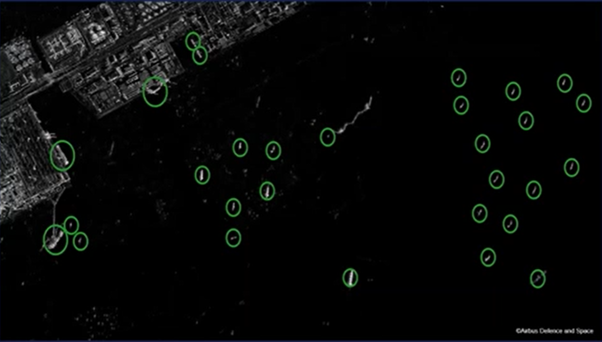
© DLR e. V. (2022), Distribution Airbus Defense and Space GmbH
Conclusion
SAR imagery and machine learning techniques are useful for ship detection and other vessels. Combining geospatial data and other sources, it is possible to detect changing trends, estimate global port congestion, and assess the multifarious impacts on economic and shipping sectors.
Synspective develops and operates SAR satellites to provide data analytics and solution services. SAR satellites are capable of high-frequency, high-resolution observations in all-weather conditions at any time of day or night. Two of our StriX series satellites have already launched and are operating in target orbit. We aim to build a constellation of 30 SAR satellites in low earth orbit by around 2026, enabling the observation of areas of interest within two hours anywhere in the world.
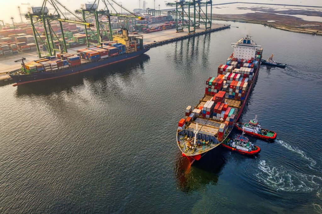
The Daily Transformation of the port of Singapore by Synspective’s StriX-β