

Overview
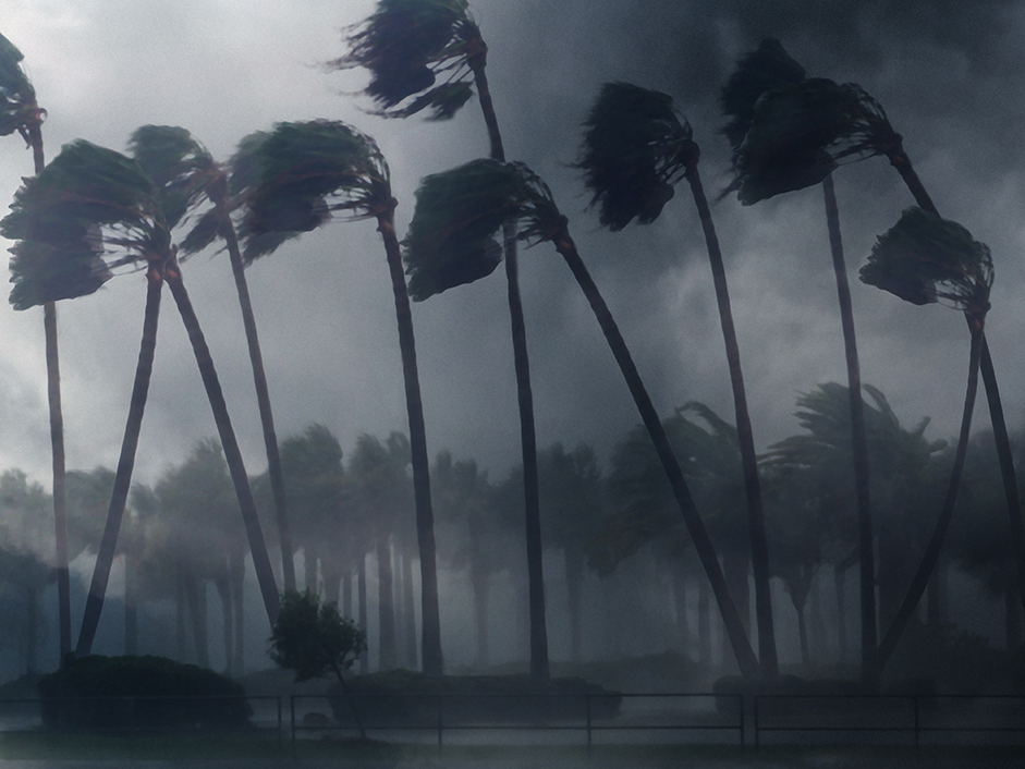
Typhoon Rai, which struck the south-eastern part of the Philippines from December 16 to 17, 2021, caused enormous damage in various parts of the country. It was reported as the most powerful typhoon that hit the country this year. We would like to express our deepest sympathies to all the victims and pray for their safety and the earliest possible recovery of the disaster area.
Synspective’s disaster analysis team conducted an analysis of the damage caused by the invasion of Typhoon Rai on Cebu Island and the Surigao del Norte region. The satellite observation data was taken with the Sentinel-1 SAR satellite from late November to December before the typhoon hit, and from 20th to 21st December after the typhoon hit.
Analysis Methods
This analysis utilizes data on the scattering intensity*1 and coherence value*2 of radio waves from SAR satellites. Based on this scattering intensity and coherence value data, the change points, assumed to have been damaged by the typhoon, are displayed with a blue frame polygon for scattering intensity and an orange frame polygon for the coherence value.
*1 Scattering Intensity: Microwaves emitted from the SAR sensor are scattered to detect physical properties on the Earth’s surface. Surface roughness has a large impact on scatter intensity.
*2 Coherence: Microwaves emitted from satellites at two different times reveal the degree of coherence (ease of coherence) depending on the phase alignment.
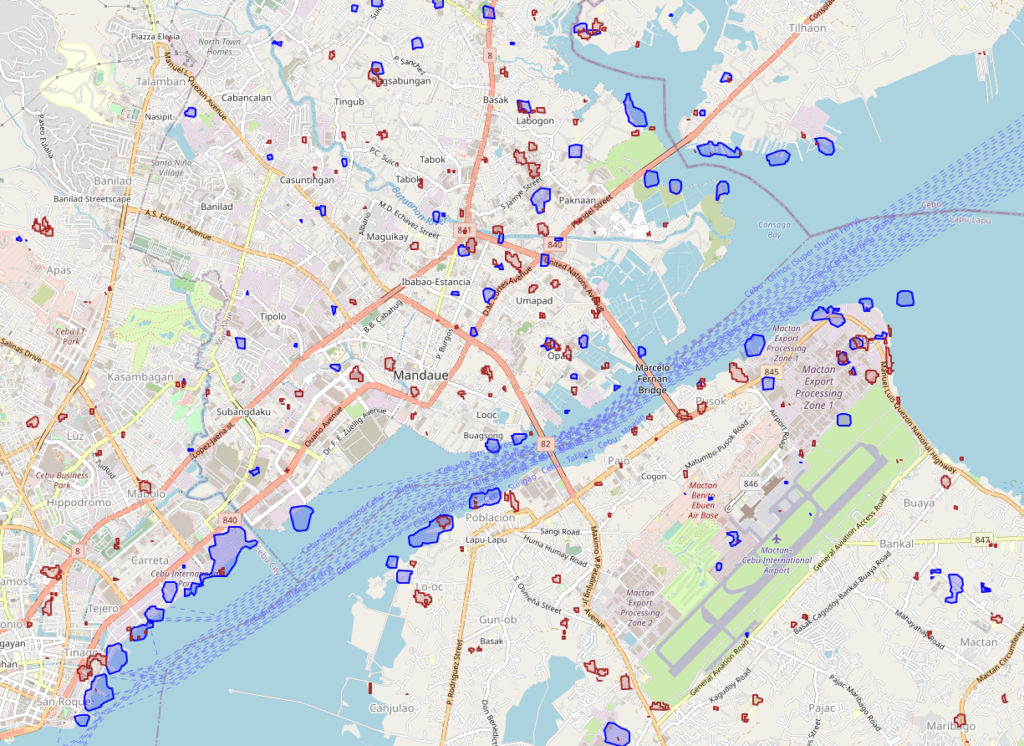
Cebu analysis results ©OpenStreetMap contributors. ©︎Copernicus Sentinel data 2021. ©Synspective Inc.
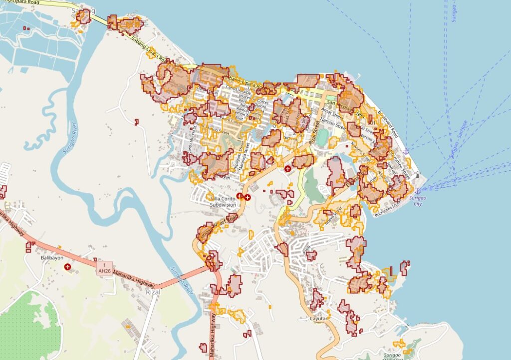
Surigao analysis result ©OpenStreetMap contributors. ©︎Copernicus Sentinel data 2021. ©Synspective Inc.
Analysis Results
From the analysis results of the two methods using SAR satellite images before and after the typhoon, it is assumed that there was extensive damage in both areas.
Conclusion
During and after a natural disaster, promptly and widely grasping the disaster situation will lead to appropriate decision-making and initial response. SAR satellite observation is functional in cases where damage has occurred multiple and over the wide area, as in the case of the recent typhoon or when bad weather continues with cloud cover. Cloud makes it impossible to acquire optical images by satellite, aircraft, and drone.
Synspective is developing and operating its own small SAR (Synthetic Aperture Radar) satellites. The company aims to build a constellation of 30 satellites by the late 2020’s, which includes one satellite already in orbit. With a full constellation in low Earth orbit, SAR satellites will be able to observe disasters anywhere in the world within two hours. Unlike traditional observation methods using optical satellites and aircraft / drones, SAR satellites are capable of all-weather ground observations, making it possible to quickly capture ground movements over a wide area.
10/2021 Analysis of the volcanic eruption at Mt. Aso in Kumamoto Prefecture
SAR analysis of debris flow from the 2021 Atami landslide in Shizuoka Prefecture
