Introduction
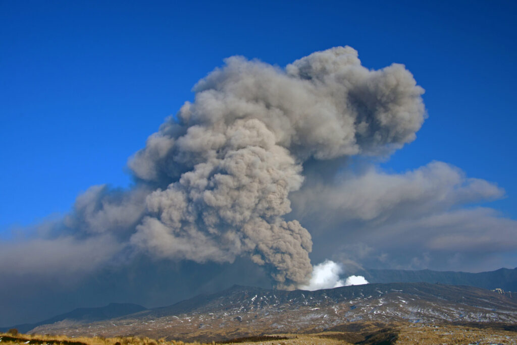
At 11:43 AM on October 20, 2021, there was an eruption at the first Nakadake crater of Mt. Aso in Kumamoto prefecture. The volcano caused pyroclastic flows within a kilometer of the crater and spouted ash 3,500 meters into the sky. The volcanic alert level was raised to a level 3 for the first time since an explosive eruption back in 2016.
Analysis Methods
The analysis uses data of scattering intensity (*1) and coherence value (*2) from radio waves in SAR satellites. Based on the scattering intensity and coherence value data, the changes that are thought to have occurred around the crater from the eruption are displayed in blue and orange polygons.
(*1) Scatter Intensity: Microwaves emitted from the SAR sensor are scattered to detect physical properties on the Earth’s surface. Surface roughness has a large impact on scatter intensity.
(*2) Coherence: Microwaves emitted from satellites at two different times reveal the degree of coherence (ease of coherence) depending on the phase alignment.
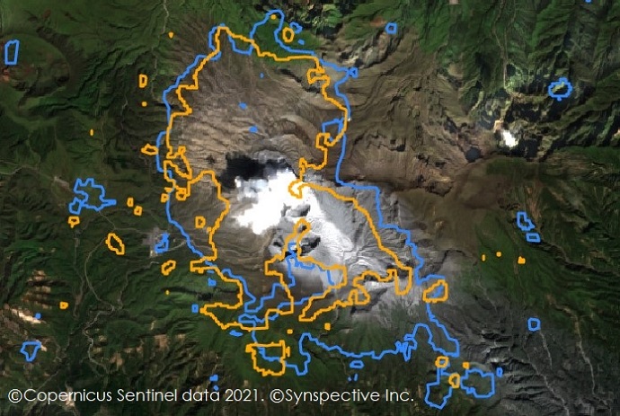
Before eruption
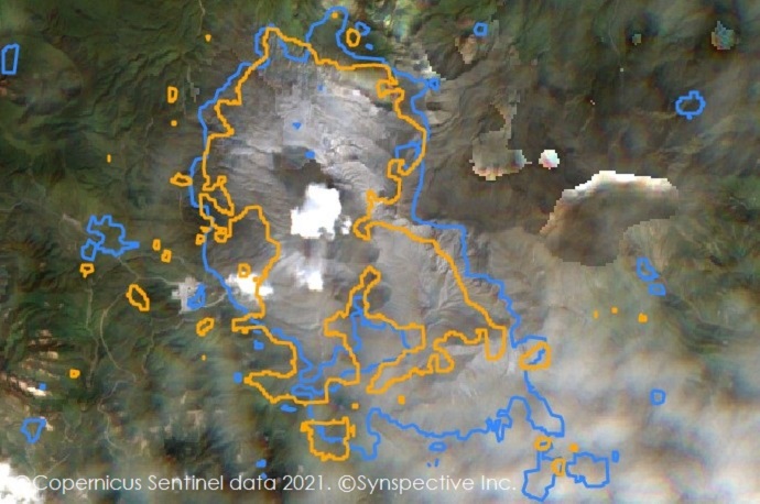
After eruption
Analysis Results
Looking at the analysis results of the two methods using SAR satellite images before and after the eruption, there are many points that match the analysis results where changes are thought to have occurred near the crater. On the other hand, there are some points that were only detected by each analysis method. We will further study high-precision, decision algorithms and also carefully examine the results from each analysis.
Conclusion
Eruption monitoring using SAR Satellite data can be applicable during ongoing eruptions and when optical imagery (satellites, aircraft, drones) cannot capture what is happening on the ground due to severe weather or night conditions.
Synspective is developing and operating its own small SAR (Synthetic Aperture Radar) satellites. The company aims to build a constellation of 30 satellites by the late 2020’s, which includes one satellite already in orbit. With a full constellation in low Earth orbit, SAR satellites will be able to observe disasters anywhere in the world within two hours. Unlike traditional observation methods using optical satellites and aircraft / drones, SAR satellites are capable of all-weather ground observations, making it possible to quickly capture ground movements over a wide area.