

Synspective monitored Typhoon Nanmadol’s path over the sea off the Ogasawara Islands on September 14, 2022. We also captured the Kyushu region using our long stripmap mode with the StriX-β satellite. The images were taken for two consecutive days on September 19 and 20.
Typhoon Nanmadol, the 14th typhoon to hit Japan this season, first made landfall in Kagoshima Prefecture around 7:00pm on September 18, traversed the region from September 19-20, and then progressed along the Sea of Japan before becoming an extratropical cyclone on September 20. The typhoon hit the Kyushu region particularly hard, which moved through the region slowly, triggering landslides, downing electrical lines, and causing thousands to evacuate to safety.
Observation Results
The images were captured descending north to south of the Kyushu region using the long stripmap mode on 2022-09-19 at 09:38:49(JST) and 2022-09-20 at 09:39:07(JST), and divided into seven areas of interest (AOI).
In this analysis, time-series changes are indicated in red and blue and mean the following:
- Red: Areas that were present in the pre-image (September 19) but missing in the post-image (September 20). (This is where the pre-image has stronger reflection intensity than the post-image.)
- Blue: Areas that were not in the pre-image (September 19) but in the post-image (September 20). (This is where the post-image has stronger reflection intensity than the pre-image.)
- Other areas: Areas other than red or blue indicate no significant changes.
Below are the imaging and change detection results for the seven areas of interest (AOI).
AOI①
©Mapbox, ©OpenStreetMap and Improve this map, ©Synspective Inc.
Imaging results of Kyushu region with StriX-β: AOI① (highlighted in the upper right)
- Since the color of the sea level has changed, it is presumed that the surface was rough because of strong winds.
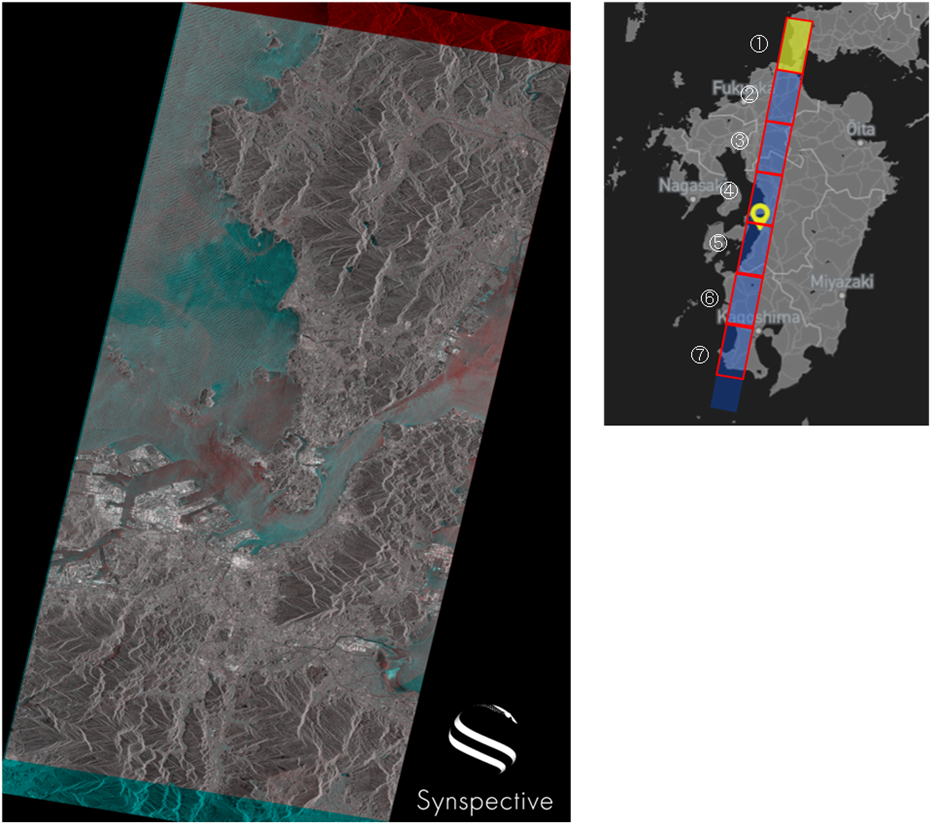
AOI②
©Mapbox, ©OpenStreetMap and Improve this map, ©Synspective Inc.
Imaging results of Kyushu region with StriX-β: AOI② (highlighted in the upper right)
- The color of the river has changed, suggesting that the surface was rough because of strong winds.
- It is presumed that the river water level rose in the blue areas along the river bank (indicated in the yellow frame) on September 19.
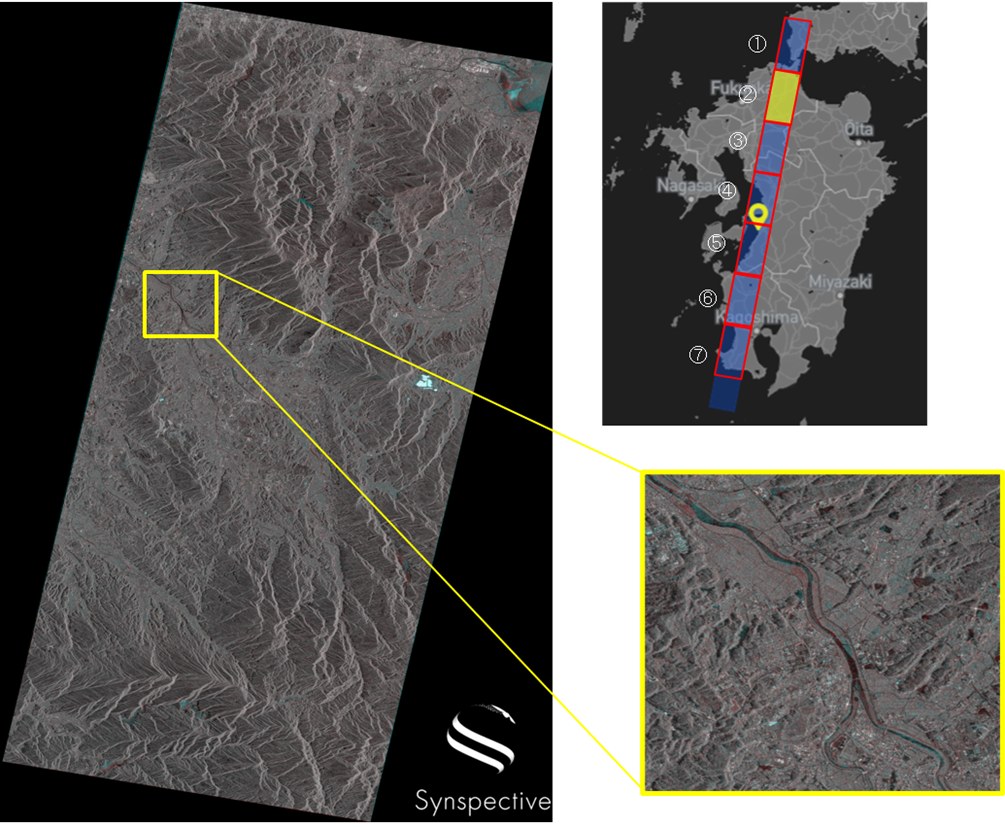
AOI③
©Mapbox, ©OpenStreetMap and Improve this map,©Synspective Inc.
Imaging results of Kyushu region with StriX-β: AOI③ (highlighted in the upper right)
- It is presumed that the phenomena is similar to AOI② because the color of the river has changed.
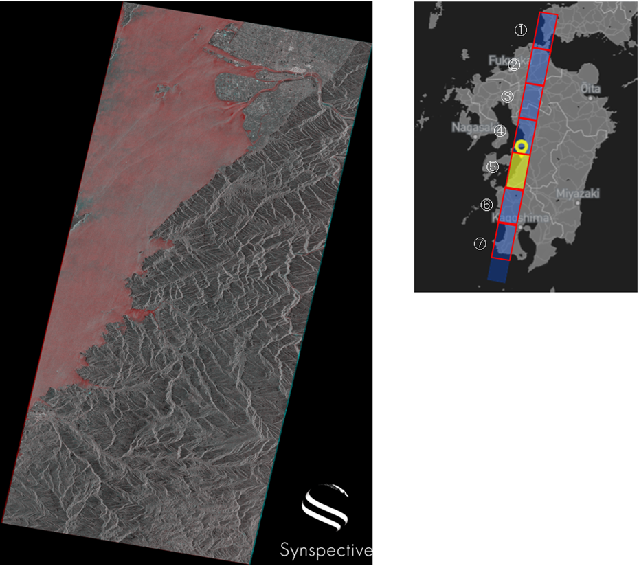
AOI④
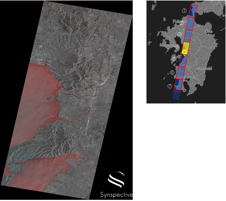
©Mapbox, ©OpenStreetMap and Improve this map, ©Synspective Inc.
Imaging results of Kyushu region with StriX-β: AOI④ (highlighted in the upper right)
- Since the sea level has become red, it is presumed that the surface was rough because of strong winds on September 19.
AOI⑤
©Mapbox, ©OpenStreetMap and Improve this map, ©Synspective Inc.
Imaging results of Kyushu region with StriX-β: AOI⑤ (highlighted in the upper right)
- It is presumed that the phenomena is similar to AOI④ because the sea level has become red.
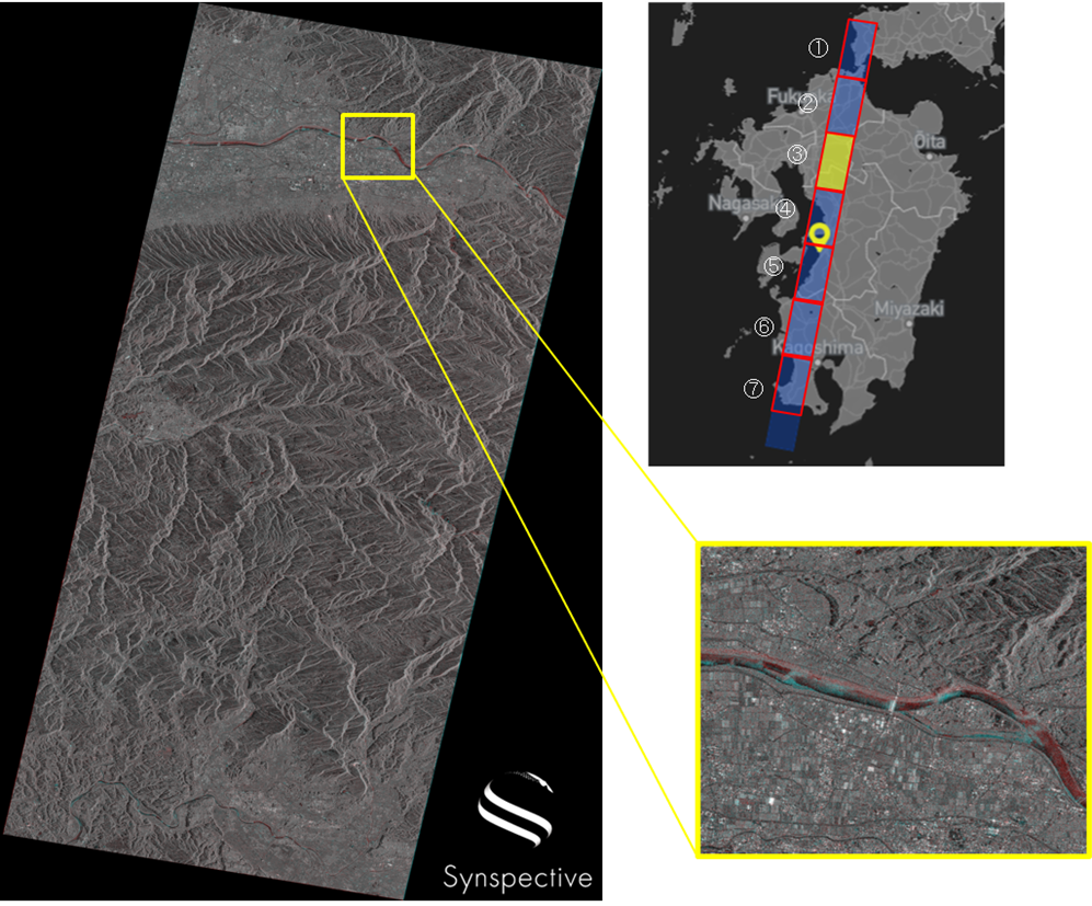
AOI⑥
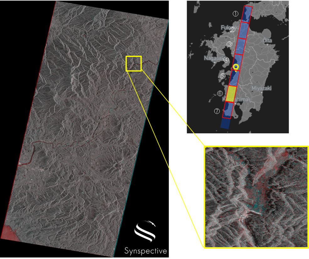
©Mapbox, ©OpenStreetMap and Improve this map, ©Synspective Inc.
Imaging results of Kyushu region with StriX-β: AOI⑥ (highlighted in the upper right)
- The color around the Tsuruta Dam (located in the yellow frame) has changed, suggesting that the water surface has changed.
AOI⑦
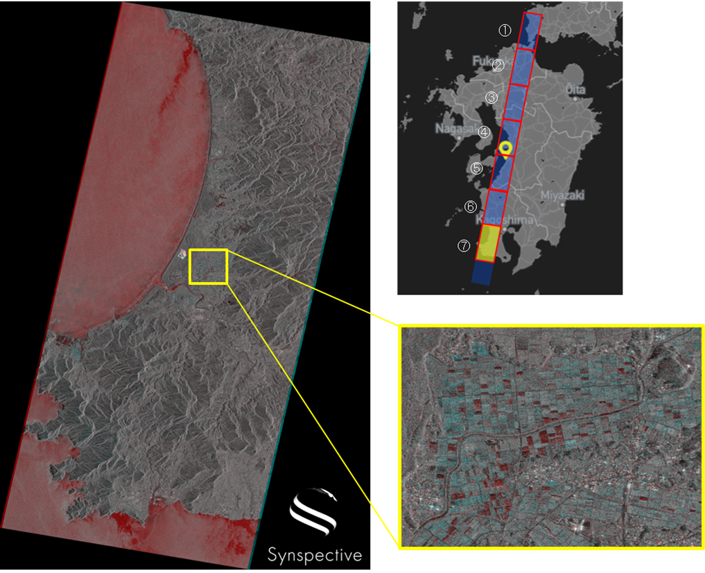
©Mapbox, ©OpenStreetMap and Improve this map, ©Synspective Inc.
Imaging results of the Kyushu region with StriX-β: AOI ⑦ (highlighted in the upper right)
- Inside the above yellow frame, changes in each farm field are detected, suggesting that there were changes to the surface and water levels.
Future Developments
With continuous imaging, it will be possible to conduct various types of monitoring including time-series imaging.
Synspective develops and operates SAR satellites to provide data analytics and solution services. SAR satellites are capable of high-frequency, high-resolution observations in all-weather conditions at any time of day or night. Three of our StriX series satellites have already launched and are operating in target orbit. We aim to build a constellation of 30 SAR satellites in low earth orbit, enabling observation of areas of interest within two hours anywhere in the world.